Erin Grass
Senior Geomatics Engineer
Government of Alberta
Sessions in which Erin Grass attends
11:30 AM
11:30 AM
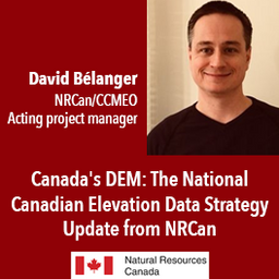
- Canada's DEM: The National Canadian Elevation Data Strategy Update from NRCan
- 11:30 AM EDT - 12:00 PM EDT | 30 minutes
- The Canadian Centre for Mapping and Earth Observation (NRCan) continues its work to implement the National Elevation Data Strategy. Through this...
- Talk
-
1:15 PM
1:15 PM
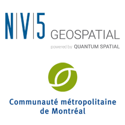
- Talk: "Beneath the Surface: A closer look at the 2020 aerial topobathymetric lidar survey of Montreal" NV5 Geospatial & CMM
- 1:15 PM EDT - 1:45 PM EDT | 30 minutes
- À l'automne 2020, NV5 Geospatial, propulsé par Quantum Spatial, a été mandaté par la Communauté Métropolitaine de Montréal (CMM) pour réaliser l...
- Talk
-
11:30 AM
11:30 AM
- Special Event: Fire Side Chat with Dr. Steve Liang, Founder & CTO of SensorUp & Dr. Nadine Alameh the OGC’s CEO
- 11:30 AM EDT - 12:00 PM EDT | 30 minutes
- Join us April 22nd for a Fireside Chat with Dr. Steve Liang, Founder and CTO of SensorUp. Professor and Rogers IoT Research Chair at University of ...
- Talk


12:00 PM
12:00 PM
- Lunch Keynote: "Why it Takes a Legion" MAXAR's Executive Vice President & CTO Dr. Walter Scott
- 12:00 PM EDT - 12:45 PM EDT | 45 minutes
- In this presentation, Dr. Walter Scott will compare the satellite imaging constellations of Maxar and other commercial companies to show how the...
- Keynote

2:00 PM
2:00 PM
- Talk: Canadian Council on Geomatics - Fostering collaboration across jurisdictions
- 2:00 PM EDT - 2:30 PM EDT | 30 minutes
- For nearly 50 years, geomatics representatives from Canadian provinces and territories have collaborated together and with the federal governmen...
- Talk
-
2:45 PM
2:45 PM
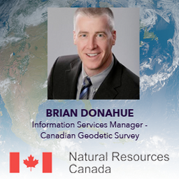
- Canadian Geodetic Survey – Supporting Accurate Geospatial Positioning in Canada
- 2:45 PM EDT - 3:15 PM EDT | 30 minutes
- The Canadian Geodetic Survey (CGS) of Natural Resources Canada (NRCan) is responsible for defining, maintaining, and providing access to the Can...
- Talk
-
12:10 PM
12:10 PM
- Lunch Break, Awards and Announcements
- 12:10 PM EDT - 12:30 PM EDT | 20 minutes
-
12:30 PM
12:30 PM
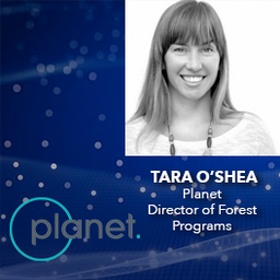
- Advances in Earth Observation & Analytics Technologies + Deployment in Forest & Climate Solutions - Tara O'Shea, Planet
- 12:30 PM EDT - 1:00 PM EDT | 30 minutes
- With rapid advances in Earth observation, cloud computing, and analytics technologies, more information on our changing world is more readily avail...
- Talk
-
2:00 PM
2:00 PM
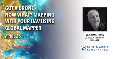
- Got a Drone - Now What? Mapping with your UAV using Global Mapper
- Signup required
- 2:00 PM EDT - 4:00 PM EDT | 2 hours
- PLEASE NOTE THE PREFERRED BROWSER IS GOOGLE CHROME. If you are running into any issues accessing the session, please try logging in via Go...
- Workshop

1:00 PM
1:00 PM
- Introduction to SAR/EO Products Workshop, Hosted by MDA
- Signup required
- 1:00 PM EDT - 3:00 PM EDT | 2 hours
- Google Chrome is the preferred browser for this session.
- Workshop

3:30 PM
3:30 PM
- Re-Imaging Remote Sensing with ERDAS IMAGINE - workshops for AI, Spatial Modeling, Python Integration
- Signup required
- 3:30 PM EDT - 5:00 PM EDT | 1 hour 30 minutes
- Google Chrome is the preferred browser for this session.
- Workshop


1:00 PM
1:00 PM
- Drone-derived data and geomatics quality and accuracy standards
- Signup required
- 1:00 PM EDT - 4:00 PM EDT | 3 hours
- Tickets for this workshop must be claimed in advance.The use of drones, officially referred to as Remotely Pilote...
- Workshop


1:00 PM
1:00 PM
- From Imagery Purchasing to Final Product Workshop
- Signup required
- 1:00 PM EDT - 2:30 PM EDT | 1 hour 30 minutes
- Tickets for this workshop must be claimed in advance.From Imagery Purchasing t...
- Workshop
-

1:00 PM
1:00 PM
- World Geospatial Industry Council: Leading global geospatial policy Advocacy
- Signup required
- 1:00 PM EDT - 3:00 PM EDT | 2 hours
- World Geospatial Industry Council: Leading global geospatial policy AdvocacyApril 30 2021, 13:00 - 14:30 EDT
- Workshop