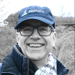
Geoff has been tracking the contribution of geospatial technology to the digitization of construction, operation and maintenance of energy, building and transportation infrastructure - primarily in his blog “Between The Poles”, on LinkedIn and Geospatial World. From 2014 to 2016 Geoff was Editor for Energy and Building with Geospatial Media. Prior to that Geoff was responsible for thought leadership, evangelization, and industry messaging for the utility industry program at Autodesk. Geoff Zeiss has more than 20 years experience in the geospatial IT industry working with utilities, communications, and public works in enterprise IT around the world. In his early career, he was responsible for some of the largest successful implementations of location-aware enterprise design and records management software in the utility and telecommunications sectors. In 2004, he received a global technology award from Oracle Corporation for technical innovation and leadership in the use of Oracle. In recognition of his efforts to increase the awareness of geospatial data and technologies in utilities and construction, Geoff received the Geospatial Ambassador Award at Geospatial World Forum 2014 in Geneva, Switzerland. He actively supports open standards as a director of the Open Geospatial Consortium and contributed to the founding of the Open Source Geospatial Foundation in 2005/2006.
Sessions in which Geoff Zeiss participates
Tuesday 22 March, 2022
Wednesday 23 March, 2022
Sessions in which Geoff Zeiss attends
Tuesday 22 March, 2022
Gyroscopic mapping of underground ducts and pipes has been around for a few decades now, and it continues to gain traction amongst the worlds' utilities as an accurate and unique technology. Nevertheless, the market perception until now is that Gyro-mapping, as it's also often referred to, is more expensive than traditional mapping and locating technologies. And although that perception is true, it is not due to the cost of the technology, but rather...
As the world continues to grow and urbanize, new urban infrastructure is being constructed at an unprecedented rate while old world infrastructure is being replaced and upgraded. This has lead to a greater demand for accurate and current utility locating and mapping. This demand is further exacerbated by the fact that infrastructure construction costs continue to rise and the slightest delay or extra cost associated with insufficient utility locating has an...
This presentation will be focusing on the advancement of "Cloud and Mobile" technologies that are currenlty being used to easily and accurately map assets and underground utilities that can be shared, re-located and leveraged thoughout the many project phases.It is critical that data accruacy and integrity is leveraged and accumulated throughout every phase of the BIM procress, creating a live "digital twin" all the way back to t...
Utilities and their Contractor Organizations have traditionally been responsible for the safe and effective construction of new underground facilities. An important aspect of the construction process is the accurate documentation and location of the newly installed assets for update into the Utilities’ Geographic Information Systems, Work Management Systems and Asset Repositories. This process is typically performed via paper-based folders that may contain missing or incorrect attribute da...
Wednesday 23 March, 2022
Utility and energy buried pipelines represent an extensive underground network covering most of a country's territory. Their precise lateral, horizontal positioning along with their depth of cover is a critical element of any operator's GIS. It enables to deploy more accurate pipeline predictive maintenance models and avoid third party interferences. The latter being identified as one of the main causes of pipeline failures. The 2020 CGA Dirt report states that 3...
Leading construction companies are finding a new software as a service component that enables them to view their virtual sites, saving them time and money. This technology breakthrough enabled pioneer construction companies serving clients in multiple industries (colleges, hospitals, residential compounds, malls) to use a new way of representing information about their buildings and utilities, above ground and underground. Benefits include avoiding planning mista...
Thursday 24 March, 2022
Reveal is building the world's most advanced and accurate digital twin technology for subsurface infrastructure. We're driving a safer, more efficient and sustainable world by revealing the truth of the underground. Join us for a 30min presentation where we will be showcasing our technology through our flagship project in Wellington, New Zealand.


