Stephen Lai
Sessions in which Stephen Lai attends
الأربعاء 23 مارس, 2022

Synopsis: The UK National Underground Asset Register has gone through rigorous pilot and preparation phases and has learned a lot about the data which we will share for 3 regions before a national roll out. However, despite all the best laid plans there will always be exceptions and unexpected scenarios which will need to either be fitted into the data model or have the data model change in order to fit them. The way in which we make these changes could make or break a project like this wh...


A longstanding and unsolved problem for utility companies has been how to keep geospatial network asset data up to date as networks are extended and maintained. Currently, it can take weeks if not months for “as-built” changes to make their way back into the enterprise system of record, typically a geographic information system (GIS). Existing mobile solutions can enable workers in the field to capture data about network asset data updates, but are too time consuming and comple...

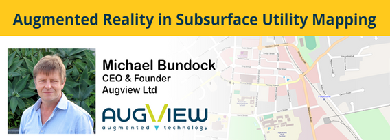
We live in a world where the skill required to interpret maps and engineering drawings is decreasing while the density of underground networks is increasing. The result is increased collateral damage, network outages and poor health & safety outcomes for our field workers.Today, we need better ways to accurately capture and comprehend the location and nature of those networks that are out of site under our feet. AR (Augmented...

الخميس 24 مارس, 2022

GIS platforms are typically populated with XYZ coordinates with a point spacing of 1 meter or more. in fact, most traditional land surveying techniques, like GPS, often have a point spacing of 3 meters or more, and that is understandable given the procedure to obtain these points. But have you ever wondered what amount of detail is lost when increasing the point frequency? Well, in this seminar, Otto Ballintijn will demonstrate the impact point frequency has on pipe detail usin...


Scribble Maps is an easy-to-use online GIS and web mapping visualization solution. The software has a robust toolset along with vast operations that can help you annotate maps, plot territories, filter and analyze data, optimize routes, add images, and more.Our powerful mapping software can easily be integrated with many different file formats including GeoJson, SHP, KML, CSV, GPX, DXF, and PDF. Founded in 2009, Scribble Maps has been developed from direct user f...


Reveal is building the world's most advanced and accurate digital twin technology for subsurface infrastructure. We're driving a safer, more efficient and sustainable world by revealing the truth of the underground. Join us for a 30min presentation where we will be showcasing our technology through our flagship project in Wellington, New Zealand.

الجمعة 25 مارس, 2022

An overview of Prostar's "Cloud and Mobile Precision Field Data Collection Solution and the set up of the ProStar "PointMan Plus" application FREE to WorkShop attendees. PointMan is a patented cloud and mobile mapping software application that captures, records, and displays the precise location and the associated metadata of critical surface and subsurface infrastructure, all in "real-time" Workshop includes: -1 FREE annual subscription of...

For decades, cities have required all utilities, communication providers and municipal services providers to build their facilities below ground. In addition, the increase in severe natural disaster conditions have driven traditional overhead utilities to revise their construction standards and build their new facilities underground. As the proliferation of underground construction continues, all utility groups must improve their procedures to ensure that any newly installed fa...


الثّلاثاء 16 مايو, 2023

Geoff Zeiss was an instrumental influencer for the Minnesota Utility Mapping Project (MN UMP). The goals of the MN UMP are to 1.) increase the accuracy of underground utility maps, 2.) provide for a method of viewing this data in relation to a "One-call" excavation area, and 3.)reduce underground utility damages. This viewed utility mapping data is supplemental to the "One-call" process. Founded in 2020, the Minnesota Underground Mapping Project completed the Phase 1 prototype for viewing ...