
Prashant has worked in the public, private and not-for-profit sectors in a variety of roles and sectors. In the past decade, he provided the vision and worked to establish the Canada Centre for Mapping and Earth Observation and then managed all aspects of its operations as its first Director-General. He also led CCMEO through deep reductions in the early 2010s and then led its renewal and subsequent large scale successes in delivering the highly successful Federal Geospatial Platform (GeoDiscovery); the science and satellite renewal elements of the 2019 Radarsat Constellation Mission; and after two years of consultation and negotiation, the launch of Canada's Flood Hazard Information Mapping Program.
Since 2019, he has been working with a variety of private sector companies where is an investor and he continues to advise Canadian geospatial and space startups. He is the Board Chair of the Open Geospatial Consortium; a Board Member of Building Smart Canada, and Ottawa's Dave Smith Youth Treatment Centre.
Sessions in which Prashant Shukle participates
الثّلاثاء 18 يونيو, 2019
Prashant Shukle is the Director General for the Canada Centre for Mapping and Earth Observation Branch, Earth Sciences Sector, at Natural Resources Canada (NRCan).NRCan has fostered an enabling policy mechanism and provided a conducive framework for geospatial information infrastructure. In today’s digital age when geospatial is becoming more and more ubiquitous, open and inter-disciplinary policies are the key instruments of harnessing the true value of this wonderful technology...
What are the ramifications of the current digital transformation globally and what will it mean for Canada and the globe? Our award winning panel of international and Canadian experts disscuss and take questions from delegates.


الأربعاء 22 يوليو, 2020

Geospatial and location technologies is present and continues to expand its reach in many sectors. Much of the current digital transformation taking place globally is built upon geospatial foundations. In this open panel discussion, our experts will discuss the latest developments and challenges facing the Canadian and global geospatial sector and what the future holds. Key components to be addressed include how has the global pandemic affected our sector and how may we be impacted in the...


الخميس 29 أبريل, 2021

Moderator: Prashant ShuklePresenters: Rob Martindale, Olive Powell, DND, PSPC


الجمعة 30 أبريل, 2021
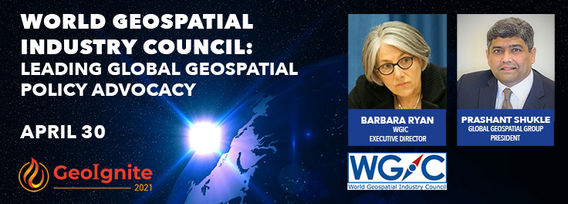
World Geospatial Industry Council: Leading global geospatial policy AdvocacyApril 30 2021, 13:00 - 14:30 EDTVirtual Workshop at GeoIgnite 2021: Canada's National Geospatial Conferencehttps://sites.grenadine.co/sites/goge...

الثّلاثاء 1 مارس, 2022


الأربعاء 17 مايو, 2023

Geoff Zeiss devoted over 30 years of his life to the Geospatial industry and global community, focusing on utility and construction sectors, and mapping underground utility infrastructure among many other projects. Sadly, Geoff passed away in September of 2022. The Geoff Zeiss Urban Infrastructure Mapping Fund was established to build on decades of innovation by Dr. Zeiss in developing effective and sustainable urban infrastructure through research and development supporting ...

الثّلاثاء 7 نوفمبر, 2023
Over the past three decades, global and national economies have undergone profound transition while the governments that have tried to steer worldwide growth have been buffeted by profound changes in how citizens interact and feel about the level of services they receive. That many of them are more empowered than ever by social media, which is often said to have hastened the growth of significant divides, speaks to the need of many governmental leader to stay in touch with prevailing th...

The GoGeomatics Expo and our sponsors are proud to present the Diversity in Leadership Panel.As the common goals of diversity, equity, and inclusion become even more widespread, organizations have the daunting task of figuring out what works.It is our vision the expo will spur the grassroots of a more diverse ecosystem where diversity of thinking and knowledge w...


الأربعاء 8 نوفمبر, 2023

Great Leadership is central to our Industry – leaders that are adeptly able to connect and interoperate with business, government, and institutional entities. While traditional hub-and-spoke leadership structures remain, a wave of agile, resilient, and dynamic leaders are stepping up. But organizations aren’t made up simply of leaders. In our quest for the best leadership, have we overlooked or forgotten about the skills, resources, and commitment to developing and empoweri...


الإثنين 28 أكتوبر, 2024

We are excited to announce that the next Canada Forum will be held during the GoGeomatics Expo in Calgary, from October 28th to 30th. This event will bring together key stakeholders from across Canada’s geospatial sector, including industry leaders, academics, indigenous communities, government representatives, and technologists, to continue vital discussions on advancing geospatial standards, interoperability, and spatial data infrastructure (SDI) in Canada.


We are excited to announce that the next Canada Forum will be held during the GoGeomatics Expo in Calgary, from October 28th to 30th. This event will bring together key stakeholders from across Canada’s geospatial sector, including industry leaders, academics, indigenous communities, government representatives, and technologists, to continue vital discussions on advancing geospatial standards, interoperability, and spatial data infrastructure (SDI) in Canada.
الثّلاثاء 29 أكتوبر, 2024

Water is one of our most vital resources, and its management is becoming increasingly complex in the face of climate change, population growth, and competing demands from agriculture, industry, and municipalities. This panel will delve into how geospatial technologies are revolutionizing water policy by providing the data-driven insights needed for smarter decision-making.Join leading experts from academia, provincial and federal gov...


30 years ago, a small group of engineers came together to work on the then difficult problem of interoperable technology, systems and data. These visionaries formed the Open Geospatial Consortium which has helped the world figure out how to collect, process, and share geospatial data over the internet and across a wide variety of technology systems. Today, with the proliferation of technology types, sensors and a...


الأربعاء 30 أكتوبر, 2024

Join us for an engaging panel discussion on Geo-Entrepreneurship, featuring distinguished experts from geospatial consultancies, geomatics communication and event companies, and geomatics software firms. This session is designed for those interested in the intersection of geospatial technology and entrepreneurship.Journey to Entrepreneurship: Hear from our panelists on their motivations for leaving traditional careers to pursue entrepreneurial ventures in the geospatial field. Dis...


Led by the World Geospatial Industry Council (WGIC) and moderated by Aaron Addison, Executive Director of WGIC, this panel will explore the transformative role of Earth observation (EO) technologies in fostering a resilient and sustainable future for Canada. With growing environmental challenges such as climate change and resource management, EO solutions provide essential insights into monitoring ecosystems, disaster resilience, and sustainable development. Panelists from diverse sectors wil...


For the built environment, digitalization is a key sustainability enabler. It helps stakeholders across the construction sector increase productivity and transparency while reducing emissions, resource consumption and costs, and adding digital tools that can help companies establish and optimize their sustainability performance.


الإثنين 12 مايو, 2025

This open forum invites all attendees to engage in discussions on Canada’s path toward greater self-reliance in the geospatial sector, particularly in light of emerging trade conflicts, including the recent U.S. tariffs, and evolving global geopolitical shifts. The forum will explore strategies to strengthen Canada’s technological capabilities and reduce reliance on external sources, with a focus on fostering innovation, security, and growth.


Join us for the OGC Canada Forum! We’ll dive into key topics like the Canadian Geospatial Data Infrastructure (CGDI) and how Building Information Modeling (BIM) integrates with Geographic Information Systems (GIS). This event gathers experts from industry, academia, Indigenous organizations, and government to explore these technologies' impact on Canada’s built environment. We'll also cover how OGC standards boost interoperability and innovation. All Canadian organ...


Join us for the OGC Canada Forum! We’ll dive into key topics like the Canadian Geospatial Data Infrastructure (CGDI) and how Building Information Modeling (BIM) integrates with Geographic Information Systems (GIS). This event gathers experts from industry, academia, Indigenous organizations, and government to explore these technologies' impact on Canada’s built environment. We'll also cover how OGC standards boost interoperability and innovation. All Canadian organ...
الثّلاثاء 13 مايو, 2025

In 2006, British mathematician Clive Humby declared that data was the new oil. Soon after there was a significant rush around the world to embrace a data revolution to try and improve humanity’s social, economic and environmental well being. Twenty-years later, the hard work of data continues. Like Canadian oil and gas, it is for the most part – a landlocked asset; unable to push us to the next levels of productivity and innovation. This keynote looks at ...


الأربعاء 14 مايو, 2025

Spatial data and related technologies have long powered the disciplines of geomatics (and its many names likes geospatial, hydrospatial) and buiilding information management. These disciplines have enabled people to better understand the natural world, the built infrastructure we place upon it, and, increasingly, the relationships between the two. The various goods and services provided by these different "spatial" communities has been global in nature and have provided eco...


Sessions in which Prashant Shukle attends
الأربعاء 22 يوليو, 2020

Opening Remarks by GeoIgnite founder Jonathan MurphyKeynote address: Geospatial Opportunities in COVID TimesGeospatial capacity has been helpful in providing answers to Canadians during a time where nothing seems normal anymore. At the forefront of tracking, reporting and managing the response to the COVID crisis are geospatial tools, data and leadership. Natural Resources Canada’s Canada Centre for Mapping and Earth Observation supported the Government of Canada’s response b...

Building on the panel discussion at GeoIgnite 2019, David Acco will discuss the potential of geospatial data and analytics to advance issues critical to Indigenous communities across Canada, from exerting sovereignty over territory, to environmental protection and climate change adaptation, to natural resources development. Mr. Acco will further outline how his firm, Acosys Consulting Services Inc., has developed an approach to marrying Indigenous Traditional Knowledge (ITK) and geospatial...

Presented by: Jake Dickinson & John Roos Abstract: As shrinking polar ice creates new opportunities for resource exploration and shipping routes, the importance for Arctic nations to monitor the ongoing expansion in the Arctic is ever increasing. Additionally, climate change continues to impact people and the environment. High resolution satellite imagery remains one of the most effective means of monitoring inaccessible and de...

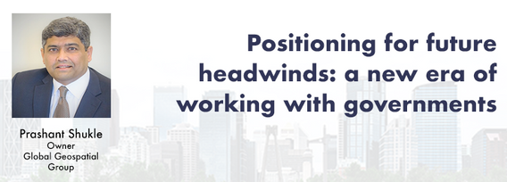
Strategic Geospatial for a Complex WorldWhere humans move and landscapes change there is value. That’s geospatial. This talk is about how to think strategically about geospatial technology in an increasingly complex world.In particular, we will focus on canada’s strengths, and how we might inject novel geospatial technology into new markets

GIS users’ numbers are expanding around the world. It is now possible to find a GIS use in every field and to optimize their success. Discover how Business Geografic work throughout all fields to offer a new and modern approach to use Geografic Information Systems. Wheter your need are the one of an expanding business, a wide world telecom company or an official government entity, find out how we can help you vizualise your data and improve your process.
الخميس 23 يوليو, 2020

Title: Growing Canada’s Next Earth Observation (EO) GenerationCanada has a proud history in Earth Observation, supporting a strong export industry driven on EO imagery and geospatial analytics. It is incumbent on all of us to continue Canada’s strong presence in the global EO community and we can only do that with a concerted effort and plan to grow the next generation of leaders. After 51 years of leadership in space and spatial information technology MDA was recen...

A closer look at some of the lidar-derived innovations for enhanced forestry management solutions and topobathymetric flood mitigation from Quantum Spatial Canada. Presented by Sven Cowan, Dr. Andrew Brenner, and Colin Cooper. Quantum Spatial, Inc., an NV5 company, is one of North America's largest geospatial services firms, providing insights to organizations that need geospatial intelligence to mitigate risk, plan for growth, better manage resources and advance scientific ...

The GeoIgnite Conference and our sponsors are proud to present the second Diversity Leadership panel. Our inaugural Summit was a great success featuring relevant diversity and inclusion topics, a powerful panel of speakers, and a "full house" of engaged participants.Increasing the diversity, equity, and inclusiveness of the Geomatics community is essential to our mission. There can be no barrier to talent at Geospatial organizations as solving the world’s most intractable proble...


Join space specialists Nick Kellett, CEO of Deploy Solutions and Kevin Jones, VP Product at PCI Geomatics for this informal, fun and insightful event! Nick and Kevin, both big hackathon advocates, will share their recent experiences of working together on exciting challenges, as well as looking at some of the coolest moments in recent space history. The session will be interactive and include a quiz and a prize giveaway, so be sure to join us for a great hour of space chat and socializing!


الجمعة 24 يوليو, 2020

In recognition of the increasing costs and risk due to flooding, the Government of Canada is investing in flood mapping as part of the Government’s commitment to build safer and more resilient communities. Flood maps are critical for the public to understand their flood risks, and the availability of up to date flood hazard maps are key to strengthening the resilience of Canadian communities to overland flooding. Natural Resources Canada (NRCan) has been working in collaboration to advance...

We are living through a transformative time, not least in the space industry. A graph of upcoming satellite launches looks like a hockey stick – soon there will be orders of magnitude leading to more satellites being launched and more downstream data being generated from space than ever before. The question is, what is the most effective means of ensuring that space data brings tangible benefits to business operations and value to end users? In our talk we cover a satellit...

Title: DEIL experiments and outputs with open geospatial dataThe Data Exploration and Integration Lab (DEIL) at Statistics Canada has implemented a number of projects using, to the extent possible, open georeferenced data and open source tools. This presentation outlines some of this work. We will present recent developments of the Linkable Open Data Environment (LODE), examples of the use of LODE data, the development of a Proximity Measures Database and Data Viewer, and an R&amp...


Abstract A fundamental shift in the geospatial industry has occurred over recent years. Modern remote sensing technology has been developed at PCI Geomatics and in Canada through advanced research through partnerships with private industry, academia, and government researchers. Ubiquitous access to openly accessible earth observation data, cloud computing infrastructures and international collaboration have created opportunities to increase downstream access to inf...
الجمعة 23 أبريل, 2021

Join GeoIgnite for this inaugural panel of provincial and territorial geospatial and location technology leaders.We will be discussing issues surrounding: What are main priorities and challenges across jurisdictions? What types of geospatial tools we use to monitor and respond to key challenges like emergency response? How are jurisdictions aligning geospatial tools, data, and people to address climate change? What are some current data...


الإثنين 26 أبريل, 2021

Tickets for this workshop must be claimed in advance.Join Maxar Product Manager, Jake Dickinson, to learn first-hand how SecureWatch provides commercial and government organizations access to authoritative geospatial information to make decisions and act with confidence. Satellite imagery is foundational to geospatial workflows because it enables analysts to understand and model the locations and characteristics of land, facilities and equipment. But histori...


PLEASE NOTE THE PREFERRED BROWSER IS GOOGLE CHROME. If you are running into any issues accessing the session, please try logging in via Google Chrome.The use of drones or UAVs has expanded dramatically over the last few years and this technology is rapidly permeating a wide variety of professional disciplines and industries, including the broad field of GIS. Ideally suited for on-demand geospatial data collection, drones can effectively eliminate the logjam tha...

الأربعاء 28 أبريل, 2021

Tickets for this workshop must be claimed in advance.At a time of rising climate change impacts, there is a vital and growing need to prepare for, respond to, and recover from natural disasters. But there is a critical communication gap between authorities and citizens.Drawing on the ongoing results of our massive multi-year climate change R&D project, and with assistance from hundreds of students, citizens...

Tickets for this workshop must be claimed in advance.The use of drones, officially referred to as Remotely Piloted Aerial Systems (RPAS), has been forecasted to play a key role in the digitalization and further optimization of a variety of geomatics applications such as in resource aggregates management, landfill management, civil engineering (3D reality capture, virtual surveying), and precision agriculture. To help realize this forecast it is important for ...


الخميس 29 أبريل, 2021
During the past 30 years the Damage prevention and Utility Engineering industry has grown and developed into what it is today. The industry has slowly grown year after year and has gained acceptance as a best practice with 811 laws in the US and in Ontario the Call Before you dig legislation Bill 8 a precedent setting event in Canada. We now look at how best to modernize the systems and leverage technology to elevate the 2 industries damage prevention and Utility Engineering. The te...
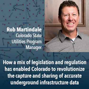
Mapping the Colorado Underground: Colorado is proactively using a 2018 One Call law and new procedures to reduce underground utility hits, which in the US exceed 50,000 annually. The law requires higher accuracy One Call utility locates (Level B). The presentation will describe: 1) including higher accuracy utility locations on contractor bidding documents, 2) installing electronically locatable devices on new utilities, 3) the impact on unde...
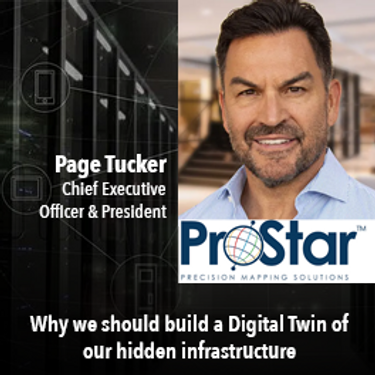
A look at the subsurface infrastructure that is far greater in size than the surface transportation systems. This other infrastructure is just as critical to our economy by providing the utilities that we take for granted.. This buried infrastructure is aging, becoming dilapidated and desperately in need of repair and replacement. It is what lies beneath our roads and railways systems and comprises our utility and pipeline systems. ProStar’s CEO and Founder Page Tucker will look at this va...


UEVO is a Digital Twin of city subsurface infrastructure, which helps solve the problem of managing aging, complex infrastructure under increasingly strained budgets. UEVO unifies fragmented data to enable multiple stakeholders to visualise, manipulate and create subsurface elements quickly and easily, collaborating in real time.


Moderator: Prashant ShuklePresenters: Rob Martindale, Olive Powell, DND, PSPC
الجمعة 4 مارس, 2022

The Association of Canada Lands Surveyord (ACLS) has developed a certification model for hydrographers which, has been officially recognized by the IHO/FIG/ICA International Board of Standards and Competence for Hydrographic Surveyors and Nautical Cartographers (IBSC) in April of 2016. The ACLS program is the second internationally recognized scheme in the world. Certification for a hydrographic surveyor is desirable because: - Certification provides a formal...

الخميس 10 مارس, 2022

Taking urgent action to combat climate change and its impacts" is a crucial goal set forward under Goal 13 – Climate Action as part of the United Nations Sustainable Development Goals (SDGs).Climate action requires global efforts related to climate change mitigation – reducing the flow of heat-trapping greenhouse gases into the atmosphere, or enhancing the "sinks" that accu...


Join this session to get the latest information on Maxar foundational products as well as demonstrations and round-table conversation with our subject matter experts. Please bring your questions if you're a current user, or come ready to experience the industry's best satellite imagery for the first time.


الإثنين 12 مايو, 2025

Join us for a thought-provoking lunchtime discussion where we explore the evolving landscape of Canada’s geospatial industry while enjoying a delicious meal.The concept of Two Solitudes has long symbolized the cultural and linguistic divide between English and French Canada, but how does this idea still resonate within our geospatial ecosystem to...

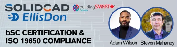
BUY YOUR TICKETJoin SolidCAD and EllisDon for an in-depth overview of the buildingSMART Certification plus additional information on ISO 19650 compliance and BIM Executive Management using Plannerly.All stakeholders in the construction and real estate industry who are eng...


📅 Date: Monday, May 12, 2025📍 Location: Rainbow Bistro, 76 Murray Street, ByWard Market, Ottawa⏰ Time: Networking at 6:30 PM | Panel begins at 7:00 PM | Live music to follow🍽 Details: Cash bar and hors d’oeuvres provided Event OverviewJoin us for an evening of high-level discussion, networking, and live music in the heart of Ottawa’s historic By...

