Dragos Dristaru
Sessions in which Dragos Dristaru attends
الأربعاء 21 أبريل, 2021
Join us for the the launch of GeoIgnite with Jonathan Murphy, the Chair of GeoIgnite, and Dr. Minda Suchan of MDA.Abstract of MDA Keynote: Canada is the world leader in wide area space-based radar Earth observation through the highly successful RADARSAT program, supporting numerous operational and scientific uses for Synthetic Aperture Radar (SAR) data. MDA, in conjunction with the Canadian government, has created an internationally recognized brand and reputation for...
Do you know what the geospatial product trap is? We fall in love with the technology, not the problem. I am a lucky person. My job has evolved to one where I primarily get to talk about geospatial technology all day. I could be scoping out internal or external projects or evaluating technologies. Increasingly, I provide advice on product ideas. This final situation has forced me to consider the nature of our community-of-practice. The common assumption that geospatial ...
À l'automne 2020, NV5 Geospatial, propulsé par Quantum Spatial, a été mandaté par la Communauté Métropolitaine de Montréal (CMM) pour réaliser l'un des plus grands levés lidar topobathymétriques aériens fluviaux jamais entrepris au Canada. Cette présentation examinera de plus près le contexte, les objectifs, les défis, la technologie, la méthodologie, ainsi que les résultats et conclusions préliminaires de cette importante étude aérienne des vingt-huit principaux cours d'eau entourant la v...
Maxar is building the highest resolution and most accurate 3D map of the planet and this talk will provide an overview of the products and capabilities that are making it possible.
الخميس 22 أبريل, 2021
At a time of rising climate change impacts, there is a vital and growing need to prepare for, respond to, and recover from natural disasters. But there is a critical communication gap between authorities and citizens. Drawing on the results of our massive multi-year climate change R&D project, and with assistance from hundreds of students, citizens, academics, NGOs, and government officials, we have identified the top perceived climate change-relatedcommunication problem...
In this presentation, Dr. Walter Scott will compare the satellite imaging constellations of Maxar and other commercial companies to show how they stack up in three key metrics: product-market fit, adaptability and capital efficiency. He will also share some key insights on the next generation of Earth Intelligence arriving in 2021 with the launch of WorldView Legion, and what impact that will have for the Canadian geospatial market in the months and years ahead.
Applying SafeGraph’s Canadian POI data for community-level analysis in ArcGIS and TableauGeospatial data empowers research bodies, government agencies, and the private sector to visualize and analyze complex problems in new and innovative ways. But location data is only valuable if it is accurate - something many GIS and data analysts know all too well. Armed with accurate, precisely geocoded POI data that includes key attribution related to brands and business types, analys...
With PetaBytes of data flowing out of Low Earth Orbit everyday, the opportunity afforded by Earth Observation seems to be greater than ever. But is our community realizing that opportunity yet? Are there winners? How should we be thinking about EO businesses in the roaring 2020s?
الجمعة 23 أبريل, 2021
The global geospatial industry is estimated at US$ 500 Billion and delivers an even more significant impact on society, with derived economic benefits estimated to be multifold. These benefits, however, are still not fully understood by key stakeholders and policy and decision-makers, ultimately hindering the global uptake of geospatial information. With decades of national spatial data infrastructure efforts around the world, how can this be? Focusing on the importance of...
In 2003, when GISPartner entered the business Poland was still far behind more developed countries in terms of IT implementation. In 2021 the gap is incomparably smaller and some of Polish IT solutions are widely used across the globe. When public administration is considered, it was also GISPartner, which greatly contributed into transforming paper & stamps into high-class software solutions. We want to share our thoughts on how clever, tailor-made IT solutions are driving this transf...
With rapid advances in Earth observation, cloud computing, and analytics technologies, more information on our changing world is more readily available than ever before. Planet is an aerospace and data analytics company at the forefront of these advances -- working to make global change visible, accessible, and actionable, Planet images the full Earth daily at 3.5m resolution and anywhere sub-daily at <50cm. In this talk, we’ll hear from Tara O’Shea, Planet’s Director of Forest Programs, o...
Join GeoIgnite for this inaugural panel of provincial and territorial geospatial and location technology leaders.We will be discussing issues surrounding: What are main priorities and challenges across jurisdictions? What types of geospatial tools we use to monitor and respond to key challenges like emergency response? How are jurisdictions aligning geospatial tools, data, and people to address climate change? What are some current data...
الإثنين 26 أبريل, 2021
PLEASE NOTE THE PREFERRED BROWSER IS GOOGLE CHROME. If you are running into any issues accessing the session, please try logging in via Google Chrome.The use of drones or UAVs has expanded dramatically over the last few years and this technology is rapidly permeating a wide variety of professional disciplines and industries, including the broad field of GIS. Ideally suited for on-demand geospatial data collection, drones can effectively eliminate the logjam tha...
الثّلاثاء 27 أبريل, 2021
Google Chrome is the preferred browser for this session.Tickets for this workshop must be claimed in advance.This session will occur from 10:00AM-11:00AM and repeat again from 11:00AM-12:00PMBeSpatial is a geospatial community platform in Ontario that has opened doors to connect, communicate and innovate. BeSpatial aims to provide networking opportunities, programs, and ...
Google Chrome is the preferred browser for this session.Tickets for this workshop must be claimed in advance.Have you ever wanted to learn more about Synthetic Aperture RADAR (SAR) and Electo-Optical (EO) products? Come join this session for an introduction to some of the basic imaging parameters and learn about the different p...
Google Chrome is the preferred browser for this session.Tickets for this workshop must be claimed in advance.This workshop will be broken down into 4 parts:1. Introduction to ERDAS IMAGINE2. Spatial Modeling for Wildlife Applications3. Using AI, Spatial Modeling and Python to Break Down Big Data Barriers4. Q & ASpatial Modeling ...
الأربعاء 28 أبريل, 2021
Tickets for this workshop must be claimed in advance.At a time of rising climate change impacts, there is a vital and growing need to prepare for, respond to, and recover from natural disasters. But there is a critical communication gap between authorities and citizens.Drawing on the ongoing results of our massive multi-year climate change R&D project, and with assistance from hundreds of students, citizens...
Tickets for this workshop must be claimed in advance.The use of drones, officially referred to as Remotely Piloted Aerial Systems (RPAS), has been forecasted to play a key role in the digitalization and further optimization of a variety of geomatics applications such as in resource aggregates management, landfill management, civil engineering (3D reality capture, virtual surveying), and precision agriculture. To help realize this forecast it is important for ...
الخميس 29 أبريل, 2021
Tickets for this workshop must be purchased in advance.
During the past 30 years the Damage prevention and Utility Engineering industry has grown and developed into what it is today. The industry has slowly grown year after year and has gained acceptance as a best practice with 811 laws in the US and in Ontario the Call Before you dig legislation Bill 8 a precedent setting event in Canada. We now look at how best to modernize the systems and leverage technology to elevate the 2 industries damage prevention and Utility Engineering. The te...
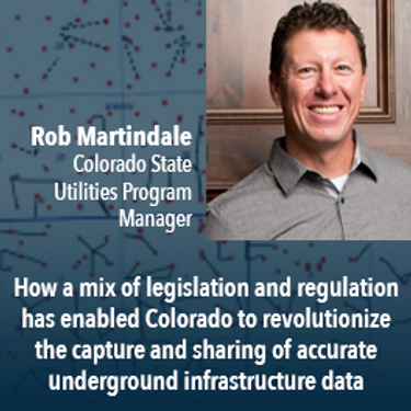
Mapping the Colorado Underground: Colorado is proactively using a 2018 One Call law and new procedures to reduce underground utility hits, which in the US exceed 50,000 annually. The law requires higher accuracy One Call utility locates (Level B). The presentation will describe: 1) including higher accuracy utility locations on contractor bidding documents, 2) installing electronically locatable devices on new utilities, 3) the impact on unde...
A look at the subsurface infrastructure that is far greater in size than the surface transportation systems. This other infrastructure is just as critical to our economy by providing the utilities that we take for granted.. This buried infrastructure is aging, becoming dilapidated and desperately in need of repair and replacement. It is what lies beneath our roads and railways systems and comprises our utility and pipeline systems. ProStar’s CEO and Founder Page Tucker will look at this va...
UEVO is a Digital Twin of city subsurface infrastructure, which helps solve the problem of managing aging, complex infrastructure under increasingly strained budgets. UEVO unifies fragmented data to enable multiple stakeholders to visualise, manipulate and create subsurface elements quickly and easily, collaborating in real time.
ASCE 38 was first published in 2002. It served as the basis for subsequent standards in UK (PAS 128), Australia, Malaysia, and Ecuador. It serves as the principal standard for the practice of subsurface utility engineering around the globe, and is referenced as the standard to use for existing buried utility investigations in CSA S-250. The latest edition of ASCE 38 takes into account the practice improvements, technological changes, and various interpretations of ASCE 38 since 2002. The l...
الجمعة 30 أبريل, 2021
Tickets for this workshop must be purchased in advance.
الثّلاثاء 1 مارس, 2022
"GHG Monitoring from Space: A mapping of capabilities across public, private and hybrid missions" was a collaborative effort undertaken by the Group on Earth Observations (GEO), WattTime, and the World Geospatial Industry Council (WGIC).This report, presented at the United Nations Framework Convention on Climate Change (UNFCCC) Earth Information Day at the 26th session of the Conference of the Parties (COP 26), was the first syst...
NV5 Geospatial has been at the forefront of hydrospatial data acquisition and processing for decades. This presentation will provide a brief corporate introduction and overview of some of the technologies relevant to remotely sensed hydrospatial data collection and development. This will also include associated analyses and ancillary data integration to solve questions surrounding hydrology and wetland mapping, flood risk modeling, and habitat...
الأربعاء 2 مارس, 2022
Dr. Marshall and Keith Masback will explore climate change and what happens at the intersection of climate and the Earth’s surface.
Inter-annual variability in agricultural production in Canada is largely determined by weather and climate. Climate-related impacts have caused billions of dollars in financial losses in some years, with the incidence of extreme weather and related costs expected in increase in a changing climate. The National Agroclimate Information Service at Agriculture and Agri-Food Canada monitors the impacts of weather and climate on agricultural activities using a number of geospatial data sets, mod...
الخميس 3 مارس, 2022
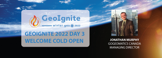
Join Jonathan Murphy as they kick off the start of Day 3 Winter Geo:GeoIgnite 2022 and announce our award recipients.


