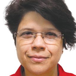
Sessions in which Adreeta Sarmah participates
الإثنين 17 يونيو, 2019
Gain insights on the possibilities and challenges with leveraging and integrating a complete open source GIS stack into your applications and projects. Sessions will be led by members of OSGEO-Ottawa.The first session involves high level presentations showcasing use case scenarios and highlighting strengths and limitations of each tools. This session is designed for managers, analysts, and non-technical individuals to discover and learn about what open source GIS tools are available, ...
The second session is a hands-on workshop, with a maximum participation of 12, and is designed more for participants that have a more technical background. This allows them to actually gain practical experience in the use of the open source GIS tools. Sessions will be led by members of OSGEO-Ottawa. Topics will include leveraging QGIS Desktop and the Semi-Automatic Classification plugin to extract a forest canopy cover map of Ottawa using either Sentinel or Landsat satellite imagery...
Sessions in which Adreeta Sarmah attends
الأربعاء 21 أبريل, 2021
Join us for the the launch of GeoIgnite with Jonathan Murphy, the Chair of GeoIgnite, and Dr. Minda Suchan of MDA.Abstract of MDA Keynote: Canada is the world leader in wide area space-based radar Earth observation through the highly successful RADARSAT program, supporting numerous operational and scientific uses for Synthetic Aperture Radar (SAR) data. MDA, in conjunction with the Canadian government, has created an internationally recognized brand and reputation for...
Do you know what the geospatial product trap is? We fall in love with the technology, not the problem. I am a lucky person. My job has evolved to one where I primarily get to talk about geospatial technology all day. I could be scoping out internal or external projects or evaluating technologies. Increasingly, I provide advice on product ideas. This final situation has forced me to consider the nature of our community-of-practice. The common assumption that geospatial ...
الإثنين 26 أبريل, 2021
Tickets for this workshop must be claimed in advance.Join Maxar Product Manager, Jake Dickinson, to learn first-hand how SecureWatch provides commercial and government organizations access to authoritative geospatial information to make decisions and act with confidence. Satellite imagery is foundational to geospatial workflows because it enables analysts to understand and model the locations and characteristics of land, facilities and equipment. But histori...
الأربعاء 28 أبريل, 2021
Tickets for this workshop must be claimed in advance.The use of drones, officially referred to as Remotely Piloted Aerial Systems (RPAS), has been forecasted to play a key role in the digitalization and further optimization of a variety of geomatics applications such as in resource aggregates management, landfill management, civil engineering (3D reality capture, virtual surveying), and precision agriculture. To help realize this forecast it is important for ...
الخميس 29 أبريل, 2021
Tickets for this workshop must be claimed in advance.This workshop will offer a deep-dive into the Avenza Maps app, a mobile app where users can upload or access custom maps for off-line navigation, way-finding, and data collection. The workshop will be composed of 5 modules covering the fundamentals of the apps usage, as well as more advanced industry-relevant features. We will also provide a walkthrough of using the Av...


