
Sessions in which Dallas Rathbone participates
Wednesday 19 June, 2019
Mainstreaming of the geospatial market has created a big demand for geospatial content and solutions across governments, businesses and consumers. The Fourth Industrial Revolution (4IR) has also helped scale up applications and value to much larger markets, amplifying overall impact and contribution of geospatial information in the world economy and society. With every added application and consumer, the return on investments get bigger and better. The panel shall focus...


Global Grid Systems is on the leading edge of DGGS technology and is applying it in many exciting applications. A Discrete Global Grid (DGG) is a partition of the Earth’s surface into a set of regions (a.k.a. cells) containing a single point and meeting the needs for global sampling, storage, modeling, processing, analysis, discovery, integration, and visualization.We're building an engine that powers applications in marketing, telecommunications, insurance, and gov...
Sessions in which Dallas Rathbone attends
Monday 17 June, 2019

Delegates, exhibitors, sponsors, speakers and volunteers are invited to Join GeoIgnite for our Pub Social at Heart & Crown on the ByWard Market.The Heart & Crown, in Ottawa’s historic ByWard Market, consists of 5 pubs under 1 roof with 6 patios that make-up what is locally known as Ottawa’s Irish Village. Featuring Irish-inspired dishes, live music daily and domestic & international sporting events; there’s a little something for everybody. A favourite amongst the Iri...
Tuesday 18 June, 2019

Jonathan Murphy the Founder of GeoIgnite and GoGeomatics welcome participants to the conference
There's never been a more exciting time to be a part of the geospatial profession. From mapping the infrastructure beneath our cities to indoor wayfinding, to plentiful and powerful remote sensing capabilities in air and space which we could hardly have imagined just a few years ago, the opportunities - and the expectations - for geospatial professionals are immense. Technology is evolving at a pace which outstrips the ability of academics, governments, and industries to keep pace. How will w...

Let’s admit it! We live in exciting times with technology, social interactions and business models changing before our eyes: Flying taxis, self-driving cars, commercial Space missions, smart cities, SmallSats and Internet Of Things (IOT) to name just a few innovations! Our kids are growing up in a world of on-demand TV, GPS availability, all around virtual assistants, and mobile devices that pretty much can do anything! Each and every one of these innovations has a location element to i...
Prashant Shukle is the Director General for the Canada Centre for Mapping and Earth Observation Branch, Earth Sciences Sector, at Natural Resources Canada (NRCan).NRCan has fostered an enabling policy mechanism and provided a conducive framework for geospatial information infrastructure. In today’s digital age when geospatial is becoming more and more ubiquitous, open and inter-disciplinary policies are the key instruments of harnessing the true value of this wonderful technology...
What are the ramifications of the current digital transformation globally and what will it mean for Canada and the globe? Our award winning panel of international and Canadian experts disscuss and take questions from delegates.


Alberta View: Economic impacts and Opportunities of the Geospatial SectorLocation technologies are changing the way we live, work, and play, and are having a transformative impact on industries across Canada. The intersection of location technologies with Virtual Reality and Augmented reality are rapidly transforming key sectors of the Canadian economy including transportation, the resource sector, the digital and interactive media sector and transforming how governments d...

The future is digital. Big data is an integral part of the digital transformation of a private or public organization. Location and geospatial technologies are at the heart of the digital transformation as enablers, game changers and contribute to the success of big data in many ways. Combined with emerging geospatial artificial intelligence, the possibilities are limitless. Smart cities and autonomous vehicles are examples of this potential. However, this big data revolution raises many lega...

Several key trends in the geospatial industry over the last few years have created the conditions needed to truly leverage remote sensing as a technology that has the potential to provide tremendous benefit to civil society. These include changes in data policy, most notably with USGS's decision in 2008 to make all Landsat archives free and open, a policy which led the European Space Agency to also implement free and open access to the Copernicus constellation. The volume of data that is incr...

Hope Spots are special places that are critical to the health of the ocean — Earth’s blue heart. Some Hope Spots are already formally protected, while others still need defined protection. The Mission Blue team has embarked on a series of expeditions to shed light on these vital ecosystems and ignite support to safeguard them as marine protected areas.The IUCN are an integral partner in the Mission Blue initiative and the Hope Spot concept ties into UN amb...

Today, geospatial technologies are embedded in many of the workflows that support the Fourth Industrial Revolution and therefore invaluable to users. This means that geospatial information is no longer the domain of specialists and suddenly has become a context for the rest of our augmented existence.From Pokémon Go, to Uber and autonomous vehicles (AV), Internet of Things (IoT) and Artificial Intelligence (AI), smart applications and on-line mapping tools give the public almost insta...

The Internet of Things (IoT) is here. Whether applied to industrial automation, wearables, connected transportation and logistics, drones or smart cities, IoT is poised to disrupt how we work, live and relate to each other, delivering great benefits along with new challenges. Improved revenue, costs, quality of life and convenience benefits are often confounded by concerns such as privacy, security, and social disruption, with location info playing no small role on both sides. So, what exactl...
The UK Government as part of its building information modeling (BIM) initiative has said repeatedly that it expects the big payoff of a digital model will be during operations and maintenance, which typically represents 80% of the cost of a facility. Companies who do design, build, finance, and maintain, or design, build, operate, or PPP projects often employ a full lifecycle BIM + geospatial strategy. For example, Crossrail appears to be the first major project that may be able to provide su...
The Earth is immense, and abundant with interesting information. Recent advancements in geospatial sensors (e.g. satellites, smart phones, meteorological instruments, and LIDAR) have resulted in the development of technologies capable of collecting large and dynamic geospatial data. As a result, we are experiencing an explosion in the volume and variability of geospatial data, and yet many in public remain unaware of or unable to access this wealth of data to make informed decisions regarding...

Cloudy with a chance of data science.Sparkgeo had been building cloud first geospatial applications, from day 1. But that was not the plan. The plan was to make more maps for more people, using the internet.Sitting at the intersection of software development and GIS we see how these two communities can benefit from each other. But, to do so, we will have to step out of our comfort zones.Let me tell you the story of a lowly GIS tech's journey through the technol...

The Mapbox live location platform was designed to serve all levels of government and the critical services they support. Develop custom mapping and location applications from start to finish in your own private cloud or on-premises infrastructure. Atlas offers the same capabilities found on Mapbox.com only offline, and deployable anywhere, even on your own infrastructure. Learn more about accessing and analyzing your sensitive geospatial data on and off network during this 30 minute session. ...

We are entering a new era of positioning, navigation and timing. Global, instantaneous, and easily accessible positioning at better than 10cm is coming, which will provide new ways of doing business and create new businesses in areas such as augmented reality. In recent years global Positioning, Navigation and Timing have been undergoing rapid technological development. New GNSS constellations (Galileo, Beidou) with new signal structures offer increased capabilities, while future posi...

Please join fellow conference attendees for an amazing networking reception in the exhibitor hall sponsored by Mapbox. The event will feature surprise performances and appetizers, and will be a great chance to connect with other geospatial professionals.
Wednesday 19 June, 2019
Marikka Williams, MSc, GISP and Professor, Fleming College Geographic Information Systems welcomes delegates to the morning and will be master of ceremonies for the morning.
The coastal zone is a challenging place to map, techniques for mapping the land elevation do not work under water and echosounding methods for mapping the seabed elevation work well in deep water but are dangerous and expensive in shallow water. As a result, detailed information in the shallow coastal zone is lacking. This presentation will focus on the Chiroptera II shallow water topo-bathymetric lidar sensor that can collect seamless elevation data in coastal or freshwater environments. The...
This Canadian military presentation will show various datasets of survey grade terrestrial LiDAR, discuss collection methods to achieve the best results and talk about possible applications/analysis that the data can be used for. Presentaers will demonstrate some workflows in Leica Cyclone to show how survey grade points can be extracted and discuss the pros/cons and considerations of using terrestrial LiDAR.

Ecopia.ai will present how its semi-automated approach of combining deep neural networks with scalable crowd map annotators can be combined to create continental scale vector map data while achieving human-level accuracy. In this discussion, Brandon Palin will speak to use cases and industries that are using our technology to make better decisions quicker, including governments, and NGOs globally.

Megan works with national players in the Construction Industry, balancing high-level strategic direction and thinking with operational needs and technologies. She works with Departmental Stakeholders, Clients, and Private Sector Service Providers alike to bring digital efficiencies and innovation to workflows and processes in Real Property portfolio, program, and project, management. Megan has been a strong voice for digital transformation within the Federal Government's Real Property Communi...
Remote sensing is the most cost-effective means for gathering timely detailed and reliable information over large areas with high revisit frequency. The integration of remote sensing data with national statistics, field observations and secondary data show great potential for mapping crop acreages. This requires the selection of appropriate satellite data, the collection of quality ground information, the application of suitable pre- and post-processing methods and the implementation of a rob...
Synthetic Aperture Radar (SAR) satellites image the Earth in all weather conditions, day or night. Canada’s RADARSAT-2 satellite, launched in 2007, orbits the Earth with a 24-day revisit cycle. It is used for mapping ground deformation produced by natural and anthropogenic hazards; natural resource development; permafrost, glacier and coastal changes. The next generation of Canadian satellites, the RADARSAT Constellation Mission (RCM), to be launched in June 2019, will improve the revisit cyc...
Creating maps has traditionally been a one-way process in which GIS professionals and cartographers translate spatial data into for use by maps used by other knowledgeable professionals. However, as the volume of data being collected by virtually every industry increases the demographic of the map consuming audience is changing to include more people with less GIS knowledge. The challenge has become how best to simplify maps for the user and also to find ways to incorporate input from users i...
The GeoIgnite Conference and our sponsors are proud to present the inaugural Diversity in Leadership Summit (DILS). It is our vision that GeoIgnite will spur the grassroots of a more diverse ecosystem where diversity of thinking and knowledge will ignite innovation and better outcomes for us all. The DILS is the flagship forum for of geo professionals of all ages and stages in...


The Government of Canada purchases on average $22 billion in goods and services each year to help deliver programs and services to Canadians. Many departments and agencies collect and manage large amounts of geospatial data, and significant investments have been made within these organizations. The demand for, and use of, geospatially-related data and tools is rapidly increasing across government, as well as in the broader public context. This information session will help you understand the ...

An experienced, senior executive, and strategic thinker, with an entrepreneurial attitude and a successful track record of growing Companies in the software and data industries through to IPO and acquisition exits. Possessing a strong technical grounding in IT, particularly in geospatial-related technologies, with extensive knowledge and experience of Marketing/Business Development, direct and indirect (channel) sales, Product Management, Systems Architecture and Software development....
The value of geospatial big data and how to efficiently convert it to useful information is an important cross disciplinary question. There has been significant investment in the collection and archiving of geospatial and other environmental data and numerous organizations recognize the importance of this information resource. However, the software and computing systems to effectively and efficiently access, interrogate, and utilize this information for specific applications has not seen the ...

It takes village to raise a business, but there is no reason it shouldn’t be a global village. Sparkgeo started with the simple idea that it would be good to put maps on the internet. From there we have evolved into a geospatial consultancy providing generalized non-vendor specific geospatial advice, with an ability to back up what we say with code and data. This is a story about serendipity, intermingled with a pinch of good fortune with an occasional lucky break.

Over the last few years, the Data Exploration and Integration Lab (DEIL) at Statistics Canada has conducted an increasing amount of work with open data using various open source tools in an open ecosystem. This exploration and experience has given rise to the idea of using an “open project” approach; that is, an approach that, to the extent possible, makes use of open source software, open code, open standards, open data, open platforms and open project management tools. The presentation outl...

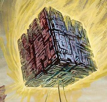
Due to climate change, natural hazards are happening more in recent days. Analyzing these changes and prediction of future hazards have been always a challenge in the field of Geographic information systems (GISs). Traditional GIS aims to use map versus globe for their models, standards, and analysis. With the advances on Discrete Global Grid Systems, a new research question has been raised on what if we adapt our traditional approaches into a Digital Earth rather than a map. Digital Earth (G...

Natural Resources Canada provides mapping and engineering advice and expertise to Public Safety Canada in support of the National Disaster Mitigation Program. Notably, NRCan develops the Federal Flood Mapping Guidelines Series and is nearing publication on two documents that will move Canada closer to having common practices for flood risk: • The Federal Hydrologic and Hydraulic Procedures for Flood Hazard Delineation, and • The Federal Geomatics Guideli...

While much of the data available about the Earth pertains to the surface, there also exists a large amount of data available about the atmosphere and regions below the surface. Examples of such data include weather information, lithospheric properties such as velocity, aircraft and satellite flight paths, and underground utility networks. Flattening such volumetric data to the surface for integration with a traditional discrete global grid system (DGGS) discards the spatial relationship betwe...