Virtual Meeting Space - Room 2
Sessions
11:30 AM
11:30 AM
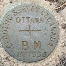
- Calvin Klatt - Director and Chief Geodesist for the Canadian Geodetic Survey - Mind the Gap! Canada’s response to the United States’ change of reference frame: Options and Implications Virtual Meeting Space - Room 2
- 11:30 AM - 12:15 PM | 45 minutes
- The U.S. reference system modernization effort will replace the North American Datum of 1983 (NAD83) with a new North American Terrestrial Refe...
-
1:30 PM
1:30 PM
- David Harper - Director General - ECCC - Talk: Space-Based Earth Observation in Canada - A Vision for the Future Virtual Meeting Space - Room 2
- 1:30 PM - 2:15 PM | 45 minutes
- Space-Based Earth Observation in Canada - A Vision for the Future Today, Canada’s landscape, coasts, waters, and cities...
-

2:30 PM
2:30 PM
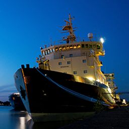
- Hydrospatial: Science Coastal Flooding + Detection & Response for Tsunami Virtual Meeting Space - Room 2
- 2:30 PM - 3:15 PM | 45 minutes
- Ocean, Marine & Coastal Hydro(Geo)spatial Management is critical for the Blue Economy. Much knowledge, data, information and coordination ar...
- Talk
-
12:00 PM
12:00 PM
- James Ashton - Technology Manager - Agriculture and Agri-Food Canada & Paul Giroux from Slimgim - Agriculture Canada’s COVID-19 Response Virtual Meeting Space - Room 2
- 12:00 PM - 12:45 PM | 45 minutes
- Agriculture Canada’s COVID-19 response with location data & technology helping drive Objectives and Key Results (OKR’s) on the Enterprise...
-

1:45 PM
1:45 PM
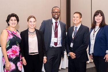
- Diversity in Leadership Panel: Canada's Geospatial Ecosystem Virtual Meeting Space - Room 2
- 1:45 PM - 2:30 PM | 45 minutes
- The GeoIgnite Conference and our sponsors are proud to present the second Diversity Leadership panel. Our inaugural Summit was a great success f...
- Panel


10:30 AM
10:30 AM
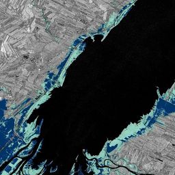
- Dr. Heather McGrath - NRCan - Talk: Flood mapping activities and research at Natural Resources Canada Virtual Meeting Space - Room 2
- 10:30 AM - 11:15 AM | 45 minutes
- In recognition of the increasing costs and risk due to flooding, the Government of Canada is investing in flood mapping as part of the Governmen...
-
12:30 PM
12:30 PM
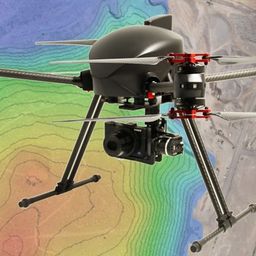
- How to challenge the Lasers-scanning market at the cost of a drone and simple tools combined with Artificial Intelligence and Pix4D processing software Virtual Meeting Space - Room 2
- 12:30 PM - 1:15 PM | 45 minutes
- The key elements to take into account a successful implementation of drone survey with a mm accuracy are: Know your camera; Trust your measureme...
-