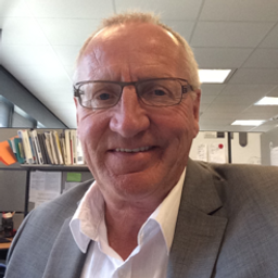
Richard Gorecki
Sessions in which Richard Gorecki attends
Tuesday 7 November, 2023
Is change the new normal? Every year seems to be the next warmest year. Those of us looking back at our planet from space are seeing these changes across our planet in near real-time through the eyes of satellites. But behind those pixels are real human stories of catastrophe and suffering. So, with all our constellations of satellites, massive computing power and new generative AI algorithms, can we do anything more than simply report what happened? What does the future hold for geospatial t...
With climate change comes a massively increased risk to billions of people due to disasters, reduced food and energy security, environmental degradation, and sea level rise to name a few. For example, it is estimated that 200,000,000 people live in low-lying areas of the world considered highly vulnerable.The global OGC community has mobilized to improve how well we connect land, sea, and air Geospatial data and information, improve regional connectivity between various SDIS &nbs...
Addressing the escalating levels of methane in the Earth's atmosphere is among the most urgent issues humanity faces. Methane ranks as one of the most potent greenhouse gases (GHGs), trapping over 25 times more heat than carbon dioxide over a 100-year period; thus, significantly reducing methane emissions will make a substantial impact in the fight against climate change.One of the most impactful methods for mitigating methane emissions involves the prompt detection and repair of metha...
In the face of escalating environmental challenges, Canada grapples with the urgent need for advanced solutions in wildfire monitoring, emissions reduction, and natural resource management. This panel discussion explores how the burgeoning "New Space" frontier offers innovative approaches to address these critical issues.We aim to provide a platform for various industry players to share their own innovative technologies and insights, creating a vibrant dialogue on crucial geospatial...
Flooding is Canada’s most costly natural disaster, and flood risk intensifies as a result of urbanization and climate change. These impacts will change over time and can jeopardize the overall sustainability of communities if they remain unaddressed. As socio-economic consequences worsen, it underlines the need for governments to provide current and accurate hazard information to vulnerable populations, including Indigenous communities who are disproportionately affected, to make decisions...
With an increasing multitude of new Earth Observation (EO) satellites, it is imperative for the geomatics community to assess the fit of these emerging space assets. This presentation aims to provide a comprehensive analysis of the diverse range of EO satellites currently being deployed, and their potential applications.Topics:1) An Overview of the recent surge in EO satellite launches2) New satellite capabilities, and use cases3) An exploration of the challenges customers ...
Incidents involving dangerous goods, including flammable gases and liquids, can happen at any time and in any place. When they do, Emergency Response Assistance Canada's 320+ members count on us to provide a safe and effective emergency response 24 hours a day, 365 days a year.Various GIS solutions exist within Emergency Response Assistance Canada (ERAC) to support these functions. Examples include our resource locator tool that spatially queries and returns key information from 40+...
Creating, managing and sharing geospatial information has never been easier, but how do we ensure the information we are using to make key business decisions is current, correct, accurate and the best fit for purpose? This session will explore the different types of geospatial information assets being used at The City and the different tools, methods and standards that are being used capture, manage and share authoritative City data across the organization and to the Citizens of Calgary.
Geomatics is growing technically and economically at a rapid pace. The need for skilled, knowledgeable workers is higher than ever. Some may argue that the technical advancements of the industry reduce the need for skilled workers and will remove the event of human errors. Others will argue that the very technology that is reducing human error can lead to increasing other errors and be a cause of delays on projects if the person operating the technology is not perceptive ...
Harnessing the power of regular collection of imagery and Lidar, the City of Calgary provides valuable information for municipal service delivery. The City publicly shares various datasets in different formats, including Orthophotos, Lidar, and 3D buildings, oh-my! Beginning in 1990, the Aerial Imagery Program supported planning, development, and operations.Regularly collecting spatial data allows for more accurate assessments of changes over time. Annual Orthophoto collection aids in ...
The end of the first day of the National Canadian GoGeomatics Expo is being marked by a lively party that is eagerly anticipated by all participants. The party is being held on the floor of the tradeshow in a venue that hosts many of the best rock concerts and shows for the Calgary Stampede. It promises to be a lot of fun, with an atmosphere buzzing with excitement and energy as attendees mingle, network, and celebrate the end of a successful day.The party is made even better by the in...
Tuesday 29 October, 2024
Stand Out in a Crowded Market In a world overflowing with information, every company needs a compelling marketing strategy to stand out. It’s not enough to simply analyze and map data—you need to tell its story in a way that truly resonates with people. But let’s face it—translating complex geospatial data into engaging content can be a challenge.


