Thinh Mai
Sessions in which Thinh Mai attends
Friday 23 April, 2021

In this presentation by Avenza Systems, we will be showcasing how high quality cartographic outputs after your data analysis can actually be achieved! We will demonstrate how to develop and design a map from raw statistical census data in Adobe Illustrator by leveraging the geospatial functionalities of MAPublisher - the industry-standard cartography solution for high quality graphical output. We’ll show how GIS data can be imported, managed, and transformed on-the-fly all d...
Tuesday 27 April, 2021

Google Chrome is the preferred browser for this session.Tickets for this workshop must be claimed in advance.This workshop will be broken down into 4 parts:1. Introduction to ERDAS IMAGINE2. Spatial Modeling for Wildlife Applications3. Using AI, Spatial Modeling and Python to Break Down Big Data Barriers4. Q & ASpatial Modeling ...

Wednesday 28 April, 2021

Tickets for this workshop must be claimed in advance.The use of drones, officially referred to as Remotely Piloted Aerial Systems (RPAS), has been forecasted to play a key role in the digitalization and further optimization of a variety of geomatics applications such as in resource aggregates management, landfill management, civil engineering (3D reality capture, virtual surveying), and precision agriculture. To help realize this forecast it is important for ...


Thursday 29 April, 2021

The Canadian Cartographic Association (CCA), is a National non-profit organization that helps advance geographic education in Canada through the use of mapping technology. We host annual cartography related conference and events, and promote geography awareness through scholarship and awards. CAA membership is open to anyone with an interest in any aspect of mapping. If you have a passion for maps then we encourage you to check out our website https://cca-acc....
Friday 30 April, 2021

Tickets for this workshop must be claimed in advance.This half-day workshop cuts through the theory and fluff to present, in practical terms, the essential practices for successful GIS project planning and management. Its intent is to provide project managers, teams, and stakeholders with the key actions methods, and tools to launch and execute successful projects --delivering results on time and on budget providing valuable...

Tuesday 1 March, 2022

Join Jonathan Murphy, Nicholas Kellett and John Roos as they kick off the start of Winter Geo:GeoIgnite 2022.


Thursday 3 March, 2022

Join Jonathan Murphy as they kick off the start of Day 3 Winter Geo:GeoIgnite 2022 and announce our award recipients.
Tuesday 7 November, 2023
Over the past three decades, global and national economies have undergone profound transition while the governments that have tried to steer worldwide growth have been buffeted by profound changes in how citizens interact and feel about the level of services they receive. That many of them are more empowered than ever by social media, which is often said to have hastened the growth of significant divides, speaks to the need of many governmental leader to stay in touch with prevailing th...


With climate change comes a massively increased risk to billions of people due to disasters, reduced food and energy security, environmental degradation, and sea level rise to name a few. For example, it is estimated that 200,000,000 people live in low-lying areas of the world considered highly vulnerable.The global OGC community has mobilized to improve how well we connect land, sea, and air Geospatial data and information, improve regional connectivity between various SDIS &nbs...


At the Earth Observation for the Environment Laboratory in The University of Calgary, we have been conducting research in developing remote sensing-based forecasting system for forest fire danger conditions since 2009. In the scope of this presentation, the chronology of such developments at daily, 4-day, and 8-day time scales will be discussed. We believe that these would be critical for managing forest fire regimes in Canada and elsewhere in the world.


Join us at the GoGeomatics Expo in Calgary for a concise panel discussion on the present and future of geomatics education. Our panel, comprised of professors and industry experts, will address the following key topics:1. Current State of Geomatics Education:Explore the status of geomatics education in Canada.Understand how educational programs are adapting to ind...


Planet scans the entire land mass of the planet nearly everyday with high resolution multispectral imagery, enabling exciting new opportunities and solving old challenges for digital transformations and sustainable business acceleration. Now with our growing fleet of 8-band Superdoves in orbit, the launch of our Planetary Variables - daily soil moisture, temperature, crop and forest biomass, etc - we have evolved even greater capabilities for a new era of Earth Observation technologies. In th...


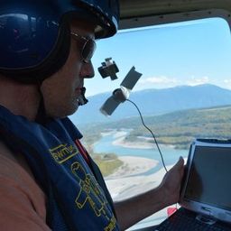
In February 2022, Balko Technologies, a Quebec-based company, launched the world's first modular drone Lidar, which aims to democratize geospatial data capture by offering a versatile, easy-to-use and quick to deploy solution. This technological showcase aims to demonstrate the performance, modularity and distinctive advantages for users of our brand new Connectiv solution and its e-LAS software, developed by a team of experts with more than 10 years of experience in airborne data capture....

LiDAR continues to be a cornerstone of the mapping industry. Since its inception, the technology has evolved from sole use on manned aircraft to being used on UAVs and mobile mapping platforms. As the LiDAR industry continues to evolve, our panel of experts will discuss what current and future trends impacting this industry. Join our award-winning panelists for an exciting discussion. Bring your questions.


This talk focused on those seeking work in GIS, cartography, remote sensing, programming, and other related geospatial fields.Jonathan Murphy, Managing Director of GoGeomatics Canada and geospatial career coach, will be sharing his valued tips and insight for your job search. He is an expert geomatics professional with close to 20 years of experience. Jon’s career has ranged from the oil fields of Alberta to projects with...
Wednesday 8 November, 2023

Join us at the GoGeomatics Expo for a dynamic panel discussion on the latest trends in Lidar technology. Our panel of experts will dive into the advancements in Lidar data, hardware, and software, providing valuable insights into the ever-evolving geospatial world. Discover the future of Lidar and its applications, and stay at the forefront of geomatics innovation.lidarcanex.com


Wetlands are important to water quality, nutrient cycling, and biodiversity, and have been identified as a management priority across Canada. Reclaiming wetlands that have been impacted can be a long-term, costly process depending on the type of wetland, location, and potential access constraints. One challenge with wetland reclamation is that the work may cause additional or new wetland impacts during access and execution of the work. Concurrent with wetland reclamation priorities, there ...


As part of Planet’s ethos of ‘agile aerospace’, we continually invest in the latest hardware and software advancements to improve the PlanetScope image quality. This dataset began life as a relatively simple 3-band image using commercial, ‘off-the-shelf’ hardware components. Through customer feedback, both software and hardware improvements were tested and launched, resulting in a second-generation of PlanetScope, or ‘Dove’ satellites. Replacing this second generation of satellites involved a...


The talk presents how multi-band SARs (X-band Iceye, C-band RADARSAT-2 and L-band SAOCOM) support various earth observation applications, such as target identification, change and displacement detection, and soil moisture map generation. Furthermore, it presents MDA's next-generation Chorus constellation (combination of C-band and X-band SARs).

Monday 13 May, 2024

This workshop will introduce you to the ENVI Ecosystem, a powerful suite of tools for processing and analysing remotely sensed data. We'll focus on its applications for using hyperspectral, multispectral, and SAR data to monitor climate change indicators like:- Vegetation Health- Deglaciation- Greenhouse Gas Emissions- Land Cover Change- Shoreline ErosionWe will also demonstrate how to leverage ENVI’s AI-powered Deep Learning tools to automate the extraction of a...


CATALYST (PCI Geomatics) has played a critical role in supporting the Government of Canada, Academic and Commercial organizations to meet their objectives processing satellite optical, SAR and aerial data using advanced science and automated workflows. New design patterns make it possible to implement the same great technology in new, innovative ways. What we will cover: In this workshop we will demonstrate how to scale processing using various approaches including:Bu...


Tuesday 14 May, 2024

In today's rapidly advancing technological environment, the imperative for robust digital governance has never been more critical. The rapid increase of digital technologies and data has underscored an necessity for standardized governance frameworks that not only bolster security and trust but also ensure innovation and efficiency across diverse global systems. This presentation will delve into the paramount importance of establishing and adhering to consensus-based standards in ...


This presentation will explore how Sault Ste. Marie leveraged two decades of Geographic Information Systems (GIS) to craft and maintain its cutting-edge Digital Twin. Exploring the innovative applications of Sault Ste. Marie’s GIS digital twin model, which offers real-time insights allowing for collaboration and more effective decision making, this presentation showcases the transformative potential of GIS enabled digital twins. We will demonstrate how this comprehensive digital r...


This presentation delves into the dynamic realm of geomatics within Environment and Climate Change Canada (ECCC), offering a comprehensive exploration of career opportunities within a research organization. Geomatics, the science of acquiring, analyzing, and interpreting geographic information, plays a pivotal role in the mandate of the Department including environmental conservation and protection, policy & regulatory development, and climate change mitigation strategies.Through t...

Monitoring large numbers of activities and assets from space has long been an aspirational “holy grail” for satellite remote sensing. However, lack of observational cadence, collection capacity, sufficient resolution, multisource capabilities and contextual understanding of monitored sites has meant that true monitoring has been limited to a handful of key facilities and mission use cases. Will we as an industry be able to overcome current challenges and turn site monitoring into a mainstream...

Public Safety Canada has a mandate to keep Canadians safe from a range of risks, including natural disasters, and has taken recent steps to incorporate the use of data and science into all aspects of Emergency Management. In 2020, Public Safety stood up the Data Science and Engineering Team (DSET) to provide technical expertise and quantitative risk analysis in support of major policy programs, including Flood Insurance, ...

Wednesday 15 May, 2024

As evidenced by the 2023 fire season, we are experiencing unprecedented fire management challenges in Canada. Innovative fire monitoring solutions can help support wildfire managers as they limit the negative impacts of wildland fires while also prioritize the positive benefits in Canada’s forested ecosystems. Opportunities for advancing fire monitoring mirror a broader paradigm shift in the field of Earth observations towards open data, large-scale analyses, and collaborative development. In...


Remote sensing and spatial analytics have substantial utility to support riverine and floodplain assessment and monitoring at extents not feasible with traditional field surveys. This presentation will provide an overview of relevant technologies such as topobathymetric lidar, sonar, and multiple imagery types, as well as processes for integrating and analyzing these data. Broad-scale, objective, and reproducible analytics allow for geographic and temporal comparison across entire...


The Carleton University Immersive Media Studio (CIMS) was awarded a New Frontiers in Research Fund (NFRF) Exploration program grant to Imagine Canada’s Digital Twin. One aspect of the project is data governance and business models. In addition, the I Trust AI research SSHRC funded project based out of UBC, is examining the CIMS and city of Ottawa Digital Twins to assess how their creators might include preservation in their design. These research projects revealed that the Architecture, Engin...


Utilities, telecoms and municipalities are faced with increasing pressure to build infrastructure faster to meet the demands of new provincial legislature. The building broadband, transit and new homes faster acts were enacted to support the ever increasing needs of Canadian population growth from immigration. Learning how to securely faciliate the expansion of utility services required to meet the needs of a growing population is something that all utility, telecom and municipal ...


GeoIgnite is proud to present a vital panel discussion titled "Bridging Worlds: Integrating BIM and GIS for a Digital Future in Built Asset Management," featuring distinguished panelists Susan Keenliside, Deputy Director at the House of Commons of Canada, and John Hale, Vice-President of buildingSMART Canada and BIM lead at the Department of National Defence. The session will be moderated by Trevor Taylor of the Open Geospatial Consortium (OGC).


The agriculture and agri-food sector is a major contributor to the Canadian economy, accounting for 2.3 millions jobs and 7% of Canada’s gross domestic product with farmland covering 62 million hectares (6.2%) of Canada’s land area. This area is changing over annual and decadal time scales as a result of changes in annual crop production, urban expansion, sustainable land use/management and a changing climate. Monitoring such a vast area to account for how these environments respond to the pr...


The City of Ottawa (City) annually invests about $3M in studies of the local subsurface geotechnical, hydrogeological, and environmental conditions in support of municipal planning, development proposals, infrastructure designs, construction, and environmental protection studies. Much of this valuable information remains with individual consulting firms and in City project files, so this data is relatively inaccessible and not ready for use to internal and external stakeholders.

Canada is big, really big! Mapping the whole country took us over 100 years to complete. Through the years, the techniques used to map Canada's features evolved.For NRCan, the latest innovation is in the operational implementation of Artificial Intelligence tools and approaches, nested in high performance cloud computing capacity, and build via micros-ervices for agile and scalable deployment. This capacity, enables the organization to increase exponentially its capacity to create and ...
