
Daniel Correa
Sessions in which Daniel Correa attends
Monday 12 May, 2025

BUY YOUR TICKETAre you a GIS professional navigating the evolving intersection of GIS and BIM? Or a government decision-maker wondering why integrating the built environment into GIS is crucial for your department’s future? Join us for BIM & GIS: Smarter Data, Smarter Decisions, a foundational wo...


BUY YOUR TICKETJoin SolidCAD and EllisDon for an in-depth overview of the buildingSMART Certification plus additional information on ISO 19650 compliance and BIM Executive Management using Plannerly.All stakeholders in the construction and real estate industry who are eng...


BUY YOUR TICKETThe workshop begins with IFC model preparation using BonsaiBIM, where participants will learn to create or modify an IFC model enriched with precise geospatial data, including longitude, latitude, and elevation and potentially export the geometry to glTF for web integration. Next, the focus shi...


Tuesday 13 May, 2025

Mini Continental BreakfastGeoIgnite is delighted to offer a selection of chilled fruit juices, freshly baked croissants, muffins, and breakfast pastries, served with butter and preserves. Guests can also enjoy fruit cocktails and yogurt. Available beverages include coffee, tea, and decaffeinated coffee.

GET YOUR TICKETSMORE PURCHASING OPTIONSPCL-EllisDon use the latest technology available to streamline processes, provide the projec...


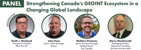
For decades, Canada’s geospatial ecosystem has thrived on deep integration with the U.S., benefiting from shared technology, markets, and collaboration. But today, shifting geopolitical and economic realities—trade conflicts, supply chain vulnerabilities, and data sovereignty concerns—are forcing us to rethink this reliance. The question is no longer whether we should adapt, but how.


Dr. Nadine Alameh, the inaugural Executive Director of the Taylor Geospatial Institute, has been leading an ambitious effort to accelerate geospatial research for tackling today’s biggest challenges—climate, disasters, health, and national security. In this session, she will reflect on what it takes to build a truly impactful geospatial ecosystem, challenge assumptions about the roles of national mapping agencies, academia, and nonprofi...


The Canadian Hydrographic Service (CHS) is Canada's agency for charting Canadian waters. Canada has the longest coastline of any country in the world, with more than a third of its territory under water. As a maritime nation, global maritime transport traffic is significant. Hydrography supports safe navigation and shipping through the production of nautical charts and other publications including water levels. With opportunities provided by emerging technologies and the move to e-navig...


Artificial Intelligence is transforming how we interpret and act on information—but what does that mean for the geospatial world? As AI models generate synthetic maps, infer locations, and automate analysis, geospatial professionals face a critical moment: will we shape the future, or be shaped by it?In this session, the CEO of the Open Geospatial Consortium (OGC) will explore the complex relationship between AI and geospatial systems—from the risks of black-box models and data halluci...


Top technical performers are often promoted into leadership roles, yet many struggle. In AI-driven, data-intensive industries, expertise alone is not enough—leaders must also navigate complexity, inspire teams, and drive execution. Without these skills, organizations face decision paralysis, disengaged teams, and stalled innovation.Senior leaders know that competency is crucial—technical excellence is the foundation of succes...


Enjoy a satisfying lunch inspired by classic Italian flavors. Begin with artisanal garlic focaccia and a classic Caesar salad with creamy dressing, croutons, and bacon bits. A medley of olives and marinated mushrooms adds a savory touch.For the main course, enjoy chicken scallopini glazed with a lemon caper sauce, served alongside potato gnocchi in a tomato and basil sa...

A seasoned leader in geomatics and Earth Observation with two decades of experience in the federal government, Eric Loubier has vast expertise in developing and implementing national geomatics and Earth observation strategies. In his talk, Eric will explore the integration of AI with Earth observation, and how this powerful combination is transforming Canada’s approach to addressing critical national issues like climate change, natural resource management, urban planning, and disaster response.


Wednesday 14 May, 2025

Mini Continental BreakfastGeoIgnite is delighted to offer a selection of chilled fruit juices, freshly baked croissants, muffins, and breakfast pastries, served with butter and preserves. Guests can also enjoy fruit cocktails and yogurt. Available beverages include coffee, tea, and decaffeinated coffee.

The Oceans cover more than 70% of our Planet… with offshore, near shore and coastal waters including rivers and lakes that are navigable or not.This Keynote Address will kick off the Hydrospatial Track on Day TWO of the GeoIgnite 2025 - Ottawa. The presentation will articulate the context and the timing of WHAT is HYDROSPATIAL in the global Geospatial community? SO WHAT is important to Measure, to Monitor an to Model? THEN WHAT is the Strategy, the Challenges, t...


As the built asset industry embraces digital transformation, the integration of Building Information Modeling (BIM) and Digital Twin technologies is redefining how we manage the built environment. While BIM facilitates data-rich 3D modeling during design and construction, Digital Twins extend this functionality into operations, enabling real-time insights and lifecycle optimization.Attendees will gain insights into buildingSMART Canada’s initiatives supporting this integration, its ali...


As digital collaboration becomes the norm in the construction industry, ensuring the authenticity and integrity of Building Information Models (BIM) is more critical than ever. While BIM and openBIM standards, such as the Industry Foundation Classes (IFC), have improved interoperability and data exchange, challenges remain in verifying data at the object level.This presentation explores the potential of digital signatures as a solution to enhance trust, transparency, and traceability i...


Presenting the CHN and highlighting how its new features leverage advancements in hydrography to improve both water-related models and their applications to support decision making. The Canadian Hydrospatial Network (CHN) was officially launched this past May, marking a significant milestone in the development of hydrospatial networks in Canada. Over the past year, the network has expanded and grown in importance, positioning itself as a key resource for the future of its field. CHN continues...


This talk will highlight method innovations in water research using satellite earth observations (SEO) in the Canada Centre for Mapping and Earth Observation (CCMEO) of Natural Resources Canada (NRCan). They include dynamic surface water mapping and modelling for water areas and water volume changes, terrestrial water storage variations, groundwater recharge evolution and storage changes, water extreme events (drought and flood) characterization, and environmental and climate impacts on the w...


The presentation focuses on the challenges of applying ISO 19650 to National Defence and Defence Construction Canada, examining the current status and progress, as well as the obstacles still faced. It highlights the key challenges of becoming a knowledgeable owner while aligning National Defence practices with ISO19650, with support from other stakeholders and partners through research, innovation, and collaboration. The importance of OpenBIM in this context is emphasized, as it plays a crit...


Natural Resources Canada’s (NRCan) Emergency Geomatics Service (EGS), under the Canada Centre for Mapping and Earth Observation (CCMEO), supports the national and international emergency response efforts by providing rapid disaster mapping services. This presentation will give an overview of the service and highlight examples of how it uses satellite imagery and advanced remote sensing technologies to assess the impact of natural disasters like floods, geohazards, and wildfires, enhancing sit...

In 1976 the Canadian Hydrographic Service was the first hydrographic agency to recognize and display a satellite-discovered feature on a nautical chart. This was the discovery of Landsat island off the coast of Labrador.In the time since the capabilities of satellites to survey coastal waters have grown exponentially yet the use of satellite based depth information on nautical charts has not. Satellite based surveying offers a multitude of benefits to the safety of operations, empowering ...


Spatial data and related technologies have long powered the disciplines of geomatics (and its many names likes geospatial, hydrospatial) and buiilding information management. These disciplines have enabled people to better understand the natural world, the built infrastructure we place upon it, and, increasingly, the relationships between the two. The various goods and services provided by these different "spatial" communities has been global in nature and have provided eco...


Unlocking the Power of EO and AI through Collaboration and PartnershipsThis panel will explore the transformative power of Earth Observations (EO) and Artificial Intelligence (AI), emphasizing the critical role of collaboration and partnerships in unlocking the full potential of these technologies. As global challenges continue to evolve, th...


Aerial thermal infrared (TIR) surveys have been a crucial tool supporting river restoration project across the North America as many salmonid-bearing rivers are projected to warm in the coming decades due to increases in atmospheric temperatures and concomitant decreases and earlier melt of snowpack. The objectives of collecting TIR imagery are to assess the current summer thermal state and the distribution of cold-water refuges within the river system, and to identify opportunities and...


In this session, we will explore key trends and insights from FEMA's National Flood Insurance Program (NFIP) data for the United States. Using publicly available data from OpenFEMA, we will analyze patterns in flood risk and claims frequency, with a particular emphasis on the impacts of major flooding events such as Hurricane Katrina (2005) and Hurricane Sandy (2012). Through a deep dive into historical claims data, we will uncover trends over time and examine how these significant storms, al...


In a world of constant change and uncertainty, how can we make informed decisions in real-time, grounded in the realities of ambiguity? This presentation tackles these fundamental questions by exploring the evolution of how we understand and interpret our world—from childhood curiosity to professional expertise—and how these insights shape decision-making in complex environments.Using case studies in GEOINT adoption inside and outside traditional national security communities, I will d...

The convergence of generative artificial intelligence and geospatial technology is transforming how we validate and ensure the quality of location-based data. This talk explores how AWS is enabling new approaches to geospatial data validation through the power of generative AI, which helps public and private sector organizations achieve their sustainability missions.As we operate in a world with more earth observation data being generated everyday, the planet is imaged daily and, with ...


Enjoy a fresh and satisfying lunch featuring a house blend of baby spinach, kale, and mesclun greens with feta cheese, pumpkin, chia, and poppy seeds, dried cranberries, and golden raisins. A tomato and cucumber salad with lime and avocado dressing adds a refreshing touch, alongside a medley of mixed greens with assorted dressings.For the main course, savor freshly roas...

Digital Twins hold enormous potential for the buildings and infrastructure sectors, but their implementation faces key challenges. What is a Digital Twin? The industry lacks a clear consensus, leading to misinformation and confusion. While Digital Twins can scale, not every project requires every possible capability—so how do we manage this effectively? More importantly, the industry is not ready—foundational work in data standards, interoperability, and governance is still needed.In r...


Nearly 45 years after its construction, the efficiency of the vertical support heat pipes along the Trans-Alaska Pipeline System (TAPS) has shown signs of degradation. These heat pipes are crucial for maintaining ground stability in permafrost regions, where the pipeline is elevated for over half of its 800-mile length. Filled with liquid ammonia, the heat pipes transfer heat from the bottom to the top, preventing excessive thawing around the support structures. Ground-based monitoring of the...

Foundation models represent a transformative shift in the utilization of EO data, historically limited by data complexity, and the manual preparation and analysis required to employ the data. By using foundation models with forthcoming AI-ready EO datasets, users will be able to efficiently develop solutions for diverse sustainability applications without extensive labeling efforts. This approach greatly expands the practical value and accessibility of EO data, driving innovations across envi...

In today’s fast-paced world, having timely information at your fingertips is more important than ever. That’s why Health Canada’s Radiation Protection Bureau reached out to Natural Resources Canada’s Centre for Mapping and Earth Observation (CCMEO) for geomatics expertise. The two departments collaborated to create the Real-Time Environmental Radioactivity Monitoring dataset. This map and geospatial data give Canadians clear information on radioactivity levels and fluctuations from natural so...


As digital transformation reshapes the global construction industry, many countries have implemented BIM mandates to drive standardization, efficiency, and improved project outcomes. But does Canada need one?This panel brings together industry leaders, policymakers, and technology experts to debate whether a national BIM mandate is the right approach for Canada. Advocates argue that mandates drive consistency, enhance productivity, and align Canada with international best practices. Sk...


The Open Building Population Layer for Canada has emerged as a transformative resource in the geospatial community, providing unprecedented access to population estimates at the building level across the country. Since its release, the dataset has garnered significant attention, reaching 8,000+ professionals on LinkedIn, and achieving thousands of downloads. This enthusiastic reception underscores its value for applications in urban planning, disaster management, and environmental assessments...


Join us as we wrap up another incredible edition of GeoIgnite with a celebration on the tradeshow floor. We’ll come together for a group photo of all our amazing participants, partners, and friends.This final moment is our way of saying thank you to everyone who helped make GeoIgnite a success — from speakers and sponsors to delegates and volunteers. Let’s end on a high note and capture the spirit of Canada’s national geospatial leadership event, together.