Skip to main page content

High-precision Terrestrial Laser Scanning with Unprecedented Productivity - A live demonstration of RIEGL's new VZ-600i
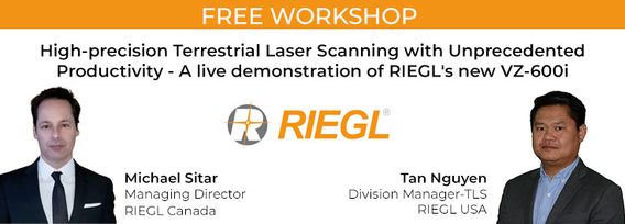
Decorative image for session High-precision Terrestrial Laser Scanning with Unprecedented Productivity - A live demonstration of RIEGL's new VZ-600i

My Session Status

What:
Workshop
When:
1:00 PM, miércoles 26 abr 2023 EDT (1 hour)
Where:
  Virtual session
This session is in the past.
The virtual space is closed.

RIEGL's next generation of terrestrial laser scanners are focused on maximizing productivity, simplifying workflow, and improving the overall user experience.  Join us as we provide a live demonstration of the features, capabilities and superior performance of RIEGL's innovative VZ-600i terrestrial lidar scanner, a purpose-designed sensor for the collection of engineering-grade data from both static and mobile platforms.

Who's Attending

Gail Robertson
Regional Manager Geomatics
PWGSC
Michael Alexander
Bus Development
Candrone
JUAN ARIAS
Survey Tech
Port of Long Beach
D El.
Spatial data coordinator
myself
Olena Pylypenko
Spatial Data & Imagery Analyst
GeoBC
Muritala Bakinson
draft design technologist
Aplin Martin
Jeff Osborne
GIS Officer
Province of Nova Scotia
Dae Lee
CTO
Consultancy
Blair Box
GIS Analyst
Government
Jayachandran Jayapal
Business Analysis
The Miller Group
Jared Martin
Director of Resale
BAMM.TECH
David Bélanger
Project Manager
NRCan
Chukwuemeka Onyeizu
GIS Analyst/Surveyor
Jerry Marth Surveys Nigeria Ltd
Alex Hill-Stosky
Manager of Reality Capture Development & Regulation
Eagle Engineering & Consulting
Andy Carbognin
President
Vecto Geomatics
Adam Pinard
NDE ENGINEER
Nucleom
Krutiben Mehta
PhD Researcher
University of Ottawa
Brad Schmidt
Global UAV Sales Manager
Applanix Corporation (A Trimble Company)
Jean-philip Giguere
director
SoluScan 3D
mark whitright
vp operations
GolfMapping
Joe Kanera
Engineering Technologist
RF Binnie & Associates Ltd.
Wenzheng Fan
Data Scientist
LiDARist Co. Ltd.
oscar orduz
survey manager
IPAC
Zofia Osuchowska
GIS Specialist
Corporation of City of Mississauga
Billy Chan
Team Lead - Sr. Staff
TDK
Daniel Hrouda
Geomatics Engineer/Geospatial Imagery Coordinator
CIty of Calgary
Reid McLean
GIS/Lidar Specialist
NB Environment and Local Government
Dening Lu
PhD candidate
None
P Medoune Ndir
Land surveyor
Open Mate Spatial Solutions
Douglas Culbert
Chief Data Officer
Spatial Data AI
WILLIAM CHEN
SURVEY TECHNICIAN
R. F. BINNIE & ASSOCIATES LTD.
Benoît Lachapelle
Geomatic Engineer
Can-Explore
Jérôme Gallichan-Carrier
Arpenteur-Géomètre
Can-Explore
Ted MacKinnon
Senior Geomatics Technologist
Natural Resources Canada (NRCan)
Jonathan Miranda
Lead Geospatial Specialist
Foth
Tim McKinney
Survey PM
Michael Baker
Adam Moszynski
GIS solutions analyst
Terracon Development
Chris Sanatar
Surveyor
Port of Long Beach
Robert Hamer
Geodetic Control Survey Specialist
MNRF Ontario
T Cormier
Engineer
Mentra Consultants
Suli Zhang
GIS professional
MTO
Tania Frechette
Project Manager
GoGeomatics Canada
Scott Hamilton
Professor
Lakehead Unversity
Alexandra Ferreira
researcher
INESC
Lara Chessie
Remote Sensing Specialist
provincial government
Doris Siu
GIS Technician
Technology Services

My Session Status

Send Feedback

Session detail
Allows attendees to send short textual feedback to the organizer for a session. This is only sent to the organizer and not the speakers.
To respect data privacy rules, this option only displays profiles of attendees who have chosen to share their profile information publicly.

Changes here will affect all session detail pages