
Ashling Redmond
Sessions in which Ashling Redmond attends
miércoles 26 abril, 2023

Our team of experts will be running the TopoDOT software workshop showing multiple types of applications using Mobile, Terrestrial, Drone and Airborne point clouds. You will learn about the latest feature extraction workflow developments for transportation applications such as corridor topographies, GIS inventories, surface modeling. See the expanding applications of point clouds in engineering grade data analysis such as Wall Displacement, Cross Slope, Volume Calculation, Clearance/Encroa...


lunes 6 noviembre, 2023

This workshop will cover the basics of deep learning:- What is deep learning?- A typical workflow using deep learning technology to identify objects (hands-on)- Issues to be aware of when using deep learning technology.- Options for deep learning tools.You need to bring a wifi equipped laptop, as we will be using a cloud-based virtual machine for you to do the exercises.Location: SAIT -


martes 7 noviembre, 2023

Join us for a riveting panel discussion featuring leading experts in the realm of reality capture. As the industry stands on the precipice of monumental change, this session aims to unpack the intricacies of current challenges, explore the intricacies of the digital twin concept, and envision the future trajectory of reality capture. Our esteemed panelists, with their wealth of knowledge and diverse experiences, will shed light on the multifaceted struggles the industry grapple...


What are the trends in education, technology, policy, perception and markets that will mold the future of Geomatics – and how has the profession responded? The presenter has worked in and written about numerous aspects of surveying for several decades and views the future of the profession as one of both challenges and opportunity – new, exciting and sometimes surprising opportunities. This session will be interactive, challenge conventional wisdom, poke a little fun, and hopefully provides s...


At the Earth Observation for the Environment Laboratory in The University of Calgary, we have been conducting research in developing remote sensing-based forecasting system for forest fire danger conditions since 2009. In the scope of this presentation, the chronology of such developments at daily, 4-day, and 8-day time scales will be discussed. We believe that these would be critical for managing forest fire regimes in Canada and elsewhere in the world.


Planet scans the entire land mass of the planet nearly everyday with high resolution multispectral imagery, enabling exciting new opportunities and solving old challenges for digital transformations and sustainable business acceleration. Now with our growing fleet of 8-band Superdoves in orbit, the launch of our Planetary Variables - daily soil moisture, temperature, crop and forest biomass, etc - we have evolved even greater capabilities for a new era of Earth Observation technologies. In th...


In the face of escalating environmental challenges, Canada grapples with the urgent need for advanced solutions in wildfire monitoring, emissions reduction, and natural resource management. This panel discussion explores how the burgeoning "New Space" frontier offers innovative approaches to address these critical issues.We aim to provide a platform for various industry players to share their own innovative technologies and insights, creating a vibrant dialogue on crucial geospatial...


This talk focused on those seeking work in GIS, cartography, remote sensing, programming, and other related geospatial fields.Jonathan Murphy, Managing Director of GoGeomatics Canada and geospatial career coach, will be sharing his valued tips and insight for your job search. He is an expert geomatics professional with close to 20 years of experience. Jon’s career has ranged from the oil fields of Alberta to projects with...


The workshop focuses on the role of Cloud Optimized Point Clouds (COPC) datasets and the SpatioTemporal Asset Catalog (STAC) within geospatial cloud systems. Attendees will gain insights into the Pointcloud Data Abstraction Library (PDAL) and the nuances of creating cloud-native metadata. Demonstrations will showcase practical methods for managing and processing large datasets in cloud infrastructures.COPC & STAC Overview: Gain a clear understanding of COPC datasets and the role of...


There is a pressing need for a global change detection system capable of persistently monitoring the entire earth with globally consistent coverage, temporally consistent sampling, scientific-grade geometric and radiometric quality, and cost-effective management of daily data. These four conditions enable near real-time monitoring and retrospective change detection applications while minimizing false positives and the required work to develop, maintain, and run harmonizing a...

Incidents involving dangerous goods, including flammable gases and liquids, can happen at any time and in any place. When they do, Emergency Response Assistance Canada's 320+ members count on us to provide a safe and effective emergency response 24 hours a day, 365 days a year.Various GIS solutions exist within Emergency Response Assistance Canada (ERAC) to support these functions. Examples include our resource locator tool that spatially queries and returns key information from 40+...


Join Canadian GNSS manufacturer Eos Positioning Systems for an in-depth look at using the high-accuracy Arrow Gold+ GNSS Receiver with RTK corrections and Esri’s ArcGIS Field Maps.In this live and interactive presentation, you will learn how to do the following:1. Add GNSS metadata fields to ArcGIS Field Maps 2. Easily connect to the local RTK network to achieve real-time <2cm accuracy in the field 3. Collect high-accuracy data in the field according to best...


Creating, managing and sharing geospatial information has never been easier, but how do we ensure the information we are using to make key business decisions is current, correct, accurate and the best fit for purpose? This session will explore the different types of geospatial information assets being used at The City and the different tools, methods and standards that are being used capture, manage and share authoritative City data across the organization and to the Citizens of Calgary.

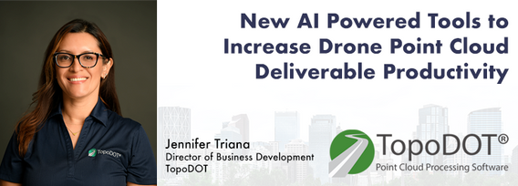
Learn how newly implemented surface modeling tools employing artificial intelligence reduce the turnaround time of point cloud surface models by 400% while maintaining high-fidelity results around break lines. Faster ground extraction routines for UAV data can be achieved without the need for classification or noise removal. In this presentation, we'll discuss several examples including how a query volume calculation project compared with traditional modeling workflows yielded nearly exact...

The end of the first day of the National Canadian GoGeomatics Expo is being marked by a lively party that is eagerly anticipated by all participants. The party is being held on the floor of the tradeshow in a venue that hosts many of the best rock concerts and shows for the Calgary Stampede. It promises to be a lot of fun, with an atmosphere buzzing with excitement and energy as attendees mingle, network, and celebrate the end of a successful day.The party is made even better by the in...
miércoles 8 noviembre, 2023

Join us at the GoGeomatics Expo for a dynamic panel discussion on the latest trends in Lidar technology. Our panel of experts will dive into the advancements in Lidar data, hardware, and software, providing valuable insights into the ever-evolving geospatial world. Discover the future of Lidar and its applications, and stay at the forefront of geomatics innovation.lidarcanex.com


Rapid, short-range data collection will only become more critical as the technological revolution continues. From planning and analytics to VDC and BIM, to Safety, Security, Project, and Facilities management, the applications for reality capture technology is only going to increase as industry calls for cost savings, awareness, accountability, and efficiency. In this climate, Simultaneous Localization and Mapping (SLAM) platforms are emerging as the solution that can meet the needs of ind...


How do you decide when to mobilize and when not to, or even where can you safely and legally fly. As the frequency of unpredictable weather and forest fire smoke increase, so too does the risk in mobilizing to a job site. This presentation will demonstrate OGL Engineering’s process and different geospatial resources available to better inform your decision and minimize risks.
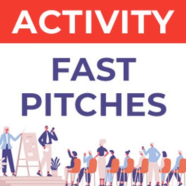
Got a cool geomatics product, service, student project, or academic/science research project/paper? Pitch it to a select panel of geomatics press and industry experts at the GoGeomatics expo held in Calgary, November 6-8 2023.Top picks will have their pitch written up as an online article published and promoted by GoGeomatics.You’ll have 3 minutes to make your presentation, with 2 minutes of questions from the panel. You can present a PowerPoint, do a live demonstration, or j...
martes 29 octubre, 2024

We explore the motivations behind the implementation of openBIM and its integral role in advancing the built asset industry. The built environment is immense and complex, it is also a huge responsibility. Our industry directly impacts it, designing, creating and maintaining it. In an era where what we all need is a better built environment, openBIM stands out as a key enabler. Together we will imagine a future where our industry works more effectively, efficiently and with more c...


Got a great idea, paper, project or product? Here’s an opportunity to hone your skills in making a “fast pitch”. There’s and art to making a fast pitch, where less can be more.The GoGeomatics Expo in 2023 launched the Fast Pitch session. Modelled after the Pitch-the-Press session of GeoWeek, presenters have 3 minutes to make your best case, followed by 2 minutes of questions from a panel and the audience. The panel of geo-journalists and industry experts judge th...


How exactly does artificial intelligence work and what can you use it for in the geomatics domain? Using real-life examples from our projects, they demonstrate how you can use AI to gain new insights and increase efficiency by automating your data processing workflows.We explore how GeoAI is fusing spatial data science and Geomatics technology to help automate the extraction, classification, and analysis of all types of spatial or non-spatial data. Learn how GeoAI can detect clusters, ...


Too often, when discussing the value proposition of geospatial data, we focus in on raw data or output products without spending a lot of time in the juicy middle of data throughputs. That is to say that modern geospatial is leaving a lot of value on the table and thus limiting our ability to good with our data by: -> Focusing too heavily on the capturing aspect of geospatial technologies;-> Ignoring or discounting analytical capabilities of geospatial technologie...


The government of Alberta manages the production of riverine flood studies under the provincial Flood Hazard Identification Program, to assist communities in keeping Albertans safe and protecting their properties from floods. Flood maps improve public safety, support emergency management, and help us build safer and more resilient communities. The government of Alberta also manages the production of alluvial fan studies to help Albertans learn about flood risks in the steep terrain of Alberta...


In flood mapping and dam breach analysis, engineers and planners define inundation areas through flow modeling. A crucial input for this analysis is a comprehensive topographic surface of the area of interest and any upstream zones. These areas can span hundreds of kilometers and cover thousands of square kilometers.Previous studies have indicated that low-resolution topography can results in larger inundation areas, greater flow volumes, and faster flood streams. However, a comparison...


Today, digital twins, autonomy and artificial intelligence (AI) dominate the lexicon of the geomatics industry. These capabilities provide significant productivity advantages to our profession, but our domain content and knowledge are critical to their success. These tools will change the way we work and transform the industry. However, they will not replace us, but rather change our role. This is no different than when the EDM, total station, CAD, or GPS became part of our professional lives...

miércoles 30 octubre, 2024

Join us for an engaging panel discussion on Geo-Entrepreneurship, featuring distinguished experts from geospatial consultancies, geomatics communication and event companies, and geomatics software firms. This session is designed for those interested in the intersection of geospatial technology and entrepreneurship.Journey to Entrepreneurship: Hear from our panelists on their motivations for leaving traditional careers to pursue entrepreneurial ventures in the geospatial field. Dis...


In this year's reality capture track, we have shown you the unprecedented value of reality capture systems when adopted into high-cost, high liability and fast pace environments, some of the problems these systems are solving today, and tools to help the effectiveness and quality of those solutions. However, our presenters will also have demonstrated how critical digital lifecycle planning can be to any asset, from pre-design through construction and lifetime operation right up to demolition,...


