
Robert Petruk
Sessions in which Robert Petruk attends
lunes 6 noviembre, 2023

Join us as we open the GoGeomatics Expo with a memorable evening filled with delicious food and great conversation! Elevate your Expo experience and forge valuable connections with fellow attendees, exhibitors, speakers and panelists. Following dinner, there will be a special panel moderated by GoGeomatics founder...

Step into the exciting realm of the inaugural GoGeomatics Expo in Calgary, a historic event that is set to make waves in Canada's geospatial sector. This compelling panel discussion will delve into the groundbreaking significance of this first-of-its-kind expo, exploring why it is a game-changer for both the public and private sectors, and how it charts a new course for the geospatial industry in Canada. This panel discussion takes place after the expo reception buffet. Participants must b...


martes 7 noviembre, 2023
This is where Canada’s geomatics sector is meeting for a show that will span manufacturers, service and data providers, professionals, academics, and thought leaders in the Canadian geospatial sector. Positioned in Calgary, Alberta, in the heart of Canada’s geomatics sector, this is an annual event where companies in geomatics will do business and meet new partners, and the sharpest innovators will be there.This expo is hosted by GoGeomatics Canada in consultation with our industry,...


Join us for a riveting panel discussion featuring leading experts in the realm of reality capture. As the industry stands on the precipice of monumental change, this session aims to unpack the intricacies of current challenges, explore the intricacies of the digital twin concept, and envision the future trajectory of reality capture. Our esteemed panelists, with their wealth of knowledge and diverse experiences, will shed light on the multifaceted struggles the industry grapple...


Over his decade plus at Suncor, Alonzo has been both witness to and active participant in a quiet digital Geospatial revolution. This revolution has democratized access to Geospatial data and tools to everyone at Suncor. Which meant that teams and professionals across a myriad of disciplines have embraced and pushed the limits of Geospatial data and software. The constant demand for newer and higher-resolution data has relegated the paper map to secondary status as the tool for spatial commun...


In February 2022, Balko Technologies, a Quebec-based company, launched the world's first modular drone Lidar, which aims to democratize geospatial data capture by offering a versatile, easy-to-use and quick to deploy solution. This technological showcase aims to demonstrate the performance, modularity and distinctive advantages for users of our brand new Connectiv solution and its e-LAS software, developed by a team of experts with more than 10 years of experience in airborne data capture....


Join Canadian GNSS manufacturer Eos Positioning Systems for an in-depth look at using the high-accuracy Arrow Gold+ GNSS Receiver with RTK corrections and Esri’s ArcGIS Field Maps.In this live and interactive presentation, you will learn how to do the following:1. Add GNSS metadata fields to ArcGIS Field Maps 2. Easily connect to the local RTK network to achieve real-time <2cm accuracy in the field 3. Collect high-accuracy data in the field according to best...


Creating, managing and sharing geospatial information has never been easier, but how do we ensure the information we are using to make key business decisions is current, correct, accurate and the best fit for purpose? This session will explore the different types of geospatial information assets being used at The City and the different tools, methods and standards that are being used capture, manage and share authoritative City data across the organization and to the Citizens of Calgary.


As GIS professionals, we understand the pivotal role that geospatial data plays in decision-making across various industries. Now, imagine harnessing that power to transform facility management. This presentation delves into VertiGIS FM, a groundbreaking solution that revolutionizes facility management through the lens of spatial intelligence, creating new opportunities and efficiencies across organizations.

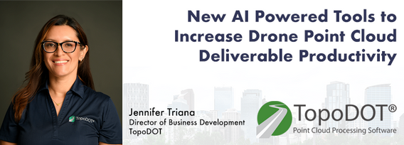
Learn how newly implemented surface modeling tools employing artificial intelligence reduce the turnaround time of point cloud surface models by 400% while maintaining high-fidelity results around break lines. Faster ground extraction routines for UAV data can be achieved without the need for classification or noise removal. In this presentation, we'll discuss several examples including how a query volume calculation project compared with traditional modeling workflows yielded nearly exact...


The end of the first day of the National Canadian GoGeomatics Expo is being marked by a lively party that is eagerly anticipated by all participants. The party is being held on the floor of the tradeshow in a venue that hosts many of the best rock concerts and shows for the Calgary Stampede. It promises to be a lot of fun, with an atmosphere buzzing with excitement and energy as attendees mingle, network, and celebrate the end of a successful day.The party is made even better by the in...
miércoles 8 noviembre, 2023

Join us at the GoGeomatics Expo for a dynamic panel discussion on the latest trends in Lidar technology. Our panel of experts will dive into the advancements in Lidar data, hardware, and software, providing valuable insights into the ever-evolving geospatial world. Discover the future of Lidar and its applications, and stay at the forefront of geomatics innovation.lidarcanex.com


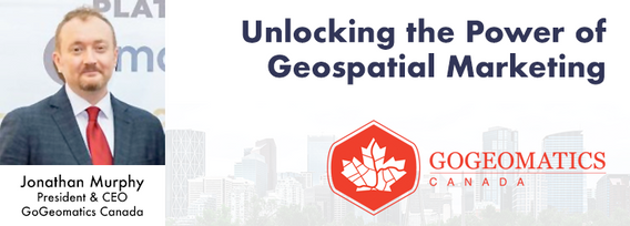
Join us at the Calgary GoGeomatics Expo for an exclusive workshop hosted by Jonathan Murphy, the founder of GoGeomatics and GeoIgnite. In this session, you'll discover the opportunites to successful marketing with GoGeomatics and explore the vibrant world of the GoGeomatics community. Workshop Highlights:Marketing with GoGeomatics: Dive into the art of geospatial marketing with one of the industry's leading experts. Jonathan Murphy will guide yo...

This panel will delve into some Geoff Zeiss's favorite topics:Example - Colorado DOT, PennDOT. Not an explicit requirement but required for permitting in their RoW’s – effectively a regulatory standard. Metrolink Regulation1: Business Case for SUE DataASCE – Not a regulatory requirement but a recommendation.Regulate on Backend – Permitting Process requirement for ASCE Benefits of Accurate Data2: Standards


The SLAM Scan-off results are in, but what does that mean, where can this technology be applied, and what technology can be applied to it?Join us for a discussion following the results of the GoGeomatics SLAM Scan-Off:- The strengths and weaknesses of adopting SLAM platforms into your workflow.- The appropriateness of SLAM platforms for specific uses.- The compatibility of SLAM platforms with downstream tools and methods.- The current and possible futures of SLAM sys...


Menu - Big Four OutletAppetizersRoasted Diablo Pork Bites (12) (GF/DF) SaladsSpiced Cauliflower, Chickpea & Tofu Bowl (GF/DF/V/VE) Sweet Potato, Roasted Cauliflower, Chickpeas, Mint Chutney,Grilled Tofu, Madras Curry DressingClassi...

The Department of National Defence, as steward of a real property (RP) portfolio that includes tens of thousands of buildings and supporting infrastructure, is seeking to manage its Real Property (RP) assets more effectively by modernizing and improving its digital capability. In this effort, interoperability between BIM and GIS through open data standards is crucial to enable the Integrated Digital Built Environment. BIM allows representation of detailed information regarding building elemen...

