Matt Teppler
Sessions in which Matt Teppler attends
lunes 28 octubre, 2024
We are excited to announce that the next Canada Forum will be held during the GoGeomatics Expo in Calgary, from October 28th to 30th. This event will bring together key stakeholders from across Canada’s geospatial sector, including industry leaders, academics, indigenous communities, government representatives, and technologists, to continue vital discussions on advancing geospatial standards, interoperability, and spatial data infrastructure (SDI) in Canada.
martes 29 octubre, 2024
Space, the final frontier. Or is it? Although many people are fascinated by space, most are relatively unaware of how space technologies pervade their everyday life. From global positioning systems (GPS) and satellite communications to weather forecasting and monitoring the health of crops or the extent of sea ice, the standard of living we currently enjoy is fundamentally dependent on satellites and space technology. Space is becoming even more important in monitoring the changing climate, p...
Large-scale habitat inventories are necessary for understanding how human land-use, natural disturbances (e.g., fire) and climate change are influencing ecological processes, species declines and how restoration can address these changes. Within the boreal forest of Alberta, Canada anthropogenic habitat alteration, also referred to as human footprint or the physical disturbance of a landscape as a result of human activity, covers over 19% of the land area. Much of this human footprint is not ...
Construction contracts are the same worldwide. While there are differences in language, classification, project delivery and other factors, the one common denominator is that a construction contract requires Drawings and Specifications. While geometric modelling software and specification software have both evolved over time, very little effort is currently being exerted in Canada to integrate them in document development processes.According to Arcadis global surveys, the #1 cause of c...
For the last five years I have been providing reality capture services to documentary film producers. These series have included NatGeo's Buried Secrets of WWII, NatGeo's Drain the Oceans, Discovery's Expedition Unknown and Expedition Bigfoot. LiDAR, photogrammetry, thermography, magnetometry, and multi spectral imagine all provide context that professional storytellers (TV producers) crave. Join me as I share stories, successes, and failures of these unique service offerings.
The three building blocks of digital building delivery are BIM, VDC and Digital Twins. There are various definitions for these three things, but based on my experience I define them as follows:- Building Information Modelling: a model with or without 3D geometry that hosts the information about building material, dimensions, connections, forces, power, flow rates, and all other elements required in each element that forms the building. - A key subset of understanding BIM is under...
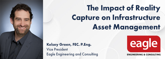
The integration of reality capture technologies—such as LiDAR, photogrammetry, and 3D scanning—into infrastructure asset management is revolutionizing how municipalities and organizations manage and maintain, their assets and deliver services. This presentation will explore the transformative impact of reality capture on the accuracy, efficiency, and overall effectiveness of infrastructure management practices. By enabling effective data collection and visualization, reality capture provides ...
Despite the rhetoric surrounding the use of building information modelling (BIM) to enhance collaboration by connecting people and data, the status quo is to work with proprietary solutions and closed file formats, limiting accessibility and interoperability. Additionally, the increasing complexity of projects in the Architecture, Engineering, Construction, and Operations (AECO) industry requires technology that integrates data at a range of scales, from asset to city, and beyond. To address ...
Wrap up the first full day of Canada's National Geomatics Expo with the GoGeomatics Meetup! This lively party and networking event, free to attend, starts right after the day's sessions, offering a perfect blend of fun and professional interaction. Held on the expo main floor, the meetup features a cash bar to help you unwind and enjoy the evening. Join us for an exciting night of music, mingling, and making connections with fellow attendees. Don't miss this chance to relax and expand your ne...
In December 2023 a unique gathering of technology and talent gathered on Alcatraz to capture the entire island, inside and out, from the ground and from the air to assist the National Park Service understand the risks seal level rise and climate change present to the island. Join me and, perhaps, other members of the extended team as we share the technology, the experience, and the adventure of this unique experience.
Today, digital twins, autonomy and artificial intelligence (AI) dominate the lexicon of the geomatics industry. These capabilities provide significant productivity advantages to our profession, but our domain content and knowledge are critical to their success. These tools will change the way we work and transform the industry. However, they will not replace us, but rather change our role. This is no different than when the EDM, total station, CAD, or GPS became part of our professional lives...
miércoles 30 octubre, 2024
This presentation details the results of a field study conducted in July in Santa Cruz, California, where thirteen participants employed terrestrial laser scanning (TLS) to assess concrete tolerance on a construction site. The study aimed to establish the precision of TLS as a test method for verifying concrete tolerance in accordance with ASTM E-691-23. Additionally, it sought to quantify the bias of the TLS method by compar...
RPAS platforms and sensors have come a long way since their commerical adoption almost a decade ago and have quickly become a main stay of many professional's tool kits. This show's the industry's appetite for adopting new technologies and matching them up with the right application. With a pannel of very experienced professionals from various sectors of Canada's Geospatial RPAS scene, we explore what has driven sensor development and how sensors might further develop along the lines of use c...
The Virtual Assembly Showcase highlights the value of integrating advanced 3D laser scanning and virtual assembly in industrial construction. In a recent expansion at a major Oil Sands Refinery, detailed 3D laser scanning and surveying were employed to ensure the precise placement and assembly of three large modules while they were still in the laydown yard.The process involved scanning critical structural elements and newly poured foundation pilings to detect potential fitment issues ...
Photogrammetry is not just limited to aerial platforms. Modern mobile devices contain high-quality cameras and increasingly have LiDAR and depth sensors built in. When combined with high-accuracy GNSS systems, these mobile devices can quickly collect accurate data for utilities, infrastructure, inspection, as-builts, construction, and more. Utilizing these readily available devices can reduce project delays, capture better documentation of utilities, and lay the foundations for digital infras...
In this year's reality capture track, we have shown you the unprecedented value of reality capture systems when adopted into high-cost, high liability and fast pace environments, some of the problems these systems are solving today, and tools to help the effectiveness and quality of those solutions. However, our presenters will also have demonstrated how critical digital lifecycle planning can be to any asset, from pre-design through construction and lifetime operation right up to demolition,...
The time has come for the presentation of this year's mobile mapping system and SLAM system participants.Are you looking to collect more data, faster and accurately? Looking to buy a mobile mobile mapping or SLAM system and incorporate it into your workflows? If you are, you're considering tens of thousands to millions of dollars of investment. Do you know what's available to you? Are you sure that's all of them? Do the options available suit your needs? Is there candid data you can lo...
Traditional teaching methods in post-secondary often included using powerpoint presentations and writing on a white or blackboard. The newer generations of students have been exposed to different ways of learning and this requires instructors or teaching professors to change their way of presenting information to help the students learn it at a deeper level. Using a radical constructivism philosophy, the students are required to engage in the material in their own way, connect wit...


