Garret Duffy
Sessions in which Garret Duffy attends
martes 29 octubre, 2024
We are hosting a special gallery of maps and posters for this year’s expo.The Canada Maps & Poster Gallery will run from October 29th to the 30th in Calgary and is an excellent opportunity to showcase your team's work and impact for the public good.This initiative is in partnership with the Canadian Cartographic Association (CCA), the Inter...
This career fair is an excellent opportunity for your organization to showcase its vision, culture, and the exciting opportunities on offer. Engage with a diverse pool of candidates, including experienced professionals and emerging talents with fresh perspectives. Each candidate brings unique skills and innovative ideas, making your participation a strategic investment in the future of your organization and the geomatics sector.The Western Canada GeoIgnite Career Fair is crucial for re...
Space, the final frontier. Or is it? Although many people are fascinated by space, most are relatively unaware of how space technologies pervade their everyday life. From global positioning systems (GPS) and satellite communications to weather forecasting and monitoring the health of crops or the extent of sea ice, the standard of living we currently enjoy is fundamentally dependent on satellites and space technology. Space is becoming even more important in monitoring the changing climate, p...
How exactly does artificial intelligence work and what can you use it for in the geomatics domain? Using real-life examples from our projects, they demonstrate how you can use AI to gain new insights and increase efficiency by automating your data processing workflows.We explore how GeoAI is fusing spatial data science and Geomatics technology to help automate the extraction, classification, and analysis of all types of spatial or non-spatial data. Learn how GeoAI can detect clusters, ...
Accurate mapping of road networks is essential for navigation, disaster response, and urban planning. Traditional methods relying on remote sensing images, Lidar data, and GPS trajectories are hampered by time-consuming manual updates and incomplete extraction due to obstructions from trees, buildings, and shadows. However, recent advancements in deep learning models have shown promise in improving road mapping and automating the detection of missing roads.This study uses a transfer le...
The session will focus on considerations for deploying Artificial Intelligence in professional practice; identifying potential landmines and working on solutions from a privacy-first perspective. The talk will include a high-level overview that underscores the fundamental components that encapsulate an AI derived “solution” and delve into a practical, real-world example being tested on an active project.Topics Covered:• An illustrated example of BIM model query using AI• AI too...
Too often, when discussing the value proposition of geospatial data, we focus in on raw data or output products without spending a lot of time in the juicy middle of data throughputs. That is to say that modern geospatial is leaving a lot of value on the table and thus limiting our ability to good with our data by: -> Focusing too heavily on the capturing aspect of geospatial technologies;-> Ignoring or discounting analytical capabilities of geospatial technologie...
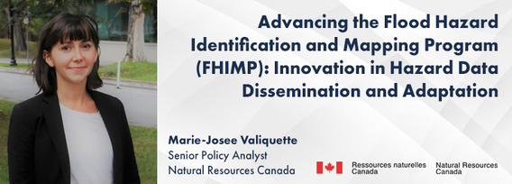
In 2021, the Government of Canada invested $63.8M in the Flood Hazard Identification and Mapping Program (FHIMP) to to create and disseminate engineering-level flood hazard maps that can help Canadians better plan and prepare for future flood risks. The program was recently extended to 2028 through the National Adaptation Strategy and enhanced with an additional $164 Million investment.Given that many Canadians are unaware of flood hazards, the FHIMP is working to fill gaps in knowledg...
30 years ago, a small group of engineers came together to work on the then difficult problem of interoperable technology, systems and data. These visionaries formed the Open Geospatial Consortium which has helped the world figure out how to collect, process, and share geospatial data over the internet and across a wide variety of technology systems. Today, with the proliferation of technology types, sensors and a...
Methane is a greenhouse gas that has a global warming potential 80 times greater than carbon dioxide over a 20-year period. Reducing methane emissions from industrial facilities is one of the most effective ways to reduce greenhouse gas emissions. This talk gives an overview of GHGSat’s approach to providing stakeholders actionable data by detecting, geolocating, and quantifying methane emissions using our fleet of space-based and airborne instruments.
Wrap up the first full day of Canada's National Geomatics Expo with the GoGeomatics Meetup! This lively party and networking event, free to attend, starts right after the day's sessions, offering a perfect blend of fun and professional interaction. Held on the expo main floor, the meetup features a cash bar to help you unwind and enjoy the evening. Join us for an exciting night of music, mingling, and making connections with fellow attendees. Don't miss this chance to relax and expand your ne...
In December 2023 a unique gathering of technology and talent gathered on Alcatraz to capture the entire island, inside and out, from the ground and from the air to assist the National Park Service understand the risks seal level rise and climate change present to the island. Join me and, perhaps, other members of the extended team as we share the technology, the experience, and the adventure of this unique experience.
Today, digital twins, autonomy and artificial intelligence (AI) dominate the lexicon of the geomatics industry. These capabilities provide significant productivity advantages to our profession, but our domain content and knowledge are critical to their success. These tools will change the way we work and transform the industry. However, they will not replace us, but rather change our role. This is no different than when the EDM, total station, CAD, or GPS became part of our professional lives...
miércoles 30 octubre, 2024
RPAS platforms and sensors have come a long way since their commerical adoption almost a decade ago and have quickly become a main stay of many professional's tool kits. This show's the industry's appetite for adopting new technologies and matching them up with the right application. With a pannel of very experienced professionals from various sectors of Canada's Geospatial RPAS scene, we explore what has driven sensor development and how sensors might further develop along the lines of use c...
Case Study: How DOTs and Utility owners took a Proactive Approach to Protect Underground Pipeline Assets Due to aging infrastructure and lack of accurate utility location information resulting in huge increased operational risk & especially at waterway, transportation, and ROW utility crossings. Utility owners understand the significant underground congestion and utility conflicts which result in future damages and the value the importance of geo location of UNLOCA...
Join us for an engaging panel discussion on Geo-Entrepreneurship, featuring distinguished experts from geospatial consultancies, geomatics communication and event companies, and geomatics software firms. This session is designed for those interested in the intersection of geospatial technology and entrepreneurship.Journey to Entrepreneurship: Hear from our panelists on their motivations for leaving traditional careers to pursue entrepreneurial ventures in the geospatial field. Dis...
With drones like the DJI Matrice 300 now being positioned using RTK GNSS, combined with Structure from Motion (SfM), high precision mosaics are possible without deploying targets. The ability to mount lidars (DJI L1 and L2) and other optical sensors (RGB, multispectral, thermal) allows for precise surveying and the production of high resolution and high accuracy mosaics with minimal ground control. While battery power still remains an issue and the limiting factor for flight duration (10’s of...
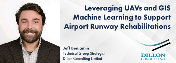
Dillon was retained by the Government of Nunavut to perform a Needs Assessment for the rehabilitation of the Runway 13-31, Taxiway A (Alpha), Taxiway C (Charlie), Apron A, and Apron C of the Rankin Inlet Airport.The project included pavement rehabilitation and geotechnical investigations for Runway 13-31, which is a 6000’ x 150’ asphalt paved runway, along with Phase I ...
Utility mapping is a crucial practice in urban planning and construction, focusing on identifying, documenting, and visualizing the precise locations of underground utilities such as water pipes, gas lines, electrical conduits, and telecommunication cables. Accurate mapping of these utilities is vital to ensure safety, efficiency, and cost-effectiveness in construction projects, preventing accidental damages that can lead to significant service disruptions, safety hazards, and financial losse...
As the drone industry is increasingly focuses on developing larger airframes and equipping them with bigger sensors, Spexi is taking a revolutionary approach to aerial imagery. At Spexi, we believe that the future of geospatial data collection lies not in size and complexity, but in numbers and standardization. The Spexi platform leverages the power of crowdsourcing, deploying local pilots with small drones to capture standardized imagery across entire cities. This method allows us to achieve...
The time has come for the presentation of this year's mobile mapping system and SLAM system participants.Are you looking to collect more data, faster and accurately? Looking to buy a mobile mobile mapping or SLAM system and incorporate it into your workflows? If you are, you're considering tens of thousands to millions of dollars of investment. Do you know what's available to you? Are you sure that's all of them? Do the options available suit your needs? Is there candid data you can lo...
Led by the World Geospatial Industry Council (WGIC) and moderated by Aaron Addison, Executive Director of WGIC, this panel will explore the transformative role of Earth observation (EO) technologies in fostering a resilient and sustainable future for Canada. With growing environmental challenges such as climate change and resource management, EO solutions provide essential insights into monitoring ecosystems, disaster resilience, and sustainable development. Panelists from diverse sectors wil...
How do hydrographic surveys, aerial Remote Sensing and GIS help with environmental efforts? Terra explores 2 projects that use a combination of different sensors and visualizations to achieve these goals. The projects include a rapid marine data collection supported by Aerial LiDAR to aid in rescue efforts of a trapped Orca cafe, and using LiDAR with GIS to support change detection efforts of a major land slide.
With the increasing focus on damage prevention, public safety concerns, and environmental damage due to underground utility strikes, it has become more critical to accuracy locate, store and be able to visualize subsurface utilities. Several key technical details are discussed when implementing a subsurface mapping system from data collection to the use of machine learning for 3D modelling and visualization. The ability to make safe and effective decisions for i...
Reduced snowpack in the Rockies presents a severe drought risk for Southern Alberta. Mountain snowmelt in the Bow and Oldman basins maintains reservoir levels, crop irrigation, municipal and industrial supply, and ecosystem services. As climate and consumption pressures increase, accurate snow water equivalent (SWE) data is crucial for water supply forecasts, which impact allocations and emergency drought measures. Field snowpack monitoring does not provide accu...


