Linda Tober
Sessions in which Linda Tober attends
lunes 28 octubre, 2024
In this virtual workshop, you will fine-tune a pretrained model from the ArcGIS Living Atlas of the World collection and apply it to high-resolution imagery to efficiently detect and classify objects in ArcGIS Pro. Participants will gain hands-on experience in adjusting the deep learning model parameters to enhance its accuracy and performance for specific use cases. Additionally, you will learn advanced techniques for data preprocessing, prepare training samples, and model evaluation, ensuri...
martes 29 octubre, 2024
Space, the final frontier. Or is it? Although many people are fascinated by space, most are relatively unaware of how space technologies pervade their everyday life. From global positioning systems (GPS) and satellite communications to weather forecasting and monitoring the health of crops or the extent of sea ice, the standard of living we currently enjoy is fundamentally dependent on satellites and space technology. Space is becoming even more important in monitoring the changing climate, p...
How exactly does artificial intelligence work and what can you use it for in the geomatics domain? Using real-life examples from our projects, they demonstrate how you can use AI to gain new insights and increase efficiency by automating your data processing workflows.We explore how GeoAI is fusing spatial data science and Geomatics technology to help automate the extraction, classification, and analysis of all types of spatial or non-spatial data. Learn how GeoAI can detect clusters, ...
Menu - Big Four OutletAppetizersRoasted Diablo Pork Bites (12) (GF/DF) SaladsSpiced Cauliflower, Chickpea & Tofu Bowl (GF/DF/V/VE) Sweet Potato, Roasted Cauliflower, Chickpeas, Mint Chutney,Grilled Tofu, Madras Curry DressingClassi...
Accurate mapping of road networks is essential for navigation, disaster response, and urban planning. Traditional methods relying on remote sensing images, Lidar data, and GPS trajectories are hampered by time-consuming manual updates and incomplete extraction due to obstructions from trees, buildings, and shadows. However, recent advancements in deep learning models have shown promise in improving road mapping and automating the detection of missing roads.This study uses a transfer le...
The session will focus on considerations for deploying Artificial Intelligence in professional practice; identifying potential landmines and working on solutions from a privacy-first perspective. The talk will include a high-level overview that underscores the fundamental components that encapsulate an AI derived “solution” and delve into a practical, real-world example being tested on an active project.Topics Covered:• An illustrated example of BIM model query using AI• AI too...
Large-scale habitat inventories are necessary for understanding how human land-use, natural disturbances (e.g., fire) and climate change are influencing ecological processes, species declines and how restoration can address these changes. Within the boreal forest of Alberta, Canada anthropogenic habitat alteration, also referred to as human footprint or the physical disturbance of a landscape as a result of human activity, covers over 19% of the land area. Much of this human footprint is not ...
Session Human footprint datasets for Canada: mapping and monitoring in support of land and resource managementHuman activities have disturbed biodiversity, ecosystems, and ecological processes over the last century. Given the growing trends of habitat loss and biodiversity decline, understanding patterns of human pressures has become a crucial element of conservation planning. In this context, cumulative pressure mapping is used to quantify the extent and intensity of multiple pressure...
Regional and provincial conservation efforts require detailed human pressure mapping to manage and mitigate human impacts effectively. However, in the province of British Columbia (BC), existing efforts to map human pressures have faced significant challenges, particularly in adequately capturing their full extent. The Geospatial Centre of Biodiversity Pathways at the University of Northern British Columbia, in collaboration with the West Moberly First Nations and the Alberta Biodiversity Mon...
Menu - Big Four OutletAppetizersRoasted Diablo Pork Bites (12) (GF/DF) SaladsSpiced Cauliflower, Chickpea & Tofu Bowl (GF/DF/V/VE) Sweet Potato, Roasted Cauliflower, Chickpeas, Mint Chutney,Grilled Tofu, Madras Curry DressingClassi...
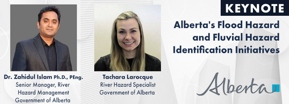
The government of Alberta manages the production of riverine flood studies under the provincial Flood Hazard Identification Program, to assist communities in keeping Albertans safe and protecting their properties from floods. Flood maps improve public safety, support emergency management, and help us build safer and more resilient communities. The government of Alberta also manages the production of alluvial fan studies to help Albertans learn about flood risks in the steep terrain of Alberta...
The integration of AI in infrastructure modeling has the potential to revolutionize decision-making processes by providing accurate predictions, identifying vulnerabilities, and optimizing resource utilization.The increasing complexity of modern infrastructure systems, coupled with growing demands on utilities, has necessitated the adoption of advanced analytical techniques. This panel discussion brings together ideas from acad...


