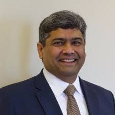
Christene Razafimaharo
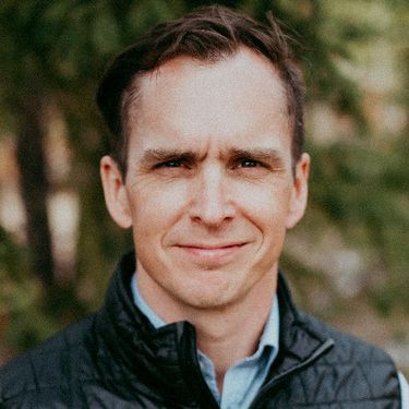
My areas of interest are in hydrology, climatology and glaciology, in which I possess a broad range of skills in programming (Python, R) and in GIS (ArcGIS, QGIS). I seek to contribute these skills to a career in geomatics.
Sessions auxquelles Christene Razafimaharo assiste
Mardi 18 Juin, 2019
Jonathan Murphy the Founder of GeoIgnite and GoGeomatics welcome participants to the conference
There's never been a more exciting time to be a part of the geospatial profession. From mapping the infrastructure beneath our cities to indoor wayfinding, to plentiful and powerful remote sensing capabilities in air and space which we could hardly have imagined just a few years ago, the opportunities - and the expectations - for geospatial professionals are immense. Technology is evolving at a pace which outstrips the ability of academics, governments, and industries to keep pace. How will w...
Let’s admit it! We live in exciting times with technology, social interactions and business models changing before our eyes: Flying taxis, self-driving cars, commercial Space missions, smart cities, SmallSats and Internet Of Things (IOT) to name just a few innovations! Our kids are growing up in a world of on-demand TV, GPS availability, all around virtual assistants, and mobile devices that pretty much can do anything! Each and every one of these innovations has a location element to i...
Participants can register for the event and pick up thier badges
Prashant Shukle is the Director General for the Canada Centre for Mapping and Earth Observation Branch, Earth Sciences Sector, at Natural Resources Canada (NRCan).NRCan has fostered an enabling policy mechanism and provided a conducive framework for geospatial information infrastructure. In today’s digital age when geospatial is becoming more and more ubiquitous, open and inter-disciplinary policies are the key instruments of harnessing the true value of this wonderful technology...
Ted works with Natural Resources Canada as the Senior Geomatics Technologist for the Survey General Branch's Atlantic Regional Office in Amherst. He has been working in the geomatics industry for over 20 years and has a diverse background in various disciplines including GIS, Cartography, LIDAR, Remote Sensing and GPS Surveying. Ted graduated from the Centre of Geographic Sciences (COGS) with advanced diplomas in both Remote Sensing and Applied Geomatics Research and with a B...
What are the ramifications of the current digital transformation globally and what will it mean for Canada and the globe? Our award winning panel of international and Canadian experts disscuss and take questions from delegates.
BeSpatial / urisa Ontario, is a not for profit representing the Geospatial and Information Community in Ontario. Our BeEmployed session, is designed to help you step out of the comfort zone of applying to jobs posted online. This presentation will teach you about: effective networkingthe information interviewusing social media as part of your job searchrecommended professional organizations to joinsuggested conferences to attenda...
Break
Avenza Systems has been developing software tools that have changed the way maps are made, distributed and used for over 20 years. Our geospatial mapping software plug-ins for Adobe Creative Cloud are standard tools in the industry, used by cartographers and people who work with spatial imagery to make beautiful maps more easily. More recently, we developed a mobile app that allows users to use digital maps on mobile devices, in remote locations, without the need for internet or n...
The Canadian federal government is not only the largest employer in Canada, it consistently ranks among the top employers in the nation for overall employee satisfaction (see Maclean’s Magazine and The Globe and Mail Top 100 Employers.) With the broad range of job opportunities and competitive pay and benefits, government jobs are clearly some of the the most attractive career opportunities in Canada.This talk will go through the manner in which you can apply for federal goverment postio...
Alberta View: Economic impacts and Opportunities of the Geospatial SectorLocation technologies are changing the way we live, work, and play, and are having a transformative impact on industries across Canada. The intersection of location technologies with Virtual Reality and Augmented reality are rapidly transforming key sectors of the Canadian economy including transportation, the resource sector, the digital and interactive media sector and transforming how governments d...
The future is digital. Big data is an integral part of the digital transformation of a private or public organization. Location and geospatial technologies are at the heart of the digital transformation as enablers, game changers and contribute to the success of big data in many ways. Combined with emerging geospatial artificial intelligence, the possibilities are limitless. Smart cities and autonomous vehicles are examples of this potential. However, this big data revolution raises many lega...
Several key trends in the geospatial industry over the last few years have created the conditions needed to truly leverage remote sensing as a technology that has the potential to provide tremendous benefit to civil society. These include changes in data policy, most notably with USGS's decision in 2008 to make all Landsat archives free and open, a policy which led the European Space Agency to also implement free and open access to the Copernicus constellation. The volume of data that is incr...
In this talk the CIG will describe the activities, History and accomplishments of the organization and explain teh benefits of mership to your career.The Canadian Institute of Geomatics is open to any individual, corporation, educational institution, government agency or association which supports the objectives of the Institute.
This talk will explore the benefits of becoming a member of the CRSS. The society is Canada's premier academic remote sensing organization.The Mission and Vision of the Canadian Remote Sensing Society is to: Provide a focal point for leadership and excellence to advance the art, science, technologies and applications of remote sensing and related fields.Facilitate opportunities for our national and international membership, including with partner Societie...
Hope Spots are special places that are critical to the health of the ocean — Earth’s blue heart. Some Hope Spots are already formally protected, while others still need defined protection. The Mission Blue team has embarked on a series of expeditions to shed light on these vital ecosystems and ignite support to safeguard them as marine protected areas.The IUCN are an integral partner in the Mission Blue initiative and the Hope Spot concept ties into UN amb...
The Association of Ontario Land Surveyors (AOLS) was established in 1892. It is a self-governing association, responsible for the licensing and governance of professional land surveyors, in accordance with the Surveyors Act. As with all self-governing professions, the AOLS has a responsibility to ensure that the public interest is paramount. Section 2(2) of the Surveyors Act states: <...
If you come to the event for one talk only this would be it. Jonathan Murphy is a geospatial career coach and mentor. He has worked across Canada and around the world as a GIS specialist, geomatics manager, and marketing consultant. He has been coaching graduates, professionals, and senior members of the geospatial industry for over ten years. Jonathan is an alumnus the University of Calgary and of the Centre of Geographic Sciences (COGS) and holds post graduate ...
Global Grid Systems is pleased to sponsor the first lunch of the conference. GeoIgnite offers our delegates a special meal for the first day of the event. Executive Chef Derek Ragnitz has put together a delicious and healthy lunch.Geoignite Day 1 Mediterranean Style Lunch:Medley of mixed greens cherry tomatoes and cucumbers with dressings.Traditional Greek salad, freshly made hummus with tabbouleh and pita bread.Grilled M...
Presentation Summary: As a student or potential student in a GIS Certification Program developing a vision for future career possibilities is an important part of meeting with success. This presentation will provide an overview of the following: •Where have all the GIS graduates gone? •Evaluating the Possibilities •Mapping your Future Career We will discuss the career paths of GIS Certification Program ...
Members of the Canadian forces will talk about the exciting and rewarding careers available in geomatics.the Canadian military will unveil it's new flexible approach to recruitment allowing for the transfer of previous geomatics education and training inito a new military career. You might be closer than you think!Geomatics Technicians are members of the Military Engineering Branch of the Canadian Forces who capture, process, disseminate and manage geosp...
Today, geospatial technologies are embedded in many of the workflows that support the Fourth Industrial Revolution and therefore invaluable to users. This means that geospatial information is no longer the domain of specialists and suddenly has become a context for the rest of our augmented existence.From Pokémon Go, to Uber and autonomous vehicles (AV), Internet of Things (IoT) and Artificial Intelligence (AI), smart applications and on-line mapping tools give the public almost insta...
The Internet of Things (IoT) is here. Whether applied to industrial automation, wearables, connected transportation and logistics, drones or smart cities, IoT is poised to disrupt how we work, live and relate to each other, delivering great benefits along with new challenges. Improved revenue, costs, quality of life and convenience benefits are often confounded by concerns such as privacy, security, and social disruption, with location info playing no small role on both sides. So, what exactl...
We will have a remote sensing specialist speaking about careers: Andrew Davidson, a scientist with the Canadian Government, will talk about his experiences negotiating the minefield that can be the Government hiring process, and the things you need to do when applying for that Government job. Have you ever applied for a job with the Government of Canada and wondered why you weren't considered for future selection? Applying for Government jobs is tricky, and rarely, if ever, does a ...
ExcelITR is one of Canada's largest independent recruitment firms dedicated to placing IT professionals in contract and permanent roles. ExcelIT epresents specialized talent in a variety of disciplines, including Canada's geospatial & IT industry. Our goal is to introduce the best technical resources to the right employers.During this talk Branka Jankovic, Senior Account Executive with Excel will share insights and specialist information on: · Curren...
The UK Government as part of its building information modeling (BIM) initiative has said repeatedly that it expects the big payoff of a digital model will be during operations and maintenance, which typically represents 80% of the cost of a facility. Companies who do design, build, finance, and maintain, or design, build, operate, or PPP projects often employ a full lifecycle BIM + geospatial strategy. For example, Crossrail appears to be the first major project that may be able to provide su...
MaxSys is one of Canada’s leading consulting and staffing service providers. We have been providing permanent and temporary help services to the private and public sectors. We are also listed and authorized to provide a multitude of consulting and staffing solutions to federal government clients across Canada using our standing offers and supply arrangements. Currently, MaxSys provides staffing support for various IM/IT and GIS related government projects within the Natio...
The Earth is immense, and abundant with interesting information. Recent advancements in geospatial sensors (e.g. satellites, smart phones, meteorological instruments, and LIDAR) have resulted in the development of technologies capable of collecting large and dynamic geospatial data. As a result, we are experiencing an explosion in the volume and variability of geospatial data, and yet many in public remain unaware of or unable to access this wealth of data to make informed decisions regarding...
Esri Canada is a leader in one of the most exciting and growing technology industries today. GIS is increasingly playing an indispensible role in governments, businesses and educational settings improving analysis and decision-making. With 26 years of consecutive revenue growth and profitability, our GIS solutions can be found in virtually every industry sector across the country.We invest significantly in our employee's personal and professional development, ensuring that eac...
Cloudy with a chance of data science.Sparkgeo had been building cloud first geospatial applications, from day 1. But that was not the plan. The plan was to make more maps for more people, using the internet.Sitting at the intersection of software development and GIS we see how these two communities can benefit from each other. But, to do so, we will have to step out of our comfort zones.Let me tell you the story of a lowly GIS tech's journey through the technol...
The changes we are witnessing today are being driven by the growing use of geospatial technology in everyday life. Artificial intelligence (AI), self-learning machines, Smart Cities, 5G, automated vehicles, and Big Data. The world has become geospatial by default and is already altering the ways decisions are made and information communicated.Our world class panelists will discuss...
We are entering a new era of positioning, navigation and timing. Global, instantaneous, and easily accessible positioning at better than 10cm is coming, which will provide new ways of doing business and create new businesses in areas such as augmented reality. In recent years global Positioning, Navigation and Timing have been undergoing rapid technological development. New GNSS constellations (Galileo, Beidou) with new signal structures offer increased capabilities, while future posi...
Please join fellow conference attendees for an amazing networking reception in the exhibitor hall sponsored by Mapbox. The event will feature surprise performances and appetizers, and will be a great chance to connect with other geospatial professionals.
Mercredi 19 Juin, 2019
Marikka Williams, MSc, GISP and Professor, Fleming College Geographic Information Systems welcomes delegates to the morning and will be master of ceremonies for the morning.
Mainstreaming of the geospatial market has created a big demand for geospatial content and solutions across governments, businesses and consumers. The Fourth Industrial Revolution (4IR) has also helped scale up applications and value to much larger markets, amplifying overall impact and contribution of geospatial information in the world economy and society. With every added application and consumer, the return on investments get bigger and better. The panel shall focus...
The coastal zone is a challenging place to map, techniques for mapping the land elevation do not work under water and echosounding methods for mapping the seabed elevation work well in deep water but are dangerous and expensive in shallow water. As a result, detailed information in the shallow coastal zone is lacking. This presentation will focus on the Chiroptera II shallow water topo-bathymetric lidar sensor that can collect seamless elevation data in coastal or freshwater environments. The...
This Canadian military presentation will show various datasets of survey grade terrestrial LiDAR, discuss collection methods to achieve the best results and talk about possible applications/analysis that the data can be used for. Presentaers will demonstrate some workflows in Leica Cyclone to show how survey grade points can be extracted and discuss the pros/cons and considerations of using terrestrial LiDAR.
NAV CANADA is a privately run, not-for-profit organization that is the Air Navigation Service Provider for Canada. With an airspace that spans all three coastlines of the country, from the west coast of British Columbia to the Arctic Ocean in the North to the east coast of Newfoundland, NAV CANADA covers a lot of territory. The Aeronautical Information Management group is responsible for creating instrument flight procedure designs (airways, instrument approach procedures, departure procedure...
Megan works with national players in the Construction Industry, balancing high-level strategic direction and thinking with operational needs and technologies. She works with Departmental Stakeholders, Clients, and Private Sector Service Providers alike to bring digital efficiencies and innovation to workflows and processes in Real Property portfolio, program, and project, management. Megan has been a strong voice for digital transformation within the Federal Government's Real Property Communi...
Brampton built a hub for the City’s Open Data and made it available to Staff, Citizens, Businesses and Students. The GeoHub makes discovering and using the City’s data more purposeful, and promotes transparency, fostering innovation everywhere. In our ongoing effort to develop a mature GIS system, the GeoHub is a big step in our goal of creating a self-serve environment. The City leveraged ArcGIS Open Data to transform it into a community hub, effectively increasing the usage of Open Data and...
Synthetic Aperture Radar (SAR) satellites image the Earth in all weather conditions, day or night. Canada’s RADARSAT-2 satellite, launched in 2007, orbits the Earth with a 24-day revisit cycle. It is used for mapping ground deformation produced by natural and anthropogenic hazards; natural resource development; permafrost, glacier and coastal changes. The next generation of Canadian satellites, the RADARSAT Constellation Mission (RCM), to be launched in June 2019, will improve the revisit cyc...
The GeoIgnite Conference and our sponsors are proud to present the inaugural Diversity in Leadership Summit (DILS). It is our vision that GeoIgnite will spur the grassroots of a more diverse ecosystem where diversity of thinking and knowledge will ignite innovation and better outcomes for us all. The DILS is the flagship forum for of geo professionals of all ages and stages in...
Investment in building construction statistics for the residential and non-residential sectors account for approximately 5% of GDP and are used extensively by internal and external clients. The statistics available for the residential and non-residential building construction sectors provide an invaluable portrait of this activity in Canada at the national, provincial and census metropolitan area (CMA) level. In order to improve the quality of our estimates, while als...
The Government of Canada purchases on average $22 billion in goods and services each year to help deliver programs and services to Canadians. Many departments and agencies collect and manage large amounts of geospatial data, and significant investments have been made within these organizations. The demand for, and use of, geospatially-related data and tools is rapidly increasing across government, as well as in the broader public context. This information session will help you understand the ...
The value of geospatial big data and how to efficiently convert it to useful information is an important cross disciplinary question. There has been significant investment in the collection and archiving of geospatial and other environmental data and numerous organizations recognize the importance of this information resource. However, the software and computing systems to effectively and efficiently access, interrogate, and utilize this information for specific applications has not seen the ...
For the second day of the conference executive Chef Derek Ragnitz and his award winning culinary team offer a Mexican themed selection for delegates enjoyment.GeoIgnite Day 2 Mexican Style LunchChef Dereks Ragnitz's tasty Chicken Fajitas using fresh ingredients.Tortilla chip platters: Chips, fresh guacamole and salsa. Shredded cheese, sliced jalapenos, sour cream and Mexican re-fried beans.Southwestern three bean salad.<...
Over the last few years, the Data Exploration and Integration Lab (DEIL) at Statistics Canada has conducted an increasing amount of work with open data using various open source tools in an open ecosystem. This exploration and experience has given rise to the idea of using an “open project” approach; that is, an approach that, to the extent possible, makes use of open source software, open code, open standards, open data, open platforms and open project management tools. The presentation outl...
The internet is an excellent channel for GIS professionals to reach their audiences. However, much of what is being diffused leaves people wanting. In many cases, static or limited functionality doesn't inspire people. Worse, some absolutely great maps are made but never reach their intended target. Karl Spencer takes us through the process of creating one of CartoVista's mesmerizing Mystery Maps. From digital research, through to design, development and finally distribution, Karl will presen...
Due to climate change, natural hazards are happening more in recent days. Analyzing these changes and prediction of future hazards have been always a challenge in the field of Geographic information systems (GISs). Traditional GIS aims to use map versus globe for their models, standards, and analysis. With the advances on Discrete Global Grid Systems, a new research question has been raised on what if we adapt our traditional approaches into a Digital Earth rather than a map. Digital Earth (G...
Natural Resources Canada provides mapping and engineering advice and expertise to Public Safety Canada in support of the National Disaster Mitigation Program. Notably, NRCan develops the Federal Flood Mapping Guidelines Series and is nearing publication on two documents that will move Canada closer to having common practices for flood risk: • The Federal Hydrologic and Hydraulic Procedures for Flood Hazard Delineation, and • The Federal Geomatics Guideli...
While much of the data available about the Earth pertains to the surface, there also exists a large amount of data available about the atmosphere and regions below the surface. Examples of such data include weather information, lithospheric properties such as velocity, aircraft and satellite flight paths, and underground utility networks. Flattening such volumetric data to the surface for integration with a traditional discrete global grid system (DGGS) discards the spatial relationship betwe...
