Craig Onafrychuk
Sessions auxquelles Craig Onafrychuk assiste
Mercredi 22 Juillet, 2020
Opening Remarks by GeoIgnite founder Jonathan MurphyKeynote address: Geospatial Opportunities in COVID TimesGeospatial capacity has been helpful in providing answers to Canadians during a time where nothing seems normal anymore. At the forefront of tracking, reporting and managing the response to the COVID crisis are geospatial tools, data and leadership. Natural Resources Canada’s Canada Centre for Mapping and Earth Observation supported the Government of Canada’s response b...
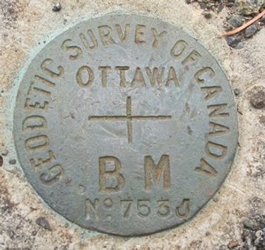
The U.S. reference system modernization effort will replace the North American Datum of 1983 (NAD83) with a new North American Terrestrial Reference Frame (NATRF2022), creating 1.3 to 1.5 m horizontal coordinate differences at the Canada–U.S. border with respect to Canada’s NAD83(CSRS). Never before have such significant differences existed between our two countries’ reference frames.There are compelling reasons for Canada to follow suit and adopt the NATRF2022 frame as our ...
Geospatial and location technologies is present and continues to expand its reach in many sectors. Much of the current digital transformation taking place globally is built upon geospatial foundations. In this open panel discussion, our experts will discuss the latest developments and challenges facing the Canadian and global geospatial sector and what the future holds. Key components to be addressed include how has the global pandemic affected our sector and how may we be impacted in the...
Jeudi 23 Juillet, 2020
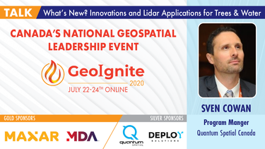
A closer look at some of the lidar-derived innovations for enhanced forestry management solutions and topobathymetric flood mitigation from Quantum Spatial Canada. Presented by Sven Cowan, Dr. Andrew Brenner, and Colin Cooper. Quantum Spatial, Inc., an NV5 company, is one of North America's largest geospatial services firms, providing insights to organizations that need geospatial intelligence to mitigate risk, plan for growth, better manage resources and advance scientific ...
Mercredi 21 Avril, 2021
Le Canada est le chef de file mondial dans le domaine de l'observation de la Terre par radar spatial à grande échelle grâce au programme RADARSAT, qui soutient de nombreuses utilisations opérationnelles et scientifiques des données radar à synthèse d'ouverture (SAR).MDA, en collaboration avec le gouvernement canadien, a créé une marque et une réputation d'excellence internationalement reconnues en matière de données SAR en temps quasi réel sur de vastes zones pour les applica...
Savez-vous ce qu'est le piège des produits géospatiaux? Nous tombons amoureux de la technologie, pas du problème. Je suis une personne chanceuse. Mon travail est devenu celui où je parle principalement de technologie géospatiale toute la journée. Je pourrais être en train d'étudier des projets internes ou externes ou d'évaluer des technologies. De plus en plus, je donne des conseils sur des idées de produits. Cette dernière situation m'a obligé à réflé...
Le Centre canadien de cartographie et d'observation de la Terre (RNCan) poursuit ses travaux de mise en œuvre de la Stratégie nationale sur les données d'élévation. Grâce à cette stratégie, l'un des objectifs de RNCan est de fournir aux Canadiens une représentation tridimensionnelle précise du pays, à l'appui des priorités du gouvernement comme la cartographie des inondations. En raison de l'énorme tâche d'obtenir une couche d'élévation nationale de haute précision et à jour, RNCan travail...
Au cours de la dernière année, Minerva Intelligence, une entreprise d'IA cognitive basée à Vancouver, a remporté deux contrats avec Ressources naturelles Canada pour concevoir des schémas au niveau national: le National Flood Hazard Data Layer (NFHDL) et le National Hydro Network V2 (NHNv2 ). Vous vous demandez peut-être pourquoi une entreprise d'IA conçoit et construit ces structures de base de données importantes. Le système d'IA cognitive de Minerva utilise des données sémantiquement in...
Jeudi 22 Avril, 2021
Depuis près de 50 ans, des représentants de la géomatique des provinces et territoires canadiens ont collaboré avec le gouvernement fédéral à des initiatives de géomatique. Cette présentation explorera pourquoi un tel conseil a vu le jour et pourquoi son travail est important pour le secteur canadien de la géomatique et les citoyens. Alors que le secteur de la géomatique et le monde dans lequel nous vivons continuent d'évoluer, le besoin de coordination entre les juridictions demeure crucial ...
Le levé géodésique canadien (SCG) de Ressources naturelles Canada (RNCan) est chargé de définir, de maintenir et de fournir l'accès au Système canadien de référence spatiale (SCRS). Le CSRS fournit une référence cohérente pour l'arpentage, la cartographie et d'autres applications qui nécessitent un positionnement précis. Cette présentation décrira les produits, les outils et les services de BESC actuellement disponibles et donnera accès au Système canadien de référence spatiale (SCRS). Il ...
Vendredi 23 Avril, 2021
oignez-vous à GeoIgnite pour ce premier panel de chefs de file provinciaux et territoriaux de la géospatiale et des technologies de localisation. Nous discuterons des problèmes entourant: Quelles sont les principales priorités et défis à travers les juridictions?Quels types d'outils géospatiaux utilisons-nous pour surveiller et répondre à des défis clés tels que les interventions d'urgence?Comment les juridictions harmonisent-elle...
Mardi 26 Mars, 2024
Airborne Topo-Bathymetric Lidar Combined with Thermal Imaging for Fish Habitat Studies in RiversResearchers at Nova Scotia Community College’s Applied Geomatics Research Group have been using the airborne Leica Chiroptera 4X topo-bathymetric lidar sensor for nearly a decade and have surveyed coastal, riverine and lake environments. They have concentrated on mapping submerged aquatic vegetation (SAV). Topo-bathy lidar data of rivers provides an opportunity for improved flood hazard h...
The Canadian government first formally created LiDAR Guidelines in 2017. The document was updated in 2022 to Version 3.1. This session will review the Canadian Guidelines and compare them to the USGS LiDAR Base specification, updated in 2023. Included in the presentation will be:LiDAR for Flood Mapping and funding from the National D...
Canada’s LiDAR Panel: Future Trends in Service and Tech, is a deep dive into the evolving landscape of LiDAR technology in Canada. Our panel of experts will explore cutting-edge developments in LiDAR, focusing on new trends in service delivery and technological advancements. Expect insights into the integration of AI, enhancements in data processing, and future applications in sectors like urban development and environmental management. This session promises to equip attendees with a forward-...
Mercredi 27 Mars, 2024
The United States’ National Geodetic Survey (NGS) plans to modernize their National Spatial Reference System (NSRS) in 2025, including adopting a new dynamic geometric reference (the North American Terrestrial Reference Frame of 2022 (NATRF2022)) and a new geoid-based height system (the North American-Pacific Geopotential Datum of 2022 (NAPGD2022)). To ensure continued geospatial referencing compatibility, the Canadian Geodetic Survey (CGS) plans to modernize the Canadian Spatial Reference Sy...


