Chris Formeller has 20+ years working in the geospatial industry providing products and services across various industries. He has spent 10 years working within the aerial industry providing GIS, Aerial mosaics, Lidar data to defense and commercial customers. The remaining part of his career has been focused on remote sensing industry and providing global product offerings that meet the needs of our defense and commercial customers.
Sessions auxquelles Chris Formeller participe
Mercredi 22 Juillet, 2020
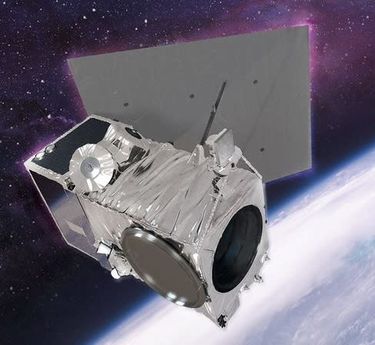
Our next-generation Earth imaging constellation will change everything. We're not just launching more satellites. In 2021, we will deploy WorldView Legion which will provide unprecedented visibility into our changing planet to solve the biggest challenges facing our world today. Grab your favorite beverage and join Maxar for a casual conversation about our next constellation, Legion! Everyone who joins will be entered for a chance to win an IPad!
Sessions auxquelles Chris Formeller assiste
Mercredi 22 Juillet, 2020
Opening Remarks by GeoIgnite founder Jonathan MurphyKeynote address: Geospatial Opportunities in COVID TimesGeospatial capacity has been helpful in providing answers to Canadians during a time where nothing seems normal anymore. At the forefront of tracking, reporting and managing the response to the COVID crisis are geospatial tools, data and leadership. Natural Resources Canada’s Canada Centre for Mapping and Earth Observation supported the Government of Canada’s response b...
Presented by: Jake Dickinson & John Roos Abstract: As shrinking polar ice creates new opportunities for resource exploration and shipping routes, the importance for Arctic nations to monitor the ongoing expansion in the Arctic is ever increasing. Additionally, climate change continues to impact people and the environment. High resolution satellite imagery remains one of the most effective means of monitoring inaccessible and de...
Geospatial and location technologies is present and continues to expand its reach in many sectors. Much of the current digital transformation taking place globally is built upon geospatial foundations. In this open panel discussion, our experts will discuss the latest developments and challenges facing the Canadian and global geospatial sector and what the future holds. Key components to be addressed include how has the global pandemic affected our sector and how may we be impacted in the...


