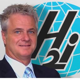
Shawn is the Director of Client Relations for the Sault Ste. Marie Innovation Centre. For more than 20 years, Shawn has worked with organizations across Canada with a specialization in enterprise-wide GIS and innovation. With a successful track record managing projects across Canada, Shawn brings expertise in bridging technology and client objectives to drive impactful results. The Sault Ste. Marie Innovation Centre is known for establishing the means to share data, knowledge, and tools among organizations to create healthier, safer, and more prosperous communities.
Sessions auxquelles Shawn Crosier participe
Mercredi 15 Mai, 2024
In an increasingly complex and rapidly evolving geospatial landscape, the demand for skilled professionals who can deliver tailored solutions is at an all-time high. Recognizing this need, GoGeomatics Canada, the Sault Ste. Marie Innovation Centre (SSMIC), and OnPar have joined forces to provide comprehensive staff augmentation services that cater to both the private and public sectors.This presentation at GeoIgnite 2024 will detail ...
Sessions auxquelles Shawn Crosier assiste
Lundi 13 Mai, 2024
Location:Play Food & Wine1 York St, Ottawa, ON K1N 5S7https://www.playfood.ca/
Lundi 12 Mai, 2025
Join us for a thought-provoking lunchtime discussion where we explore the evolving landscape of Canada’s geospatial industry while enjoying a delicious meal.The concept of Two Solitudes has long symbolized the cultural and linguistic divide between English and French Canada, but how does this idea still resonate within our geospatial ecosystem to...
Join us for the OGC Canada Forum! We’ll dive into key topics like the Canadian Geospatial Data Infrastructure (CGDI) and how Building Information Modeling (BIM) integrates with Geographic Information Systems (GIS). This event gathers experts from industry, academia, Indigenous organizations, and government to explore these technologies' impact on Canada’s built environment. We'll also cover how OGC standards boost interoperability and innovation. All Canadian organ...
📅 Date: Monday, May 12, 2025📍 Location: Rainbow Bistro, 76 Murray Street, ByWard Market, Ottawa⏰ Time: Networking at 6:30 PM | Panel begins at 7:00 PM | Live music to follow🍽 Details: Cash bar and hors d’oeuvres provided Event OverviewJoin us for an evening of high-level discussion, networking, and live music in the heart of Ottawa’s historic By...
Mardi 13 Mai, 2025
For decades, Canada’s geospatial ecosystem has thrived on deep integration with the U.S., benefiting from shared technology, markets, and collaboration. But today, shifting geopolitical and economic realities—trade conflicts, supply chain vulnerabilities, and data sovereignty concerns—are forcing us to rethink this reliance. The question is no longer whether we should adapt, but how.
The Canadian Hydrographic Service (CHS) is Canada's agency for charting Canadian waters. Canada has the longest coastline of any country in the world, with more than a third of its territory under water. As a maritime nation, global maritime transport traffic is significant. Hydrography supports safe navigation and shipping through the production of nautical charts and other publications including water levels. With opportunities provided by emerging technologies and the move to e-navig...
Artificial Intelligence is transforming how we interpret and act on information—but what does that mean for the geospatial world? As AI models generate synthetic maps, infer locations, and automate analysis, geospatial professionals face a critical moment: will we shape the future, or be shaped by it?In this session, the CEO of the Open Geospatial Consortium (OGC) will explore the complex relationship between AI and geospatial systems—from the risks of black-box models and data halluci...
Top technical performers are often promoted into leadership roles, yet many struggle. In AI-driven, data-intensive industries, expertise alone is not enough—leaders must also navigate complexity, inspire teams, and drive execution. Without these skills, organizations face decision paralysis, disengaged teams, and stalled innovation.Senior leaders know that competency is crucial—technical excellence is the foundation of succes...
At GeoIgnite 2025, Alexander will explore how Canada's geospatial community is uniquely positioned to lead in developing solutions to environmental challenges in a rapidly changing geopolitical landscape. Drawing on compelling case studies from around the globe, including successful Dutch-Canadian collaborations, he will demonstrate how geospatial technologies are becoming indispensable tools for environmental monitoring, climate resilience planning, and sustainable...
Mercredi 14 Mai, 2025
As the built asset industry embraces digital transformation, the integration of Building Information Modeling (BIM) and Digital Twin technologies is redefining how we manage the built environment. While BIM facilitates data-rich 3D modeling during design and construction, Digital Twins extend this functionality into operations, enabling real-time insights and lifecycle optimization.Attendees will gain insights into buildingSMART Canada’s initiatives supporting this integration, its ali...
In a world of constant change and uncertainty, how can we make informed decisions in real-time, grounded in the realities of ambiguity? This presentation tackles these fundamental questions by exploring the evolution of how we understand and interpret our world—from childhood curiosity to professional expertise—and how these insights shape decision-making in complex environments.Using case studies in GEOINT adoption inside and outside traditional national security communities, I will d...
Discover the future of Canadian property development! Join Archistar to see how our AI platform and eCheck technology revolutionise municipal and developer processes. Learn how to overcome poor application data quality and lengthy approvals to unlock housing supply in municipalities across Canada. We will discuss our Digital Permitting Readiness Framework, including integration with BIM workflows, and our bottom-up approach to empowering the digital workforce to achieve streamlined permitting...


