Zack Budge
Sessions auxquelles Zack Budge assiste
Lundi 13 Mai, 2024
This workshop will introduce you to the ENVI Ecosystem, a powerful suite of tools for processing and analysing remotely sensed data. We'll focus on its applications for using hyperspectral, multispectral, and SAR data to monitor climate change indicators like:- Vegetation Health- Deglaciation- Greenhouse Gas Emissions- Land Cover Change- Shoreline ErosionWe will also demonstrate how to leverage ENVI’s AI-powered Deep Learning tools to automate the extraction of a...
CATALYST (PCI Geomatics) has played a critical role in supporting the Government of Canada, Academic and Commercial organizations to meet their objectives processing satellite optical, SAR and aerial data using advanced science and automated workflows. New design patterns make it possible to implement the same great technology in new, innovative ways. What we will cover: In this workshop we will demonstrate how to scale processing using various approaches including:Bu...
Location:Play Food & Wine1 York St, Ottawa, ON K1N 5S7https://www.playfood.ca/
Mardi 14 Mai, 2024
Mini Continental BreakfastGeoIgnite is delighted to offer a selection of chilled fruit juices, freshly baked croissants, muffins, and breakfast pastries, served with butter and preserves. Guests can also enjoy fruit cocktails and yogurt. Available beverages include coffee, tea, and decaffeinated coffee.
Connecting the knowledge economy to the emerging relationship economy in a geospatial context. This talk will emphasize the growing importance of social skills and human connectivity in harnessing the power of data and technology. His talk, titled "Human Interoperability: Enhancing Geospatial Effectiveness in the Relationship Economy," explores the notion of valuing existing resources and optimizing the use of data and technology, particularly in the geospatial sector. As the Executive Office...
GeoIgnite is thrilled to present its keynote session, "Canada's Geospatial Leadership Panel," a gathering of some of Canada's most influential figures in the field of geospatial technology in Canada. Panelist: Melanie Desjardins, Director of the NWT Centre for Geomatics, showcases the application of geospatial technology in public sector management and natural resource governance. Her leadership in geomatics plays a significant role in shaping policies and strategies that utilize ...
This presentation will explore how Sault Ste. Marie leveraged two decades of Geographic Information Systems (GIS) to craft and maintain its cutting-edge Digital Twin. Exploring the innovative applications of Sault Ste. Marie’s GIS digital twin model, which offers real-time insights allowing for collaboration and more effective decision making, this presentation showcases the transformative potential of GIS enabled digital twins. We will demonstrate how this comprehensive digital r...
Mercredi 15 Mai, 2024
Simplify your AI infrastructure and reduce your interoperability headaches with TileDB, the adaptive database for geospatial AI.The need for geospatial insights with AI requires the management and ETL of legacy geospatial data lakes. Learn how TileDB can model all data as n-dimensional arrays as it sees no data as unstructured. TileDB is multi-modal and supports rasters, point clouds and geometries with a single API.We will explain that TileDB is ideal for Generative AI with geo...
Within its highly dynamic environment, Geospatial Leaders need to integrate knowledge, knowhow, and leadership skills to promote and fully enable this domain while communicating their value proposition to decision makers. This talk will introduce a Framework for leadership development to assist Geospatial Leaders to optimize their success as leaders a...
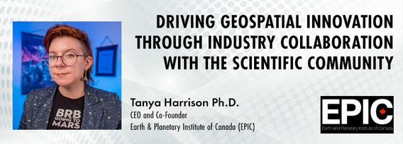
The Earth observation (EO) sector has struggled to break outside its own space echo chamber to have its full potential realised for both social and economic benefit. Can better collaboration between industry and the scientific community help to unlock this potential and drive geospatial innovation? Dr. Tanya Harrison, Co-Founder and CEO of the Earth and Planetary Institute of Canada (EPIC), will highlight examples of such collaborations that have led to breakthroughs that enhanced both indust...
In the rapidly evolving geospatial industry, modern advancements in technology have paved the way for companies to offer geospatial data as a service, revolutionizing the way businesses approach and use geographic information. The advent of micro services to ultimately drive managed services has significantly reduced the necessity for dedicated in-house geospatial teams, providing a cost-effective and efficien...
The City of Ottawa (City) annually invests about $3M in studies of the local subsurface geotechnical, hydrogeological, and environmental conditions in support of municipal planning, development proposals, infrastructure designs, construction, and environmental protection studies. Much of this valuable information remains with individual consulting firms and in City project files, so this data is relatively inaccessible and not ready for use to internal and external stakeholders.
Canada is big, really big! Mapping the whole country took us over 100 years to complete. Through the years, the techniques used to map Canada's features evolved.For NRCan, the latest innovation is in the operational implementation of Artificial Intelligence tools and approaches, nested in high performance cloud computing capacity, and build via micros-ervices for agile and scalable deployment. This capacity, enables the organization to increase exponentially its capacity to create and ...


