
Mario Santana
Sessions auxquelles Mario Santana assiste
Mercredi 15 Mai, 2024

The City of Ottawa (City) annually invests about $3M in studies of the local subsurface geotechnical, hydrogeological, and environmental conditions in support of municipal planning, development proposals, infrastructure designs, construction, and environmental protection studies. Much of this valuable information remains with individual consulting firms and in City project files, so this data is relatively inaccessible and not ready for use to internal and external stakeholders.

Lundi 12 Mai, 2025

BUY YOUR TICKETThe workshop begins with IFC model preparation using BonsaiBIM, where participants will learn to create or modify an IFC model enriched with precise geospatial data, including longitude, latitude, and elevation and potentially export the geometry to glTF for web integration. Next, the focus shi...


Mardi 13 Mai, 2025

Mini Continental BreakfastGeoIgnite is delighted to offer a selection of chilled fruit juices, freshly baked croissants, muffins, and breakfast pastries, served with butter and preserves. Guests can also enjoy fruit cocktails and yogurt. Available beverages include coffee, tea, and decaffeinated coffee.

For decades, Canada’s geospatial ecosystem has thrived on deep integration with the U.S., benefiting from shared technology, markets, and collaboration. But today, shifting geopolitical and economic realities—trade conflicts, supply chain vulnerabilities, and data sovereignty concerns—are forcing us to rethink this reliance. The question is no longer whether we should adapt, but how.


Dr. Nadine Alameh, the inaugural Executive Director of the Taylor Geospatial Institute, has been leading an ambitious effort to accelerate geospatial research for tackling today’s biggest challenges—climate, disasters, health, and national security. In this session, she will reflect on what it takes to build a truly impactful geospatial ecosystem, challenge assumptions about the roles of national mapping agencies, academia, and nonprofi...


Artificial Intelligence is transforming how we interpret and act on information—but what does that mean for the geospatial world? As AI models generate synthetic maps, infer locations, and automate analysis, geospatial professionals face a critical moment: will we shape the future, or be shaped by it?In this session, the CEO of the Open Geospatial Consortium (OGC) will explore the complex relationship between AI and geospatial systems—from the risks of black-box models and data halluci...

Mercredi 14 Mai, 2025

Mini Continental BreakfastGeoIgnite is delighted to offer a selection of chilled fruit juices, freshly baked croissants, muffins, and breakfast pastries, served with butter and preserves. Guests can also enjoy fruit cocktails and yogurt. Available beverages include coffee, tea, and decaffeinated coffee.

As the built asset industry embraces digital transformation, the integration of Building Information Modeling (BIM) and Digital Twin technologies is redefining how we manage the built environment. While BIM facilitates data-rich 3D modeling during design and construction, Digital Twins extend this functionality into operations, enabling real-time insights and lifecycle optimization.Attendees will gain insights into buildingSMART Canada’s initiatives supporting this integration, its ali...


As digital collaboration becomes the norm in the construction industry, ensuring the authenticity and integrity of Building Information Models (BIM) is more critical than ever. While BIM and openBIM standards, such as the Industry Foundation Classes (IFC), have improved interoperability and data exchange, challenges remain in verifying data at the object level.This presentation explores the potential of digital signatures as a solution to enhance trust, transparency, and traceability i...


This session unveils the findings of this groundbreaking report, which builds on international research and best practices in digital construction from countries leading in BIM and data standards. Central to the roadmap is the use of OpenBIM principles to ensure compatibility, transparency, and collaboration across diverse systems and stakeholders. The report outlines strategies to enhance data management, improve BIM compatibility, achieve interoperability within Common Data Environments (CD...


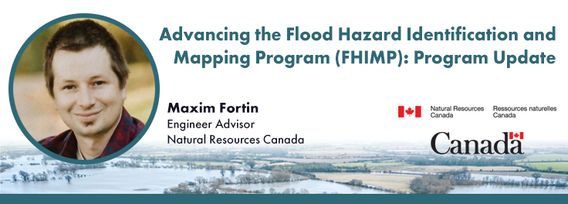
Under the FHIMP, Natural Resources Canada, supported by Public Safety and Environment and Climate Change Canada, collaborates with provinces and territories to create, and disseminate engineering-level flood hazard maps and information. In this presentation, Natural Resources Canada (NRCan) will provide an update on the ongoing work under FHIMP with results of the first stage of the FHIMP (2021-24) and the kickoff of the FHIMP expansion (2023-2028) which will see investments in every jurisdic...


The presentation focuses on the challenges of applying ISO 19650 to National Defence and Defence Construction Canada, examining the current status and progress, as well as the obstacles still faced. It highlights the key challenges of becoming a knowledgeable owner while aligning National Defence practices with ISO19650, with support from other stakeholders and partners through research, innovation, and collaboration. The importance of OpenBIM in this context is emphasized, as it plays a crit...


Aerial thermal infrared (TIR) surveys have been a crucial tool supporting river restoration project across the North America as many salmonid-bearing rivers are projected to warm in the coming decades due to increases in atmospheric temperatures and concomitant decreases and earlier melt of snowpack. The objectives of collecting TIR imagery are to assess the current summer thermal state and the distribution of cold-water refuges within the river system, and to identify opportunities and...


Digital Twins hold enormous potential for the buildings and infrastructure sectors, but their implementation faces key challenges. What is a Digital Twin? The industry lacks a clear consensus, leading to misinformation and confusion. While Digital Twins can scale, not every project requires every possible capability—so how do we manage this effectively? More importantly, the industry is not ready—foundational work in data standards, interoperability, and governance is still needed.In r...


The Open Building Population Layer for Canada has emerged as a transformative resource in the geospatial community, providing unprecedented access to population estimates at the building level across the country. Since its release, the dataset has garnered significant attention, reaching 8,000+ professionals on LinkedIn, and achieving thousands of downloads. This enthusiastic reception underscores its value for applications in urban planning, disaster management, and environmental assessments...
