Kelsey Meyer
Sessions auxquelles Kelsey Meyer assiste
Mardi 29 Octobre, 2024
The new Canadian Hydrospatial Network (CHN) is set to replace the National Hydrographic Network (NHN) for Canada. Designed for improved use in hydrological models, the CHN is analysis ready with full-network traversing ability, and value-added attributes such as stream order. The CHN is also created from higher-resolution source data and better aligned to elevation than the NHN, where possible, and has been streamlined for production and maintenance.Work is on-going to refine methods a...
Got a great idea, paper, project or product? Here’s an opportunity to hone your skills in making a “fast pitch”. There’s and art to making a fast pitch, where less can be more.The GoGeomatics Expo in 2023 launched the Fast Pitch session. Modelled after the Pitch-the-Press session of GeoWeek, presenters have 3 minutes to make your best case, followed by 2 minutes of questions from a panel and the audience. The panel of geo-journalists and industry experts judge th...
The Alberta Biodiversity Monitoring Institute (ABMI) defines human footprint as the visible alteration or conversion of native ecosystems to temporary or permanent residential, recreational, agricultural, or industrial landscapes. It also includes land that is periodically reset to earlier successional conditions by industrial activities such as forestry harvest areas and seismic lines. To monitor and map human footprint across Alberta, the ABMI, in partnership with the Alberta Human Footprin...
How exactly does artificial intelligence work and what can you use it for in the geomatics domain? Using real-life examples from our projects, they demonstrate how you can use AI to gain new insights and increase efficiency by automating your data processing workflows.We explore how GeoAI is fusing spatial data science and Geomatics technology to help automate the extraction, classification, and analysis of all types of spatial or non-spatial data. Learn how GeoAI can detect clusters, ...
Accurate mapping of road networks is essential for navigation, disaster response, and urban planning. Traditional methods relying on remote sensing images, Lidar data, and GPS trajectories are hampered by time-consuming manual updates and incomplete extraction due to obstructions from trees, buildings, and shadows. However, recent advancements in deep learning models have shown promise in improving road mapping and automating the detection of missing roads.This study uses a transfer le...
Maintaining undisturbed habitat is key to the recovery strategy of the Woodland Caribou boreal population. Seismic lines have been identified as a human footprint feature that requires specific attention for habitat restoration in part because linear features are linked to increases in the predation rates of caribou as they provide lines of sight and easy transportation routes for predators. It is estimated that there are hundreds of thousands of kilometers of seismic lines within Alberta (AB...
Construction contracts are the same worldwide. While there are differences in language, classification, project delivery and other factors, the one common denominator is that a construction contract requires Drawings and Specifications. While geometric modelling software and specification software have both evolved over time, very little effort is currently being exerted in Canada to integrate them in document development processes.According to Arcadis global surveys, the #1 cause of c...
In 2021, the Government of Canada invested $63.8M in the Flood Hazard Identification and Mapping Program (FHIMP) to to create and disseminate engineering-level flood hazard maps that can help Canadians better plan and prepare for future flood risks. The program was recently extended to 2028 through the National Adaptation Strategy and enhanced with an additional $164 Million investment.Given that many Canadians are unaware of flood hazards, the FHIMP is working to fill gaps in knowledg...
The government of Alberta manages the production of riverine flood studies under the provincial Flood Hazard Identification Program, to assist communities in keeping Albertans safe and protecting their properties from floods. Flood maps improve public safety, support emergency management, and help us build safer and more resilient communities. The government of Alberta also manages the production of alluvial fan studies to help Albertans learn about flood risks in the steep terrain of Alberta...
For the last five years I have been providing reality capture services to documentary film producers. These series have included NatGeo's Buried Secrets of WWII, NatGeo's Drain the Oceans, Discovery's Expedition Unknown and Expedition Bigfoot. LiDAR, photogrammetry, thermography, magnetometry, and multi spectral imagine all provide context that professional storytellers (TV producers) crave. Join me as I share stories, successes, and failures of these unique service offerings.
The Riparian Web Portal (www.riparian.info) is an award-winning project, launched in 2021 by Alberta’s watershed community. This dynamic online space empowers Albertans to enhance riparian health through interactive access to comprehensive data and resources. It serves a crucial role in advancing the riparian health objectives pursued by various watershed groups.At its core, the portal integrates innovative GIS-based assessments from six watershed agencies, covering over 60,000 km of r...
The integration of AI in infrastructure modeling has the potential to revolutionize decision-making processes by providing accurate predictions, identifying vulnerabilities, and optimizing resource utilization.The increasing complexity of modern infrastructure systems, coupled with growing demands on utilities, has necessitated the adoption of advanced analytical techniques. This panel discussion brings together ideas from acad...
Despite the rhetoric surrounding the use of building information modelling (BIM) to enhance collaboration by connecting people and data, the status quo is to work with proprietary solutions and closed file formats, limiting accessibility and interoperability. Additionally, the increasing complexity of projects in the Architecture, Engineering, Construction, and Operations (AECO) industry requires technology that integrates data at a range of scales, from asset to city, and beyond. To address ...
The integration of reality capture technologies—such as LiDAR, photogrammetry, and 3D scanning—into infrastructure asset management is revolutionizing how municipalities and organizations manage and maintain, their assets and deliver services. This presentation will explore the transformative impact of reality capture on the accuracy, efficiency, and overall effectiveness of infrastructure management practices. By enabling effective data collection and visualization, reality capture provides ...
Algal blooms, typically consisting of cyanobacteria which can produce harmful toxins, are a recurring problem on lakes around the world. Although Alberta has long-term sampling programs on selected lakes, monitoring is limited in time and space. Satellite remote sensing offers a way to monitor cyanobacteria blooms across the entire ice-free season and track spatial patterns of bloom development, dynamics, and spread across lakes. The Alberta Biodiversity Monitoring Institute (ABMI), Alb...
Mercredi 30 Octobre, 2024
Case Study: How DOTs and Utility owners took a Proactive Approach to Protect Underground Pipeline Assets Due to aging infrastructure and lack of accurate utility location information resulting in huge increased operational risk & especially at waterway, transportation, and ROW utility crossings. Utility owners understand the significant underground congestion and utility conflicts which result in future damages and the value the importance of geo location of UNLOCA...
RPAS platforms and sensors have come a long way since their commerical adoption almost a decade ago and have quickly become a main stay of many professional's tool kits. This show's the industry's appetite for adopting new technologies and matching them up with the right application. With a pannel of very experienced professionals from various sectors of Canada's Geospatial RPAS scene, we explore what has driven sensor development and how sensors might further develop along the lines of use c...
Photogrammetry is not just limited to aerial platforms. Modern mobile devices contain high-quality cameras and increasingly have LiDAR and depth sensors built in. When combined with high-accuracy GNSS systems, these mobile devices can quickly collect accurate data for utilities, infrastructure, inspection, as-builts, construction, and more. Utilizing these readily available devices can reduce project delays, capture better documentation of utilities, and lay the foundations for digital infras...
In this year's reality capture track, we have shown you the unprecedented value of reality capture systems when adopted into high-cost, high liability and fast pace environments, some of the problems these systems are solving today, and tools to help the effectiveness and quality of those solutions. However, our presenters will also have demonstrated how critical digital lifecycle planning can be to any asset, from pre-design through construction and lifetime operation right up to demolition,...
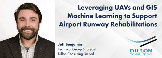
Dillon was retained by the Government of Nunavut to perform a Needs Assessment for the rehabilitation of the Runway 13-31, Taxiway A (Alpha), Taxiway C (Charlie), Apron A, and Apron C of the Rankin Inlet Airport.The project included pavement rehabilitation and geotechnical investigations for Runway 13-31, which is a 6000’ x 150’ asphalt paved runway, along with Phase I ...
Utility mapping is a crucial practice in urban planning and construction, focusing on identifying, documenting, and visualizing the precise locations of underground utilities such as water pipes, gas lines, electrical conduits, and telecommunication cables. Accurate mapping of these utilities is vital to ensure safety, efficiency, and cost-effectiveness in construction projects, preventing accidental damages that can lead to significant service disruptions, safety hazards, and financial losse...
With drones like the DJI Matrice 300 now being positioned using RTK GNSS, combined with Structure from Motion (SfM), high precision mosaics are possible without deploying targets. The ability to mount lidars (DJI L1 and L2) and other optical sensors (RGB, multispectral, thermal) allows for precise surveying and the production of high resolution and high accuracy mosaics with minimal ground control. While battery power still remains an issue and the limiting factor for flight duration (10’s of...
As the drone industry is increasingly focuses on developing larger airframes and equipping them with bigger sensors, Spexi is taking a revolutionary approach to aerial imagery. At Spexi, we believe that the future of geospatial data collection lies not in size and complexity, but in numbers and standardization. The Spexi platform leverages the power of crowdsourcing, deploying local pilots with small drones to capture standardized imagery across entire cities. This method allows us to achieve...
In countries that have very accurate and accessible map records, utility damage events are a rare occurrence. Japan with a one third of the population of the US has less than 200 line strikes per year. We will discuss how creating, sharing, and using accurate maps is critical in reducing damage to buried infrastructure.
With the increasing focus on damage prevention, public safety concerns, and environmental damage due to underground utility strikes, it has become more critical to accuracy locate, store and be able to visualize subsurface utilities. Several key technical details are discussed when implementing a subsurface mapping system from data collection to the use of machine learning for 3D modelling and visualization. The ability to make safe and effective decisions for i...
How do hydrographic surveys, aerial Remote Sensing and GIS help with environmental efforts? Terra explores 2 projects that use a combination of different sensors and visualizations to achieve these goals. The projects include a rapid marine data collection supported by Aerial LiDAR to aid in rescue efforts of a trapped Orca cafe, and using LiDAR with GIS to support change detection efforts of a major land slide.
Reduced snowpack in the Rockies presents a severe drought risk for Southern Alberta. Mountain snowmelt in the Bow and Oldman basins maintains reservoir levels, crop irrigation, municipal and industrial supply, and ecosystem services. As climate and consumption pressures increase, accurate snow water equivalent (SWE) data is crucial for water supply forecasts, which impact allocations and emergency drought measures. Field snowpack monitoring does not provide accu...
