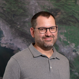
James Ashton completed his undergraduate degree in Geography at Queen’s University in Kingston Ontario, and has a post graduate certificate as a Geographic Information Systems Applications Specialist, from Sir Sanford Fleming College in Lindsay Ontario. James has spent most of his 20 year GIS career working for Agriculture and Agri-Food Canada in Regina, Saskatchewan. James has work experience with Land Information Ontario (LIO) in the Ontario Ministry of Natural Resources, and has worked as a Geospatial Consultant on Canadian International Development Agency (CIDA) enterprise geospatial implementations in Egypt and Ethiopia. James also worked closely with Natural Resources Canada and other federal Departments on the implementation of a Federal Geospatial Platform.
James is a certified Project Management Professional (PMP) and also has accreditations IT service management, Information Technology Infrastructure Library (ITIL).
Sessions auxquelles James Ashton participe
Jeudi 23 Juillet, 2020
Agriculture Canada’s COVID-19 response with location data & technology helping drive Objectives and Key Results (OKR’s) on the Enterprise GIS Roadmap This talk is designed to provide insights and guidelines for managing and directing Geospatial programs and uses the COVID-19 response (Maps Apps and Data) and digital transformation as the means to achieve the Objectives and Key Results of the Geomatics program.At AAFC the strategic initiatives of our data driven...
Mercredi 21 Avril, 2021
Explorez la structure d'une plateforme de renseignements de localisation d'entreprise à Agriculture Agroalimentaire Canada et comment ils ont créé une feuille de route stratégique pour diagnostiquer systématiquement les forces et les faiblesses afin de stimuler l'utilisation de l'intelligence de localisation dans les décisions quotidiennes de programme et de politique d'un ministère fédéral. Agriculture et Agroalimentaire Canada appuie le secteur canadien de l'agricultur...
Sessions auxquelles James Ashton assiste
Mercredi 22 Juillet, 2020
Building on the panel discussion at GeoIgnite 2019, David Acco will discuss the potential of geospatial data and analytics to advance issues critical to Indigenous communities across Canada, from exerting sovereignty over territory, to environmental protection and climate change adaptation, to natural resources development. Mr. Acco will further outline how his firm, Acosys Consulting Services Inc., has developed an approach to marrying Indigenous Traditional Knowledge (ITK) and geospatial...
Space-Based Earth Observation in Canada - A Vision for the Future Today, Canada’s landscape, coasts, waters, and cities are changing rapidly, in a large part due to unstable geopolitical currents and the acceleration of global climate change. Our future economic and environmental security, as well as the safety and well-being of its citizens, depend on our ability to understand, plan, and respond quickly to change. Space-Based Earth Observation (SBEO) technologies ...
Geospatial and location technologies is present and continues to expand its reach in many sectors. Much of the current digital transformation taking place globally is built upon geospatial foundations. In this open panel discussion, our experts will discuss the latest developments and challenges facing the Canadian and global geospatial sector and what the future holds. Key components to be addressed include how has the global pandemic affected our sector and how may we be impacted in the...
Jeudi 23 Juillet, 2020
Title: Growing Canada’s Next Earth Observation (EO) GenerationCanada has a proud history in Earth Observation, supporting a strong export industry driven on EO imagery and geospatial analytics. It is incumbent on all of us to continue Canada’s strong presence in the global EO community and we can only do that with a concerted effort and plan to grow the next generation of leaders. After 51 years of leadership in space and spatial information technology MDA was recen...
Mercredi 21 Avril, 2021
Savez-vous ce qu'est le piège des produits géospatiaux? Nous tombons amoureux de la technologie, pas du problème. Je suis une personne chanceuse. Mon travail est devenu celui où je parle principalement de technologie géospatiale toute la journée. Je pourrais être en train d'étudier des projets internes ou externes ou d'évaluer des technologies. De plus en plus, je donne des conseils sur des idées de produits. Cette dernière situation m'a obligé à réflé...
Au cours de la dernière année, Minerva Intelligence, une entreprise d'IA cognitive basée à Vancouver, a remporté deux contrats avec Ressources naturelles Canada pour concevoir des schémas au niveau national: le National Flood Hazard Data Layer (NFHDL) et le National Hydro Network V2 (NHNv2 ). Vous vous demandez peut-être pourquoi une entreprise d'IA conçoit et construit ces structures de base de données importantes. Le système d'IA cognitive de Minerva utilise des données sémantiquement in...
Jeudi 22 Avril, 2021
Rejoignez-nous le 22 avril pour une discussion au coin du feu avec le Dr Steve Liang, fondateur et directeur technique de SensorUp. Professeur et titulaire de la chaire de recherche Rogers IoT à l’Université de Calgary et Dr Nadine Alameh, chef de la direction (PDG) de l’OGC.L'objectif de Steve est de perturber les silos de l'Internet des objets en créant, en utilisant et en mettant en œuvre des normes et des produits ouverts et interopérables pour les communications appa...
Avec des PetaBytes de données sortant de l'orbite terrestre basse tous les jours, l'opportunité offerte par l'observation de la Terre semble être plus grande que jamais. Mais notre communauté réalise-t-elle encore cette opportunité? Y a-t-il des gagnants? Comment devrions-nous penser aux entreprises EO dans les années 2020 rugissantes?
Mardi 1 Mars, 2022
Planet's constellation of satellites capture the whole of Earth's landmass every day. This unprecedented dataset provides insights to the agricultural sector, helping farmers and the companies that serve them make informed, timely decisions. But translating that data into insights isn’t always straightforward. In this session, Greg Crutsinger will go over the fundamental ways space observation is serving agricultural customers and present new applications in satellite data - everything fro...
Mercredi 2 Mars, 2022
Inter-annual variability in agricultural production in Canada is largely determined by weather and climate. Climate-related impacts have caused billions of dollars in financial losses in some years, with the incidence of extreme weather and related costs expected in increase in a changing climate. The National Agroclimate Information Service at Agriculture and Agri-Food Canada monitors the impacts of weather and climate on agricultural activities using a number of geospatial data sets, mod...
Mardi 8 Mars, 2022
This workshop will use open tools and standards to create STAC compliant data for a Canadian Federal Dataset. The workshop will focus on the nuances of working on Canadian Data in a Cloud environment. It will further demonstrate modern geospatial data science tools to create a SpatioTemporal Asset Catalogue. Sparkgeo will also demonstrate use in leading desktop and cloud mapping software.
