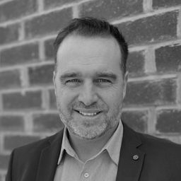
ahmad yacoub
Sessions auxquelles ahmad yacoub assiste
Mardi 16 Mai, 2023
Geoff Zeiss was an instrumental influencer for the Minnesota Utility Mapping Project (MN UMP). The goals of the MN UMP are to 1.) increase the accuracy of underground utility maps, 2.) provide for a method of viewing this data in relation to a "One-call" excavation area, and 3.)reduce underground utility damages. This viewed utility mapping data is supplemental to the "One-call" process. Founded in 2020, the Minnesota Underground Mapping Project completed the Phase 1 prototype for viewing ...
Reveal are Australasia's leading underground utility locating specialists. Over the past 10 years, Reveal has moved from a 'paint-on-the-ground' provider to pioneering the digital and GIS deliverables for major infrastructure projects. Reveal continues to push the industry towards better practices of proactive mapping, data capture and engagement with all stakeholders of the underground.In this talk, CEO Sam Wiffen will outline a number of recent innovations, including new visualis...
Every year the vast majority of seemingly routine street excavations occurring around the world are adversely impacted by lack of usable information about buried utility infrastructure. Large-scale construction projects are frequently stalled, incurring delay claims and change orders that significantly increase costs, because the locations of utility installations were never properly recorded or depicted. Bid costs may be increased by a minimum of 10-30% for cont...
Utilities across North America are investing in a vast array of Distribution System improvements and system expansion efforts. As these investments progress, the current / manual 'as-built' data collection procedures are unable to address the increased reporting and documentation burden on the back office staff.To address these ever growing documentation demands, Utilities will need to revolutionize their field data capture process as well as their back office system updat...
Geoff Zeiss devoted over 30 years of his life to the Geospatial industry and global community, focusing on utility and construction sectors, and mapping underground utility infrastructure among many other projects. Sadly, Geoff passed away in September of 2022. The Geoff Zeiss Urban Infrastructure Mapping Fund was established to build on decades of innovation by Dr. Zeiss in developing effective and sustainable urban infrastructure through research and development supporting urban in...
Gyro mapping is rapidly becoming a widely accepted technology for obtaining accurate XYZ data of subsurface utility infrastructure. Whether through national regulation or the utility network owners’ diligent network management policies, gyro mapping is becoming a standard new-build specification, in particular for trenchless installation methods. In addition, Utility network owners see a great benefit in having an objective and accurate as-built profile duri...
The talk summarizes a market product of deep learning based semantic segmentation of point clouds and automatic 3D reconstruction of as-built BIM for underground utilities and pipework for 3D GIS. The presentation covers a general workflow of the approach (including point cloud labeling, definition of classes, deep neural network, information extraction, and pipe modeling), accuracy of semantic segmentation, real case studies, and foreseeable challenges down the road. Also, the speakers wi...
CUIR is a portal solution that will allow the owners of buried infrastructure to exchange information with firms requesting the nature and location of buried assets bounded within the area outlined in a One Call ticket. Unlike a central database, the CUIR process does not provide anyone access to the owners database, but rather allows the owner to receive the request and push the data to the requestor thus preventing any external party access to their database.This process will also...
Mardi 25 Juin, 2024
The applications of GeoAI are as wide and diverse as our imaginations. Many applications like remote sensing, image classification and object detection using computer vision, improve visual clarity and allow higher zoom levels using super-resolution networks, extract geospatial information from unstructured data using natural language processing, deep learning application for large 3D geospatial datasets etc. and have shown positive trends in GeoAI.With the increasing focus on damage p...
What is industry doing to implement a "zero strike policy"Divide and ConquerMake Ready PlanActive LocatesPrivate locators"Ground Disturbance Permitting Policy" What is in a permitArea of Permit Time Frame/ Duration of Permit Where in information stored Do we allow personnel to use cell phones? Who can accessManagement enforcement
Today's conference attendees don't need to be convinced that constructors, utility companies, and municipalities all have an obligation to adhere to best-practices and perform underground utility mapping prior to excavation; we've all seen the numbers: every year, countless accidents occur due to the lack of reliable underground utility data, leading to significant financial losses, project delays, and, most tragically, injuries and fatalities.Yes, the need for coordination and multi-s...
In 2017, representatives of Gopher State One Call (GSOC) reached out to the leadership of Emergency Preparedness Committee of the Minnesota Geospatial Advisory Council (EPC) in hopes of learning what could potentially be done to improve the use of geospatial technology in the underground utility community. From ensuing discussions over the next three years, the Underground Utilities Mapping Project Team (UUMPT) came into existence under the auspices of the EPC in early 2020. Now comprised of ...
BC's Master Municipal Construction Documents Association was founded in the early 1990's as a non profit organization to publish standardized infrastructure specifications and construction contract documents. MMCD Infrastructure Data Standards (IDS) were introduced in 2009 as an initiative to not only standardize infrastructure geomatics, design modeling, drawing production and construction workflows, but also to support standardized post construction data submissions to support automat...
In recent years, Canada and the United States have witnessed numerous injuries and fatalities due to accidental contact with underground infrastructure, highlighting the need to enhance current damage prevention practices. This presentation, "Knowing What's Below: Maps Save Lives," authored by Steve Slusarenko, Director of Subsurface Utility Map Data Exchange (SUMDEx), delves into the current damage prevention processes and underscores the importance of creating and exchanging accurate maps.<...

