
Gavin Schrock
Gavin Schrock is a licensed land surveyor, technology writer, and administrator of a cooperative real-time GNSS network and Consulting Editor for GoGeomatics, a trade publication focused on geomatics sciences. He has worked in surveying, mapping, geodesy. Monitoring, geospatial data management, GNSS/radio navigation, and GIS for over three decades in public works, commercial development, defense, and utilities.
Sessions auxquelles Gavin Schrock participe
Mardi 7 Novembre, 2023


What are the trends in education, technology, policy, perception and markets that will mold the future of Geomatics – and how has the profession responded? The presenter has worked in and written about numerous aspects of surveying for several decades and views the future of the profession as one of both challenges and opportunity – new, exciting and sometimes surprising opportunities. This session will be interactive, challenge conventional wisdom, poke a little fun, and hopefully provides s...

Join us at the BIM/GIS panel of our conference as we delve into critical subjects shaping the intersection of Building Information Modeling (BIM) and Geographic Information Systems (GIS). Our expert panelists will explore the evolving landscape of BIM and GIS, offering invaluable insights into various aspects of this dynamic field.Agenda:The Importance of Standards and Interoperability...


Mercredi 8 Novembre, 2023

Got a cool geomatics product, service, student project, or academic/science research project/paper? Pitch it to a select panel of geomatics press and industry experts at the GoGeomatics expo held in Calgary, November 6-8 2023.Top picks will have their pitch written up as an online article published and promoted by GoGeomatics.You’ll have 3 minutes to make your presentation, with 2 minutes of questions from the panel. You can present a PowerPoint, do a live demonstration, or j...

Join us at the GoGeomatics Expo for an insightful panel discussion that tackles the pressing question: Where will the next generation of land surveyors emerge from? Our panel, featuring experienced educators and professional land surveyors, will engage in a thought-provoking dialogue on strategies and solutions to attract and nurture the future leaders of the land surveying profession. Don't miss this opportunity to gain valuable perspectives on the future of land surveying.


Mardi 29 Octobre, 2024

Got a great idea, paper, project or product? Here’s an opportunity to hone your skills in making a “fast pitch”. There’s and art to making a fast pitch, where less can be more.The GoGeomatics Expo in 2023 launched the Fast Pitch session. Modelled after the Pitch-the-Press session of GeoWeek, presenters have 3 minutes to make your best case, followed by 2 minutes of questions from a panel and the audience. The panel of geo-journalists and industry experts judge th...


The integration of AI in infrastructure modeling has the potential to revolutionize decision-making processes by providing accurate predictions, identifying vulnerabilities, and optimizing resource utilization.The increasing complexity of modern infrastructure systems, coupled with growing demands on utilities, has necessitated the adoption of advanced analytical techniques. This panel discussion brings together ideas from acad...


Mercredi 30 Octobre, 2024

This panel will explore how to effectively identify the standard and quality level under which Subsurface Utility Engineering (SUE) data was collected, following established guidelines such as the ASCE 38-22 Standard. A key focus will be on how this data can be repurposed for future projects while ensuring that liability does not fall back on the original professional who signed off on the data. Panelists will also discuss t...


Mercredi 29 Janvier, 2025

As we navigate the peak of Solar Cycle 25, the geomagnetic storms it brings are more than just cosmic phenomena—they're operational challenges that demand our attention. In this talk, Gavin explores how solar storms disrupt GNSS, a foundational technology underpinning nearly all reality capture workflows, including LiDAR-based field operations. Drawing insights from recent solar events like the Gannon Geomagnetic Storm of 2024, Gavin unpacks the impacts of ionosphe...

Join us at LiDARCanEX 2025 for an insightful panel discussion moderated by Dr. Tim Webster. This session will bring together experts to explore the current state of LiDAR projects in Canada and discuss what the future holds. Topics include:Wide-Area Topographic LiDAR Mapping: Applications in forestry, flood risk assessment, powerlines, infrastructure, and urban development.Topo-Bathymet...


Sessions auxquelles Gavin Schrock assiste
Mercredi 21 Avril, 2021

Le Canada est le chef de file mondial dans le domaine de l'observation de la Terre par radar spatial à grande échelle grâce au programme RADARSAT, qui soutient de nombreuses utilisations opérationnelles et scientifiques des données radar à synthèse d'ouverture (SAR).MDA, en collaboration avec le gouvernement canadien, a créé une marque et une réputation d'excellence internationalement reconnues en matière de données SAR en temps quasi réel sur de vastes zones pour les applica...

Mercredi 23 Mars, 2022
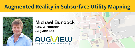
We live in a world where the skill required to interpret maps and engineering drawings is decreasing while the density of underground networks is increasing. The result is increased collateral damage, network outages and poor health & safety outcomes for our field workers.Today, we need better ways to accurately capture and comprehend the location and nature of those networks that are out of site under our feet. AR (Augmented...

Jeudi 24 Mars, 2022

GIS platforms are typically populated with XYZ coordinates with a point spacing of 1 meter or more. in fact, most traditional land surveying techniques, like GPS, often have a point spacing of 3 meters or more, and that is understandable given the procedure to obtain these points. But have you ever wondered what amount of detail is lost when increasing the point frequency? Well, in this seminar, Otto Ballintijn will demonstrate the impact point frequency has on pipe detail usin...


Scribble Maps is an easy-to-use online GIS and web mapping visualization solution. The software has a robust toolset along with vast operations that can help you annotate maps, plot territories, filter and analyze data, optimize routes, add images, and more.Our powerful mapping software can easily be integrated with many different file formats including GeoJson, SHP, KML, CSV, GPX, DXF, and PDF. Founded in 2009, Scribble Maps has been developed from direct user f...


Reveal is building the world's most advanced and accurate digital twin technology for subsurface infrastructure. We're driving a safer, more efficient and sustainable world by revealing the truth of the underground. Join us for a 30min presentation where we will be showcasing our technology through our flagship project in Wellington, New Zealand.

Vendredi 25 Mars, 2022

An overview of Prostar's "Cloud and Mobile Precision Field Data Collection Solution and the set up of the ProStar "PointMan Plus" application FREE to WorkShop attendees. PointMan is a patented cloud and mobile mapping software application that captures, records, and displays the precise location and the associated metadata of critical surface and subsurface infrastructure, all in "real-time" Workshop includes: -1 FREE annual subscription of...

For decades, cities have required all utilities, communication providers and municipal services providers to build their facilities below ground. In addition, the increase in severe natural disaster conditions have driven traditional overhead utilities to revise their construction standards and build their new facilities underground. As the proliferation of underground construction continues, all utility groups must improve their procedures to ensure that any newly installed fa...


Lundi 28 Octobre, 2024

Join us at the National Geomatics Networking Reception Enjoy a selection of gourmet hors d'oeuvres, including savoury Moroccan lamb meatballs, smoked pork belly lollipops, and wild mushroom arancini with truffle oil. Vegetarian options like vegetable samosas with mango chutney and goat cheese tartelettes will satisfy all palates. Plus, your ticket includes a drink to enjoy while you connect with industry professionals. Elevate your evening with these delicious bites and great company!

Mardi 29 Octobre, 2024

The session will focus on considerations for deploying Artificial Intelligence in professional practice; identifying potential landmines and working on solutions from a privacy-first perspective. The talk will include a high-level overview that underscores the fundamental components that encapsulate an AI derived “solution” and delve into a practical, real-world example being tested on an active project.Topics Covered:• An illustrated example of BIM model query using AI• AI too...


For the last five years I have been providing reality capture services to documentary film producers. These series have included NatGeo's Buried Secrets of WWII, NatGeo's Drain the Oceans, Discovery's Expedition Unknown and Expedition Bigfoot. LiDAR, photogrammetry, thermography, magnetometry, and multi spectral imagine all provide context that professional storytellers (TV producers) crave. Join me as I share stories, successes, and failures of these unique service offerings.


In December 2023 a unique gathering of technology and talent gathered on Alcatraz to capture the entire island, inside and out, from the ground and from the air to assist the National Park Service understand the risks seal level rise and climate change present to the island. Join me and, perhaps, other members of the extended team as we share the technology, the experience, and the adventure of this unique experience.

Today, digital twins, autonomy and artificial intelligence (AI) dominate the lexicon of the geomatics industry. These capabilities provide significant productivity advantages to our profession, but our domain content and knowledge are critical to their success. These tools will change the way we work and transform the industry. However, they will not replace us, but rather change our role. This is no different than when the EDM, total station, CAD, or GPS became part of our professional lives...