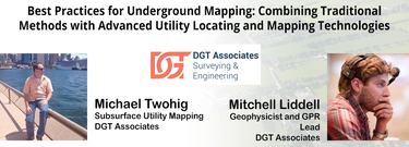
Best Practices for Underground Mapping: Combining Traditional Methods with Advanced Utility Locating and Mapping Technologies

As one of the oldest American cities, Boston holds a rich history and culture that runs not only through the streets but also beneath them. Many of the large underground infrastructure projects completed between the late 1890s and the late 1920s in Boston are still in use today. The preservation of infrastructure and the insights gleaned from the practices used to create it provide valuable lessons in how to maintain standards of excellence in major development, even as we use new methods and technologies to do the work.
While innovative technologies, such as Building Information Modeling (BIM), were initially slow to gain momentum, they are now being accelerated into current workflows and platforms pushing the industry forward. Building Information Modeling (BIM) gives professionals the insight and tools to more efficiently plan, design, construct and manage buildings and infrastructure above ground. But it does not highlight the importance and the connectivity of the subterranean environment.
Building on BIM, Subsurface Information Modeling (SIM) aims to fill the gap between above- and below-ground knowledge to provide insight into potential conflicts that lie below the surface. True SIM combines the best practices of SUM with the sophisticated data modeling of BIM. With SIM, utilizing LiDAR technologies in unison with subsurface utility mapping and cutting-edge GPR technology is a best practice when investigating convoluted underground environments, like those traditionally found in an urban Boston environment. Data gathered can then be used to identify any possible utility conflicts and assist in making final design adjustments, if needed.
In this session, we will review how best practices learned from Boston’s underground can be incorporated with innovative technological advancements, like Subsurface Information Modeling (SIM), creating a cohesive blend between the past and present while creating a better future.
Personnes inscrites
-
Mark Whelan
marketing, SeeScan -
Mitchell Liddell
Geophysicist, DGT Associates.com -
Rick Jacobs
Owner, SUE-USA -
Joe Arcuri
Director of Sales, Locusview -
Gordon McElravy
President, McElravy Associates -
Olga Kraynova
GIS Manager, The Lorrnel Group -
Elizabeth Ho
Graduate Designer, ARUP -
Florian Cardi
Head of international development , Sogelink -
Pikibo Daniel-Kalio
Geophysics Division Lead, Premier Locates -
Tiana Hann
Engineer-in-Training, ARUP -
Iffat Damji
Data Analyst , PSD CityWide -
Matt Mikolajczyk
Deliverables Maanger


