Passer au contenu de la page principale

The benefits of high frequency XYZ data

Mon statut pour la session

Quand:
10:00 AM, Jeudi 24 Mar 2022 EDT (1 heure)
Où:
  Session virtuelle
Cette session est dans le passé.
L'espace virtuel est fermé.

GIS platforms are typically populated with XYZ coordinates with a point spacing of 1 meter or more. in fact, most traditional land surveying techniques, like GPS, often have a point spacing of 3 meters or more, and that is understandable given the procedure to obtain these points. 

But have you ever wondered what amount of detail is lost when increasing the point frequency? Well, in this seminar, Otto Ballintijn will demonstrate the impact point frequency has on pipe detail using a couple of Case Studies using high frequency Gyroscopic Mapping data. 

Gyro-mapping systems capture data at 100 Hz, or 10 samples per second. At the recommended mapping speed of 1m per second this yields a point frequency of 1cm. That may be too rich for GIS purposes, but learn how it can help engineers involved with installation acceptance or subsidence monitoring.
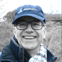
Otto Ballintijn

Conférencier.ère

Personnes inscrites

Amrita Johar
Student
SAIT
Peter Srajer
Chief Engineer
Prostar
Michael Mayr
President
3-D Line Locating Ltd
oluwaseyi Dasho
Lecturer
Olusegun Agagu University of Science and Technology Okitipupa
Dean Parker
partner
Hihnshaw
Mohamad Nasrullah
PHD student
Saint Petersburg Mining University
Radek Grabowski
SUE Project Manager
WGI Inc.
Naveen Shahi
CEO
BhuSatyam Technologies
Ahmad Nashriq Ferdaus
Regional Technical Support Engineer
Leica Geosystems Technologies Pte Ltd
Wenzheng Fan
Data Scientist
LiDARist Co. Ltd.
Celso Isidro
Mining EIT
CST Canada Coal Ltd.
Seember Gbargbar
Assistant Surveyor
Joternam Limited
Richard Loo
Senior Surveyor
Singapore Land Authority
Gavin Schrock
Land Surveyor, Consulting Editor for GoGeomatics
GoGeomatics
Jonathan Brown
digital innovation lead
https://www.linkedin.com/feed/
Nijat Gojamanov
Consultant
N/A
Rob McKay
Vice President
Planview Utility Services Ltd.
Stephen Twist
Project Manager
Atlas Geophysical
Nijat Gojamanov
Consultant
N/A
Brenan Andre
Cartographer, GIS Analyst
Personal
Sebastien Long
Business Dev
CAE
Mitchell Liddell
Geophysicist
DGT Associates.com
Glenn Fox
SUE Manager
Horrocks
Mohamed Attia
Vice President, Geospatial & Advanced Technology
GeoVerra Inc.
Santosh Saride
VP
Condux Intl
Leonardo Parra
GIS Technical Specialist
Defence Construction Canada
Zhi Rui Foo
Operations Development Executive
HSC Pipeline Engineering Pte Ltd
Kenneth Smith
Gdt
Kens Welding
Gurpreet Gill
GIS Consultant
Independent Consultant
Lasse Hansen
Industial PostDoc
IT34 A/S
Sarah Pitts
SUE Utility Coordinator
Atlas Surveying
Edward Hilchey
Geomatic technician
DND
Jackson Durham
Manager
Bury Services
Guy E McIntosh
Co-Founder
SUE
Tom van Hemert
Capital Asset Managment Coordinator
Alberta Parks
Simon Chevrier
Marketing Manager
GEOSYSTEMS France
Jean-Francois Dionne
Geospatial Strategist
City of Ottawa
Shane Shi
Managing Director
HSC Pipeline Engineering Pte Ltd
Edward Hilchey
Geomatic technician
DND
Rob van Son
Project Lead Digital Underground
Singapore-ETH Centre
Vera Anakwuo
Student
Poznan University of Life Sciences
Irene Chang
Undergraduate Student
University
Shiraz Ahmed
Manager
Geotechoverseas
Troy Greene
Instructor
Nova Scotia Community College
Bert de Bruijn
analyst
my own
Kathy Robitaille-Feick
Fluvial Geomorphologist
AECOM

Mon statut pour la session

Évaluer

Detail de session
Pour chaque session, permet aux participants d'écrire un court texte de feedback qui sera envoyé à l'organisateur. Ce texte n'est pas envoyé aux présentateurs.
Afin de respecter les règles de gestion des données privées, cette option affiche uniquement les profils des personnes qui ont accepté de partager leur profil publiquement.

Les changements ici affecteront toutes les pages de détails des sessions