Andrea Tampus
Sessions in which Andrea Tampus attends
Tuesday 29 October, 2024
Space, the final frontier. Or is it? Although many people are fascinated by space, most are relatively unaware of how space technologies pervade their everyday life. From global positioning systems (GPS) and satellite communications to weather forecasting and monitoring the health of crops or the extent of sea ice, the standard of living we currently enjoy is fundamentally dependent on satellites and space technology. Space is becoming even more important in monitoring the changing climate, p...
How exactly does artificial intelligence work and what can you use it for in the geomatics domain? Using real-life examples from our projects, they demonstrate how you can use AI to gain new insights and increase efficiency by automating your data processing workflows.We explore how GeoAI is fusing spatial data science and Geomatics technology to help automate the extraction, classification, and analysis of all types of spatial or non-spatial data. Learn how GeoAI can detect clusters, ...
Too often, when discussing the value proposition of geospatial data, we focus in on raw data or output products without spending a lot of time in the juicy middle of data throughputs. That is to say that modern geospatial is leaving a lot of value on the table and thus limiting our ability to good with our data by: -> Focusing too heavily on the capturing aspect of geospatial technologies;-> Ignoring or discounting analytical capabilities of geospatial technologie...
Wednesday 30 October, 2024
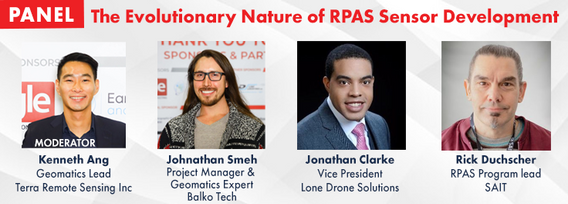
RPAS platforms and sensors have come a long way since their commerical adoption almost a decade ago and have quickly become a main stay of many professional's tool kits. This show's the industry's appetite for adopting new technologies and matching them up with the right application. With a pannel of very experienced professionals from various sectors of Canada's Geospatial RPAS scene, we explore what has driven sensor development and how sensors might further develop along the lines of use c...
Photogrammetry is not just limited to aerial platforms. Modern mobile devices contain high-quality cameras and increasingly have LiDAR and depth sensors built in. When combined with high-accuracy GNSS systems, these mobile devices can quickly collect accurate data for utilities, infrastructure, inspection, as-builts, construction, and more. Utilizing these readily available devices can reduce project delays, capture better documentation of utilities, and lay the foundations for digital infras...
With drones like the DJI Matrice 300 now being positioned using RTK GNSS, combined with Structure from Motion (SfM), high precision mosaics are possible without deploying targets. The ability to mount lidars (DJI L1 and L2) and other optical sensors (RGB, multispectral, thermal) allows for precise surveying and the production of high resolution and high accuracy mosaics with minimal ground control. While battery power still remains an issue and the limiting factor for flight duration (10’s of...
As the drone industry is increasingly focuses on developing larger airframes and equipping them with bigger sensors, Spexi is taking a revolutionary approach to aerial imagery. At Spexi, we believe that the future of geospatial data collection lies not in size and complexity, but in numbers and standardization. The Spexi platform leverages the power of crowdsourcing, deploying local pilots with small drones to capture standardized imagery across entire cities. This method allows us to achieve...
Led by the World Geospatial Industry Council (WGIC) and moderated by Aaron Addison, Executive Director of WGIC, this panel will explore the transformative role of Earth observation (EO) technologies in fostering a resilient and sustainable future for Canada. With growing environmental challenges such as climate change and resource management, EO solutions provide essential insights into monitoring ecosystems, disaster resilience, and sustainable development. Panelists from diverse sectors wil...
How do hydrographic surveys, aerial Remote Sensing and GIS help with environmental efforts? Terra explores 2 projects that use a combination of different sensors and visualizations to achieve these goals. The projects include a rapid marine data collection supported by Aerial LiDAR to aid in rescue efforts of a trapped Orca cafe, and using LiDAR with GIS to support change detection efforts of a major land slide.
In our rapidly evolving urban landscapes, inadequate accessibility maps leave many people with disabilities facing significant challenges. This talk begins by illustrating the problem with real examples of accessibility fails on platforms like Google Maps. Attendees are encouraged to check accessibility features on their phones, highlighting current gaps.We will then explore the necessity of specialized tools for meaningful navigation and destination planning for people with disabiliti...


