Jenna Sie
Sessions in which Jenna Sie attends
Tuesday 29 October, 2024
We are hosting a special gallery of maps and posters for this year’s expo.The Canada Maps & Poster Gallery will run from October 29th to the 30th in Calgary and is an excellent opportunity to showcase your team's work and impact for the public good.This initiative is in partnership with the Canadian Cartographic Association (CCA), the Inter...
Space, the final frontier. Or is it? Although many people are fascinated by space, most are relatively unaware of how space technologies pervade their everyday life. From global positioning systems (GPS) and satellite communications to weather forecasting and monitoring the health of crops or the extent of sea ice, the standard of living we currently enjoy is fundamentally dependent on satellites and space technology. Space is becoming even more important in monitoring the changing climate, p...
The Alberta Biodiversity Monitoring Institute (ABMI) defines human footprint as the visible alteration or conversion of native ecosystems to temporary or permanent residential, recreational, agricultural, or industrial landscapes. It also includes land that is periodically reset to earlier successional conditions by industrial activities such as forestry harvest areas and seismic lines. To monitor and map human footprint across Alberta, the ABMI, in partnership with the Alberta Human Footprin...
Sessions: Human footprint datasets for Canada: mapping and monitoring in support of land and resource managementDisturbance is a key component of boreal-forest ecosystems, impacting their structure and functions. In Alberta, disturbances are both natural and anthropogenic, including > 30,000 sqkm of harvest areas. The recovery of all types of forest disturbance influences not only local landscapes, but also carbon dynamics and biodiversity. In the face of a changing climate, the imp...
From ancient cave drawings depicting hunting grounds to hand-sketched layouts of backyard gardens, humans conceptualize space through map making. Maps serve both to capture what exists on the landscape and to plan future uses by intentionally defining where specific activities can happen. Modern satellite technology creates geospatial datasets that can contribute to current and proposed land use management planning, all underpinned by the pursuit of the public good.Background
Accurate mapping of road networks is essential for navigation, disaster response, and urban planning. Traditional methods relying on remote sensing images, Lidar data, and GPS trajectories are hampered by time-consuming manual updates and incomplete extraction due to obstructions from trees, buildings, and shadows. However, recent advancements in deep learning models have shown promise in improving road mapping and automating the detection of missing roads.This study uses a transfer le...
Too often, when discussing the value proposition of geospatial data, we focus in on raw data or output products without spending a lot of time in the juicy middle of data throughputs. That is to say that modern geospatial is leaving a lot of value on the table and thus limiting our ability to good with our data by: -> Focusing too heavily on the capturing aspect of geospatial technologies;-> Ignoring or discounting analytical capabilities of geospatial technologie...
Session Human footprint datasets for Canada: mapping and monitoring in support of land and resource managementHuman activities have disturbed biodiversity, ecosystems, and ecological processes over the last century. Given the growing trends of habitat loss and biodiversity decline, understanding patterns of human pressures has become a crucial element of conservation planning. In this context, cumulative pressure mapping is used to quantify the extent and intensity of multiple pressure...
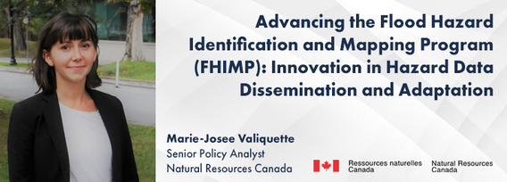
In 2021, the Government of Canada invested $63.8M in the Flood Hazard Identification and Mapping Program (FHIMP) to to create and disseminate engineering-level flood hazard maps that can help Canadians better plan and prepare for future flood risks. The program was recently extended to 2028 through the National Adaptation Strategy and enhanced with an additional $164 Million investment.Given that many Canadians are unaware of flood hazards, the FHIMP is working to fill gaps in knowledg...
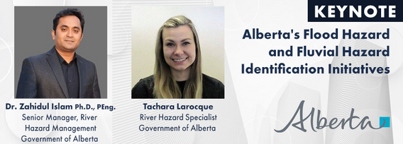
The government of Alberta manages the production of riverine flood studies under the provincial Flood Hazard Identification Program, to assist communities in keeping Albertans safe and protecting their properties from floods. Flood maps improve public safety, support emergency management, and help us build safer and more resilient communities. The government of Alberta also manages the production of alluvial fan studies to help Albertans learn about flood risks in the steep terrain of Alberta...
The First Peoples Innovation Centre (FPIC) plays a significant role in empowering Indigenous communities. The Centre has adapted the FabLab (Fabrication Laboratory) model developed by the Massachusetts Institute of Technology (MIT) with a culturally appropriate response to Indigenous youth, enabling them to take charge of their professional future. The FPIC, incorporating the FabLab Onaki, is pivotal in this empowerment process, as it funds and partners with various organizations to create co...
The integration of AI in infrastructure modeling has the potential to revolutionize decision-making processes by providing accurate predictions, identifying vulnerabilities, and optimizing resource utilization.The increasing complexity of modern infrastructure systems, coupled with growing demands on utilities, has necessitated the adoption of advanced analytical techniques. This panel discussion brings together ideas from acad...
The integration of reality capture technologies—such as LiDAR, photogrammetry, and 3D scanning—into infrastructure asset management is revolutionizing how municipalities and organizations manage and maintain, their assets and deliver services. This presentation will explore the transformative impact of reality capture on the accuracy, efficiency, and overall effectiveness of infrastructure management practices. By enabling effective data collection and visualization, reality capture provides ...
In December 2023 a unique gathering of technology and talent gathered on Alcatraz to capture the entire island, inside and out, from the ground and from the air to assist the National Park Service understand the risks seal level rise and climate change present to the island. Join me and, perhaps, other members of the extended team as we share the technology, the experience, and the adventure of this unique experience.
Today, digital twins, autonomy and artificial intelligence (AI) dominate the lexicon of the geomatics industry. These capabilities provide significant productivity advantages to our profession, but our domain content and knowledge are critical to their success. These tools will change the way we work and transform the industry. However, they will not replace us, but rather change our role. This is no different than when the EDM, total station, CAD, or GPS became part of our professional lives...
Wednesday 30 October, 2024
We will explore tangible ways in which to involve Indigenous people, especially youth, in a new ad, emerging infrastructure business sector.Dale Booth will lead you through a more fulsome understanding of Indigenous inclusion and participation on major infrastructure projects and how working with Indigenous companies, especially in the BIM modelling space, can greatly improve opportunities for everyone.Innovation 7 has been successful in the identification of training and work p...
Local governments have been updating their asset inventories to comply with the TCA legislation since the early 2000s, paying particular attention to the attributes, locations, ages and conditions of their assets. However, infrastructure changes constantly due to capital projects and land development, especially in fast-growing municipalities like Kelowna. Collecting accurate and complete information on new assets has been a major challenge, mainly due to limited staff resources. To address t...
Photogrammetry is not just limited to aerial platforms. Modern mobile devices contain high-quality cameras and increasingly have LiDAR and depth sensors built in. When combined with high-accuracy GNSS systems, these mobile devices can quickly collect accurate data for utilities, infrastructure, inspection, as-builts, construction, and more. Utilizing these readily available devices can reduce project delays, capture better documentation of utilities, and lay the foundations for digital infras...
In this year's reality capture track, we have shown you the unprecedented value of reality capture systems when adopted into high-cost, high liability and fast pace environments, some of the problems these systems are solving today, and tools to help the effectiveness and quality of those solutions. However, our presenters will also have demonstrated how critical digital lifecycle planning can be to any asset, from pre-design through construction and lifetime operation right up to demolition,...
The time has come for the presentation of this year's mobile mapping system and SLAM system participants.Are you looking to collect more data, faster and accurately? Looking to buy a mobile mobile mapping or SLAM system and incorporate it into your workflows? If you are, you're considering tens of thousands to millions of dollars of investment. Do you know what's available to you? Are you sure that's all of them? Do the options available suit your needs? Is there candid data you can lo...
Led by the World Geospatial Industry Council (WGIC) and moderated by Aaron Addison, Executive Director of WGIC, this panel will explore the transformative role of Earth observation (EO) technologies in fostering a resilient and sustainable future for Canada. With growing environmental challenges such as climate change and resource management, EO solutions provide essential insights into monitoring ecosystems, disaster resilience, and sustainable development. Panelists from diverse sectors wil...
In our rapidly evolving urban landscapes, inadequate accessibility maps leave many people with disabilities facing significant challenges. This talk begins by illustrating the problem with real examples of accessibility fails on platforms like Google Maps. Attendees are encouraged to check accessibility features on their phones, highlighting current gaps.We will then explore the necessity of specialized tools for meaningful navigation and destination planning for people with disabiliti...
Earth Observation technologies have experienced unprecedented innovation and accessibility over the past several years. The role of the commercial sector has stepped in to offer several capabilities historically only available from government. This session will focus on examples of how EO technology is being...


