Canadian Perspectives: The Power of Geospatial Literacy for Space, Earth Observation, and Education

My Session Status
Tickets for this seminar must be claimed in advance.
GeoIgnite , and Peggy March, Paul VanZant, Dr. Lynn Moorman, Dr. Gordon Osinski, Dave MacLean, Dr. Trevor Bell, Jonathan Murphy, and Ewan Geddes, all Fellows of the Royal Canadian Geographical Society www.rcgs.org, in conjunction with Canadian Geographic Education www.cgeducation.ca , invite you to this event. The purpose is to showcase and raise awareness of what is currently taking place on a number of different levels by sharing the work of remarkable individuals who are instructing and inspiring others to further our goals.
Sub Sessions
Dr. Gordon “Oz” Osinski is a Professor and the NSERC/MDA/CSA/CEMI Industrial Research Chair in Earth and Space Exploration in the Department of Earth Sciences at the University of Western Ontario (Western), Canada. He holds a PhD from the University of New Brunswick (2004) and a BSc (Hons) from the University of St. Andrews (1999), Scotland, both in Geology. Dr. Osinski’s research interests are diverse and interdisciplinary in nature. His main area of research focuses on understanding impact ...
Sometimes your vision of what your career path will be and what it actually ends up being can be quite different from one another. Dr. Tanya Harrison will discuss her somewhat non-traditional and non-linear pathway through academia and into the space industry, focusing on topics such as transferable skill sets and not being afraid to take a detour—or a different path entirely—if an opportunity or speed bump arise.
As examples of various online map styles and techniques, Dave prepares maps of pictures of Earth taken by astronauts and cosmonauts onboard the International Space Station. These are also "of interest" to many in the general public. In this talk, he'll dive into some favourites photos, some of the mapping techniques, and some interesting anecdotes along the way. View the whole set of maps at https://isspix.com/MapTourHowTo
SmartICE is an internationally recognized work integration social enterprise (WISE) that empowers Indigenous communities to adapt to increasingly unpredictable ice conditions. It is the world’s first climate change adaptation to integrate Indigenous knowledge of ice safety and travel with advanced data acquisition and remote monitoring technology. As a social innovator, SmartICE harnesses the vast potential of Indigenous women and men—especially youth—to embrace science, technology and tra...
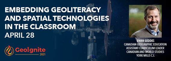
The presentation will focus on strategies of how to embed geoliteracy and geospatial technologies by using the Ontario Curriculum as a platform. Participants will examine exemplars of activities that incoporate geoliteracy and geotechnologies to engage students as well as methods on how to create activities that focus on geoliteracy and technology.
Geography plays an important role in being a parent and a teacher. Developing geographical perspectives gives a sense of understanding cultural connections and the complexity of building relationships. The connections of understanding the purpose of our actions towards physical and human sustainability. It is a lens of perspective understanding that defines human actions and connections.
This session will include a general overview of various GIS education projects for Omushkego youth in northern Ontario. These projects were managed during the time as a GIS Education Specialist with Mushkegowuk Council's Information Services department. We will look at ArcGIS Online, Survey123, Collector, Story Maps and Dashboard as tools, and how they were used in the implementation of CreeGeo Mush Guardians, Trash Trackers and a GIS Day activity.
