
Elizabeth McCready
CAREER CHANGE: After almost two decades of being self-employed in special education as an academic coach and adaptive technology specialist, Elizabeth is changing careers into a more IT/data based role. She’s rediscovering her background in IT (pre-Google!), data analysis, geospatial sciences (GIS), and natural sciences/plant biology. She is passionate about the use of geospatial in agriculture, forestry, and environmental management, and is especially fascinated by the use of drones in agriculture and precision farming.
CURRENT PROFESSIONAL WORK: Elizabeth is continuing her life-long commitment to volunteering as a online content writer and editor and online community manager for GoGeomatics. From that she's started part-time freelance writing and editing within the geospatial and IT field. Her current project is doing a small amount of editing and writing for GeoIgnite - Canada's National Geospatial Conference. Elizabeth is currently working on a new professional website: www.mapgeek.world to showcase her academic, volunteer work, and current freelance writing and editing.
POSTGRAD GEOSPATIAL SCIENCES STUDENT: As a dual New Zealand and Canadian citizen she's rediscovering her Kiwi roots, and is greatly enjoying taking postgrad studies online at Massey University in New Zealand. The first course on the history of town planning in New Zealand helped Elizabeth figure out that she really prefers to focus on the geospatial sciences side of Resource and Environmental Planning. Elizabeth is taking two programs simultaneously: a PostGrad Diploma in Geospatial Sciences, and an undergraduate diploma in Science and Technology (computer science, IT, and agriculture).
SKLLS AND CAREER GOALS: Full-time studies will be completed in February 2021. By then, she will have experience in: Python, server-side programming with PHP, CSS, HTML, QGIS, ArcGIS, system administration and networking, databases, web technologies, and the applications of GIS and remote sensing to the environment. She is currently seeking part-time career positions with an awesome team in Toronto, and is looking for a challenging permanent or long-term full-time position for spring/summer 2021.
FITNESS: She does at least an hour of physical activity every day including strength training, yoga, meditation, walks 4-10+km every day, and is about to start spin biking. Elizabeth uses the Peloton app everyday, and is working towards multiple goals and challenges on it. She's open to connecting to others on Peloton. Her user name is: GingerMapGeek.
Elementy, w których Elizabeth McCready attends
środa 22 lipca, 2020

Presented by: Jake Dickinson & John Roos Abstract: As shrinking polar ice creates new opportunities for resource exploration and shipping routes, the importance for Arctic nations to monitor the ongoing expansion in the Arctic is ever increasing. Additionally, climate change continues to impact people and the environment. High resolution satellite imagery remains one of the most effective means of monitoring inaccessible and de...

Geospatial and location technologies is present and continues to expand its reach in many sectors. Much of the current digital transformation taking place globally is built upon geospatial foundations. In this open panel discussion, our experts will discuss the latest developments and challenges facing the Canadian and global geospatial sector and what the future holds. Key components to be addressed include how has the global pandemic affected our sector and how may we be impacted in the...


Our next-generation Earth imaging constellation will change everything. We're not just launching more satellites. In 2021, we will deploy WorldView Legion which will provide unprecedented visibility into our changing planet to solve the biggest challenges facing our world today. Grab your favorite beverage and join Maxar for a casual conversation about our next constellation, Legion! Everyone who joins will be entered for a chance to win an IPad!


czwartek 23 lipca, 2020

A closer look at some of the lidar-derived innovations for enhanced forestry management solutions and topobathymetric flood mitigation from Quantum Spatial Canada. Presented by Sven Cowan, Dr. Andrew Brenner, and Colin Cooper. Quantum Spatial, Inc., an NV5 company, is one of North America's largest geospatial services firms, providing insights to organizations that need geospatial intelligence to mitigate risk, plan for growth, better manage resources and advance scientific ...

Agriculture Canada’s COVID-19 response with location data & technology helping drive Objectives and Key Results (OKR’s) on the Enterprise GIS Roadmap This talk is designed to provide insights and guidelines for managing and directing Geospatial programs and uses the COVID-19 response (Maps Apps and Data) and digital transformation as the means to achieve the Objectives and Key Results of the Geomatics program.At AAFC the strategic initiatives of our data driven...
piątek 24 lipca, 2020
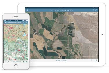
In this presentation, Avenza’s Nick Burchell will provide a series of case studies on how maps created with the Avenza suite of tools are being used to solve tangible needs in the industries where we serve. Learn how our customers are creating high-quality, spatially aware cartographic products through MAPublisher and Geographic Imager in Adobe CC, and how they are using them for critical work in conjunction with the Avenza Maps app. We will also review some of the exciting new initiatives...

The key elements to take into account a successful implementation of drone survey with a mm accuracy are: Know your camera; Trust your measurement; Control your space; Understand your photogrammetry software. Working out that, we present this nuance including special tags around the surveyed object as the measurement system to get details.A correct implementation of photogrammetry tags with consumer grade measurement devices and consumer grade UAVs and cameras enables very precise a...