
Edward Melcher
Senior Geospatial Analyst at Enview
Geospatial data can provide the right insights to help solve many problems. I have focused on lidar and photogrammetry technology for the last 14 years and making sure the data is of highest quality to make the insights more meaningful.
Elementy, w których Edward Melcher attends
wtorek 18 czerwca, 2019

There's never been a more exciting time to be a part of the geospatial profession. From mapping the infrastructure beneath our cities to indoor wayfinding, to plentiful and powerful remote sensing capabilities in air and space which we could hardly have imagined just a few years ago, the opportunities - and the expectations - for geospatial professionals are immense. Technology is evolving at a pace which outstrips the ability of academics, governments, and industries to keep pace. How will w...

Let’s admit it! We live in exciting times with technology, social interactions and business models changing before our eyes: Flying taxis, self-driving cars, commercial Space missions, smart cities, SmallSats and Internet Of Things (IOT) to name just a few innovations! Our kids are growing up in a world of on-demand TV, GPS availability, all around virtual assistants, and mobile devices that pretty much can do anything! Each and every one of these innovations has a location element to i...
Prashant Shukle is the Director General for the Canada Centre for Mapping and Earth Observation Branch, Earth Sciences Sector, at Natural Resources Canada (NRCan).NRCan has fostered an enabling policy mechanism and provided a conducive framework for geospatial information infrastructure. In today’s digital age when geospatial is becoming more and more ubiquitous, open and inter-disciplinary policies are the key instruments of harnessing the true value of this wonderful technology...
What are the ramifications of the current digital transformation globally and what will it mean for Canada and the globe? Our award winning panel of international and Canadian experts disscuss and take questions from delegates.


Break

Alberta View: Economic impacts and Opportunities of the Geospatial SectorLocation technologies are changing the way we live, work, and play, and are having a transformative impact on industries across Canada. The intersection of location technologies with Virtual Reality and Augmented reality are rapidly transforming key sectors of the Canadian economy including transportation, the resource sector, the digital and interactive media sector and transforming how governments d...

The future is digital. Big data is an integral part of the digital transformation of a private or public organization. Location and geospatial technologies are at the heart of the digital transformation as enablers, game changers and contribute to the success of big data in many ways. Combined with emerging geospatial artificial intelligence, the possibilities are limitless. Smart cities and autonomous vehicles are examples of this potential. However, this big data revolution raises many lega...

Several key trends in the geospatial industry over the last few years have created the conditions needed to truly leverage remote sensing as a technology that has the potential to provide tremendous benefit to civil society. These include changes in data policy, most notably with USGS's decision in 2008 to make all Landsat archives free and open, a policy which led the European Space Agency to also implement free and open access to the Copernicus constellation. The volume of data that is incr...

Hope Spots are special places that are critical to the health of the ocean — Earth’s blue heart. Some Hope Spots are already formally protected, while others still need defined protection. The Mission Blue team has embarked on a series of expeditions to shed light on these vital ecosystems and ignite support to safeguard them as marine protected areas.The IUCN are an integral partner in the Mission Blue initiative and the Hope Spot concept ties into UN amb...

Today, geospatial technologies are embedded in many of the workflows that support the Fourth Industrial Revolution and therefore invaluable to users. This means that geospatial information is no longer the domain of specialists and suddenly has become a context for the rest of our augmented existence.From Pokémon Go, to Uber and autonomous vehicles (AV), Internet of Things (IoT) and Artificial Intelligence (AI), smart applications and on-line mapping tools give the public almost insta...

The Internet of Things (IoT) is here. Whether applied to industrial automation, wearables, connected transportation and logistics, drones or smart cities, IoT is poised to disrupt how we work, live and relate to each other, delivering great benefits along with new challenges. Improved revenue, costs, quality of life and convenience benefits are often confounded by concerns such as privacy, security, and social disruption, with location info playing no small role on both sides. So, what exactl...
The UK Government as part of its building information modeling (BIM) initiative has said repeatedly that it expects the big payoff of a digital model will be during operations and maintenance, which typically represents 80% of the cost of a facility. Companies who do design, build, finance, and maintain, or design, build, operate, or PPP projects often employ a full lifecycle BIM + geospatial strategy. For example, Crossrail appears to be the first major project that may be able to provide su...
The Earth is immense, and abundant with interesting information. Recent advancements in geospatial sensors (e.g. satellites, smart phones, meteorological instruments, and LIDAR) have resulted in the development of technologies capable of collecting large and dynamic geospatial data. As a result, we are experiencing an explosion in the volume and variability of geospatial data, and yet many in public remain unaware of or unable to access this wealth of data to make informed decisions regarding...


Cloudy with a chance of data science.Sparkgeo had been building cloud first geospatial applications, from day 1. But that was not the plan. The plan was to make more maps for more people, using the internet.Sitting at the intersection of software development and GIS we see how these two communities can benefit from each other. But, to do so, we will have to step out of our comfort zones.Let me tell you the story of a lowly GIS tech's journey through the technol...

The Mapbox live location platform was designed to serve all levels of government and the critical services they support. Develop custom mapping and location applications from start to finish in your own private cloud or on-premises infrastructure. Atlas offers the same capabilities found on Mapbox.com only offline, and deployable anywhere, even on your own infrastructure. Learn more about accessing and analyzing your sensitive geospatial data on and off network during this 30 minute session. ...

We are entering a new era of positioning, navigation and timing. Global, instantaneous, and easily accessible positioning at better than 10cm is coming, which will provide new ways of doing business and create new businesses in areas such as augmented reality. In recent years global Positioning, Navigation and Timing have been undergoing rapid technological development. New GNSS constellations (Galileo, Beidou) with new signal structures offer increased capabilities, while future posi...
środa 19 czerwca, 2019
Mainstreaming of the geospatial market has created a big demand for geospatial content and solutions across governments, businesses and consumers. The Fourth Industrial Revolution (4IR) has also helped scale up applications and value to much larger markets, amplifying overall impact and contribution of geospatial information in the world economy and society. With every added application and consumer, the return on investments get bigger and better. The panel shall focus...


Ecopia.ai will present how its semi-automated approach of combining deep neural networks with scalable crowd map annotators can be combined to create continental scale vector map data while achieving human-level accuracy. In this discussion, Brandon Palin will speak to use cases and industries that are using our technology to make better decisions quicker, including governments, and NGOs globally.
The GeoIgnite Conference and our sponsors are proud to present the inaugural Diversity in Leadership Summit (DILS). It is our vision that GeoIgnite will spur the grassroots of a more diverse ecosystem where diversity of thinking and knowledge will ignite innovation and better outcomes for us all. The DILS is the flagship forum for of geo professionals of all ages and stages in...


As we worked with multiple government organizations this past year, we faced this same question along the way: Should we move our data processes to the cloud? Now as much as we would like to give you a yes or no answer, there are different paths or options you need to explore inside your organization before taking this decision. In this presentation, you will hear about the latest trends and some ways to use the Cloud as a platform for geo data processes. You will also learn different conside...

The Government of Canada purchases on average $22 billion in goods and services each year to help deliver programs and services to Canadians. Many departments and agencies collect and manage large amounts of geospatial data, and significant investments have been made within these organizations. The demand for, and use of, geospatially-related data and tools is rapidly increasing across government, as well as in the broader public context. This information session will help you understand the ...
Come One, Come All: Utility GIS Data AggregationTo illustrate and make the case that cooperation between utility stakeholders is long overdue, and in everyone’s best interest…not only for damage prevention, but public safety as well.For over a decade, we have been successfully aggregating data on behalf of utility stakeholders, municipalities, one call centers, locate service providers, excavators, and engineering firms. In so doing, we add situational awareness, improve data quality,...
The internet is an excellent channel for GIS professionals to reach their audiences. However, much of what is being diffused leaves people wanting. In many cases, static or limited functionality doesn't inspire people. Worse, some absolutely great maps are made but never reach their intended target. Karl Spencer takes us through the process of creating one of CartoVista's mesmerizing Mystery Maps. From digital research, through to design, development and finally distribution, Karl will presen...

Natural Resources Canada provides mapping and engineering advice and expertise to Public Safety Canada in support of the National Disaster Mitigation Program. Notably, NRCan develops the Federal Flood Mapping Guidelines Series and is nearing publication on two documents that will move Canada closer to having common practices for flood risk: • The Federal Hydrologic and Hydraulic Procedures for Flood Hazard Delineation, and • The Federal Geomatics Guideli...

While much of the data available about the Earth pertains to the surface, there also exists a large amount of data available about the atmosphere and regions below the surface. Examples of such data include weather information, lithospheric properties such as velocity, aircraft and satellite flight paths, and underground utility networks. Flattening such volumetric data to the surface for integration with a traditional discrete global grid system (DGGS) discards the spatial relationship betwe...
środa 21 kwietnia, 2021

Join us for the the launch of GeoIgnite with Jonathan Murphy, the Chair of GeoIgnite, and Dr. Minda Suchan of MDA.Abstract of MDA Keynote: Canada is the world leader in wide area space-based radar Earth observation through the highly successful RADARSAT program, supporting numerous operational and scientific uses for Synthetic Aperture Radar (SAR) data. MDA, in conjunction with the Canadian government, has created an internationally recognized brand and reputation for...

poniedziałek 26 kwietnia, 2021

Tickets for this workshop must be claimed in advance.Join Maxar Product Manager, Jake Dickinson, to learn first-hand how SecureWatch provides commercial and government organizations access to authoritative geospatial information to make decisions and act with confidence. Satellite imagery is foundational to geospatial workflows because it enables analysts to understand and model the locations and characteristics of land, facilities and equipment. But histori...


wtorek 27 kwietnia, 2021

Google Chrome is the preferred browser for this session.Tickets for this workshop must be claimed in advance.This session will occur from 10:00AM-11:00AM and repeat again from 11:00AM-12:00PMBeSpatial is a geospatial community platform in Ontario that has opened doors to connect, communicate and innovate. BeSpatial aims to provide networking opportunities, programs, and ...

Google Chrome is the preferred browser for this session.Tickets for this workshop must be claimed in advance.Have you ever wanted to learn more about Synthetic Aperture RADAR (SAR) and Electo-Optical (EO) products? Come join this session for an introduction to some of the basic imaging parameters and learn about the different p...

Google Chrome is the preferred browser for this session.Tickets for this workshop must be claimed in advance.This workshop will be broken down into 4 parts:1. Introduction to ERDAS IMAGINE2. Spatial Modeling for Wildlife Applications3. Using AI, Spatial Modeling and Python to Break Down Big Data Barriers4. Q & ASpatial Modeling ...

środa 28 kwietnia, 2021

Tickets for this workshop must be claimed in advance.At a time of rising climate change impacts, there is a vital and growing need to prepare for, respond to, and recover from natural disasters. But there is a critical communication gap between authorities and citizens.Drawing on the ongoing results of our massive multi-year climate change R&D project, and with assistance from hundreds of students, citizens...

piątek 30 kwietnia, 2021
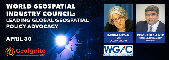
World Geospatial Industry Council: Leading global geospatial policy AdvocacyApril 30 2021, 13:00 - 14:30 EDTVirtual Workshop at GeoIgnite 2021: Canada's National Geospatial Conferencehttps://sites.grenadine.co/sites/goge...
