Chen Xu
Elementy, w których Chen Xu attends
środa 22 lipiec, 2020
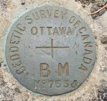
The U.S. reference system modernization effort will replace the North American Datum of 1983 (NAD83) with a new North American Terrestrial Reference Frame (NATRF2022), creating 1.3 to 1.5 m horizontal coordinate differences at the Canada–U.S. border with respect to Canada’s NAD83(CSRS). Never before have such significant differences existed between our two countries’ reference frames.There are compelling reasons for Canada to follow suit and adopt the NATRF2022 frame as our ...
Presented by: Jake Dickinson & John Roos Abstract: As shrinking polar ice creates new opportunities for resource exploration and shipping routes, the importance for Arctic nations to monitor the ongoing expansion in the Arctic is ever increasing. Additionally, climate change continues to impact people and the environment. High resolution satellite imagery remains one of the most effective means of monitoring inaccessible and de...
Space-Based Earth Observation in Canada - A Vision for the Future Today, Canada’s landscape, coasts, waters, and cities are changing rapidly, in a large part due to unstable geopolitical currents and the acceleration of global climate change. Our future economic and environmental security, as well as the safety and well-being of its citizens, depend on our ability to understand, plan, and respond quickly to change. Space-Based Earth Observation (SBEO) technologies ...
GIS users’ numbers are expanding around the world. It is now possible to find a GIS use in every field and to optimize their success. Discover how Business Geografic work throughout all fields to offer a new and modern approach to use Geografic Information Systems. Wheter your need are the one of an expanding business, a wide world telecom company or an official government entity, find out how we can help you vizualise your data and improve your process.
Geospatial and location technologies is present and continues to expand its reach in many sectors. Much of the current digital transformation taking place globally is built upon geospatial foundations. In this open panel discussion, our experts will discuss the latest developments and challenges facing the Canadian and global geospatial sector and what the future holds. Key components to be addressed include how has the global pandemic affected our sector and how may we be impacted in the...
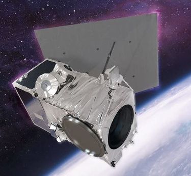
Our next-generation Earth imaging constellation will change everything. We're not just launching more satellites. In 2021, we will deploy WorldView Legion which will provide unprecedented visibility into our changing planet to solve the biggest challenges facing our world today. Grab your favorite beverage and join Maxar for a casual conversation about our next constellation, Legion! Everyone who joins will be entered for a chance to win an IPad!
czwartek 23 lipiec, 2020
Title: Growing Canada’s Next Earth Observation (EO) GenerationCanada has a proud history in Earth Observation, supporting a strong export industry driven on EO imagery and geospatial analytics. It is incumbent on all of us to continue Canada’s strong presence in the global EO community and we can only do that with a concerted effort and plan to grow the next generation of leaders. After 51 years of leadership in space and spatial information technology MDA was recen...
The GeoIgnite Conference and our sponsors are proud to present the second Diversity Leadership panel. Our inaugural Summit was a great success featuring relevant diversity and inclusion topics, a powerful panel of speakers, and a "full house" of engaged participants.Increasing the diversity, equity, and inclusiveness of the Geomatics community is essential to our mission. There can be no barrier to talent at Geospatial organizations as solving the world’s most intractable proble...
piątek 24 lipiec, 2020
We are living through a transformative time, not least in the space industry. A graph of upcoming satellite launches looks like a hockey stick – soon there will be orders of magnitude leading to more satellites being launched and more downstream data being generated from space than ever before. The question is, what is the most effective means of ensuring that space data brings tangible benefits to business operations and value to end users? In our talk we cover a satellit...
The key elements to take into account a successful implementation of drone survey with a mm accuracy are: Know your camera; Trust your measurement; Control your space; Understand your photogrammetry software. Working out that, we present this nuance including special tags around the surveyed object as the measurement system to get details.A correct implementation of photogrammetry tags with consumer grade measurement devices and consumer grade UAVs and cameras enables very precise a...
Abstract A fundamental shift in the geospatial industry has occurred over recent years. Modern remote sensing technology has been developed at PCI Geomatics and in Canada through advanced research through partnerships with private industry, academia, and government researchers. Ubiquitous access to openly accessible earth observation data, cloud computing infrastructures and international collaboration have created opportunities to increase downstream access to inf...
środa 21 kwiecień, 2021
Join us for the the launch of GeoIgnite with Jonathan Murphy, the Chair of GeoIgnite, and Dr. Minda Suchan of MDA.Abstract of MDA Keynote: Canada is the world leader in wide area space-based radar Earth observation through the highly successful RADARSAT program, supporting numerous operational and scientific uses for Synthetic Aperture Radar (SAR) data. MDA, in conjunction with the Canadian government, has created an internationally recognized brand and reputation for...
The Canadian Centre for Mapping and Earth Observation (NRCan) continues its work to implement the National Elevation Data Strategy. Through this strategy, one of NRCan's goal is to provide Canadians with an accurate three-dimensional representation of the country, in support of government priorities such as flood mapping. Because of the enormous task of obtaining a high-precision and up-to-date national elevation layer, NRCan works with different entities.The data coverage of the st...
Over the past year, Minerva Intelligence, a Vancouver-based cognitive AI company, has been awarded two contracts with Natural Resources Canada to design schemas at a national level: the National Flood Hazard Data Layer (NFHDL) and the National Hydro Network V2 (NHNv2). You might be asking yourself why an AI company is designing and building these important database structures. Minerva's cognitive AI system makes use of semantically inoperable data in knowledge graphs and has designed syste...
Title: Advancing Space Based Observation in Canada:The GeoIgnite 2021 Directors General Geospatial Panel, part of Canada's National Geospatial Conference.Title: Advancing Space Based Observation in CanadaThis is a must attend panel for anyone interested in learning the direction Canada's Federal government geospatial leadership is taking.Join our panelists for an exploration of Canada's geospatial priorities and mission in this exciting discuss...
czwartek 22 kwiecień, 2021
Abstract forth coming: Oversight for CSA program sectors, including in Space Utilization, Space Exploration, and Space Science and Technology.
Join us April 22nd for a Fireside Chat with Dr. Steve Liang, Founder and CTO of SensorUp. Professor and Rogers IoT Research Chair at University of Calgary and Dr. Nadine Alameh the OGC’s Chief Executive Office (CEO).Steve's goal is to disrupt the silos of the Internet of Things by creating, using, and implementing open and interoperable standards and products for device-cloud communications and cloud-cloud communications. Steve is chairing and the editor of several key IoT enabling...
In this presentation, Dr. Walter Scott will compare the satellite imaging constellations of Maxar and other commercial companies to show how they stack up in three key metrics: product-market fit, adaptability and capital efficiency. He will also share some key insights on the next generation of Earth Intelligence arriving in 2021 with the launch of WorldView Legion, and what impact that will have for the Canadian geospatial market in the months and years ahead.
The Canadian Geodetic Survey (CGS) of Natural Resources Canada (NRCan) is responsible for defining, maintaining, and providing access to the Canadian Spatial Reference System (CSRS). The CSRS provides a consistent reference for surveying, mapping, and other applications which require accurate positioning. This presentation will describe the CGS products, tools and services which are currently available and provide access to the Canadian Spatial Reference System (CSRS). It will also take a ...
With PetaBytes of data flowing out of Low Earth Orbit everyday, the opportunity afforded by Earth Observation seems to be greater than ever. But is our community realizing that opportunity yet? Are there winners? How should we be thinking about EO businesses in the roaring 2020s?
piątek 23 kwiecień, 2021
The global geospatial industry is estimated at US$ 500 Billion and delivers an even more significant impact on society, with derived economic benefits estimated to be multifold. These benefits, however, are still not fully understood by key stakeholders and policy and decision-makers, ultimately hindering the global uptake of geospatial information. With decades of national spatial data infrastructure efforts around the world, how can this be? Focusing on the importance of...
In 2003, when GISPartner entered the business Poland was still far behind more developed countries in terms of IT implementation. In 2021 the gap is incomparably smaller and some of Polish IT solutions are widely used across the globe. When public administration is considered, it was also GISPartner, which greatly contributed into transforming paper & stamps into high-class software solutions. We want to share our thoughts on how clever, tailor-made IT solutions are driving this transf...
Join GeoIgnite for this inaugural panel of provincial and territorial geospatial and location technology leaders.We will be discussing issues surrounding: What are main priorities and challenges across jurisdictions? What types of geospatial tools we use to monitor and respond to key challenges like emergency response? How are jurisdictions aligning geospatial tools, data, and people to address climate change? What are some current data...
poniedziałek 26 kwiecień, 2021
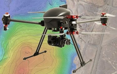
PLEASE NOTE THE PREFERRED BROWSER IS GOOGLE CHROME. If you are running into any issues accessing the session, please try logging in via Google Chrome.The use of drones or UAVs has expanded dramatically over the last few years and this technology is rapidly permeating a wide variety of professional disciplines and industries, including the broad field of GIS. Ideally suited for on-demand geospatial data collection, drones can effectively eliminate the logjam tha...
wtorek 27 kwiecień, 2021
Google Chrome is the preferred browser for this session.Tickets for this workshop must be claimed in advance.This session will occur from 10:00AM-11:00AM and repeat again from 11:00AM-12:00PMBeSpatial is a geospatial community platform in Ontario that has opened doors to connect, communicate and innovate. BeSpatial aims to provide networking opportunities, programs, and ...
Google Chrome is the preferred browser for this session.Tickets for this workshop must be claimed in advance.Have you ever wanted to learn more about Synthetic Aperture RADAR (SAR) and Electo-Optical (EO) products? Come join this session for an introduction to some of the basic imaging parameters and learn about the different p...
Google Chrome is the preferred browser for this session.Tickets for this workshop must be claimed in advance.This workshop will be broken down into 4 parts:1. Introduction to ERDAS IMAGINE2. Spatial Modeling for Wildlife Applications3. Using AI, Spatial Modeling and Python to Break Down Big Data Barriers4. Q & ASpatial Modeling ...
środa 28 kwiecień, 2021
Tickets for this workshop must be claimed in advance.The use of drones, officially referred to as Remotely Piloted Aerial Systems (RPAS), has been forecasted to play a key role in the digitalization and further optimization of a variety of geomatics applications such as in resource aggregates management, landfill management, civil engineering (3D reality capture, virtual surveying), and precision agriculture. To help realize this forecast it is important for ...
czwartek 29 kwiecień, 2021
Tickets for this workshop must be claimed in advance.This workshop will offer a deep-dive into the Avenza Maps app, a mobile app where users can upload or access custom maps for off-line navigation, way-finding, and data collection. The workshop will be composed of 5 modules covering the fundamentals of the apps usage, as well as more advanced industry-relevant features. We will also provide a walkthrough of using the Av...
środa 27 marzec, 2024
The United States’ National Geodetic Survey (NGS) plans to modernize their National Spatial Reference System (NSRS) in 2025, including adopting a new dynamic geometric reference (the North American Terrestrial Reference Frame of 2022 (NATRF2022)) and a new geoid-based height system (the North American-Pacific Geopotential Datum of 2022 (NAPGD2022)). To ensure continued geospatial referencing compatibility, the Canadian Geodetic Survey (CGS) plans to modernize the Canadian Spatial Reference Sy...
