
Cindy Lu
Elementy, w których Cindy Lu attends
wtorek 7 listopad, 2023
Student posters will be available for viewing in the Expo Gallery November 7th and 8th. Authors will present a brief summary of their poster and will be available for questions on Tuesday, November 7th from 2-4 pm.


Join us for a riveting panel discussion featuring leading experts in the realm of reality capture. As the industry stands on the precipice of monumental change, this session aims to unpack the intricacies of current challenges, explore the intricacies of the digital twin concept, and envision the future trajectory of reality capture. Our esteemed panelists, with their wealth of knowledge and diverse experiences, will shed light on the multifaceted struggles the industry grapple...


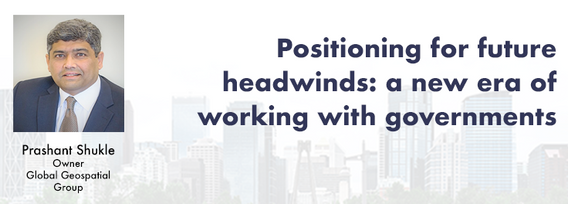
Over the past three decades, global and national economies have undergone profound transition while the governments that have tried to steer worldwide growth have been buffeted by profound changes in how citizens interact and feel about the level of services they receive. That many of them are more empowered than ever by social media, which is often said to have hastened the growth of significant divides, speaks to the need of many governmental leader to stay in touch with prevailing th...


Over his decade plus at Suncor, Alonzo has been both witness to and active participant in a quiet digital Geospatial revolution. This revolution has democratized access to Geospatial data and tools to everyone at Suncor. Which meant that teams and professionals across a myriad of disciplines have embraced and pushed the limits of Geospatial data and software. The constant demand for newer and higher-resolution data has relegated the paper map to secondary status as the tool for spatial commun...


Join us at the GoGeomatics Expo in Calgary for a concise panel discussion on the present and future of geomatics education. Our panel, comprised of professors and industry experts, will address the following key topics:1. Current State of Geomatics Education:Explore the status of geomatics education in Canada.Understand how educational programs are adapting to ind...


With climate change comes a massively increased risk to billions of people due to disasters, reduced food and energy security, environmental degradation, and sea level rise to name a few. For example, it is estimated that 200,000,000 people live in low-lying areas of the world considered highly vulnerable.The global OGC community has mobilized to improve how well we connect land, sea, and air Geospatial data and information, improve regional connectivity between various SDIS &nbs...


Teams can become the catalyst to co-elevate results-driven organizations accelerate outcomes, unleash their full potential, and create unprecedented internal and external value. But it’s not a given!In an increasingly volatile, uncertain, and non-linear Geomatics landscape, senior-level managers find it increasingly challenging to keep up and get things done – efficiently, effectively, and timely. The organizational silos have begun to come down, but often remain camou...


Geodetic Reference Systems are the foundation for geospatial data, serving as the official reference for latitude, longitude, height and gravity in Canada. There are many contributors to providing such standards to Canadians, including Federal, Provincial and Municipal governments, the private sector, academia, and others. Users will know that every few years there are new versions introduced of the datums or reference frames. A change in reference system, however, invo...


Flooding is Canada’s most costly natural disaster, and flood risk intensifies as a result of urbanization and climate change. These impacts will change over time and can jeopardize the overall sustainability of communities if they remain unaddressed. As socio-economic consequences worsen, it underlines the need for governments to provide current and accurate hazard information to vulnerable populations, including Indigenous communities who are disproportionately affected, to make decisions...


With an increasing multitude of new Earth Observation (EO) satellites, it is imperative for the geomatics community to assess the fit of these emerging space assets. This presentation aims to provide a comprehensive analysis of the diverse range of EO satellites currently being deployed, and their potential applications.Topics:1) An Overview of the recent surge in EO satellite launches2) New satellite capabilities, and use cases3) An exploration of the challenges customers ...


The GoGeomatics Expo and our sponsors are proud to present the Diversity in Leadership Panel.As the common goals of diversity, equity, and inclusion become even more widespread, organizations have the daunting task of figuring out what works.It is our vision the expo will spur the grassroots of a more diverse ecosystem where diversity of thinking and knowledge w...


Incidents involving dangerous goods, including flammable gases and liquids, can happen at any time and in any place. When they do, Emergency Response Assistance Canada's 320+ members count on us to provide a safe and effective emergency response 24 hours a day, 365 days a year.Various GIS solutions exist within Emergency Response Assistance Canada (ERAC) to support these functions. Examples include our resource locator tool that spatially queries and returns key information from 40+...


Join us at the BIM/GIS panel of our conference as we delve into critical subjects shaping the intersection of Building Information Modeling (BIM) and Geographic Information Systems (GIS). Our expert panelists will explore the evolving landscape of BIM and GIS, offering invaluable insights into various aspects of this dynamic field.Agenda:The Importance of Standards and Interoperability...


Creating, managing and sharing geospatial information has never been easier, but how do we ensure the information we are using to make key business decisions is current, correct, accurate and the best fit for purpose? This session will explore the different types of geospatial information assets being used at The City and the different tools, methods and standards that are being used capture, manage and share authoritative City data across the organization and to the Citizens of Calgary.


Geomatics is growing technically and economically at a rapid pace. The need for skilled, knowledgeable workers is higher than ever. Some may argue that the technical advancements of the industry reduce the need for skilled workers and will remove the event of human errors. Others will argue that the very technology that is reducing human error can lead to increasing other errors and be a cause of delays on projects if the person operating the technology is not perceptive ...

Harnessing the power of regular collection of imagery and Lidar, the City of Calgary provides valuable information for municipal service delivery. The City publicly shares various datasets in different formats, including Orthophotos, Lidar, and 3D buildings, oh-my! Beginning in 1990, the Aerial Imagery Program supported planning, development, and operations.Regularly collecting spatial data allows for more accurate assessments of changes over time. Annual Orthophoto collection aids in ...


The end of the first day of the National Canadian GoGeomatics Expo is being marked by a lively party that is eagerly anticipated by all participants. The party is being held on the floor of the tradeshow in a venue that hosts many of the best rock concerts and shows for the Calgary Stampede. It promises to be a lot of fun, with an atmosphere buzzing with excitement and energy as attendees mingle, network, and celebrate the end of a successful day.The party is made even better by the in...
środa 8 listopad, 2023
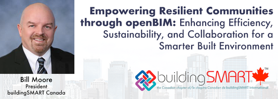
openBIM aims to make the built environment more efficient, sustainable, and productive, leading to more liveable and resilient communities. Smarter infrastructure and buildings help to improve energy-efficiency, sustainable practice and future-proof standards to ensure a more equitable society.Open standards ensure that different products and systems can work together seamlessly, regardless of who developed them or what platform they run on. This generates comprehensive, trusted and...


Great Leadership is central to our Industry – leaders that are adeptly able to connect and interoperate with business, government, and institutional entities. While traditional hub-and-spoke leadership structures remain, a wave of agile, resilient, and dynamic leaders are stepping up. But organizations aren’t made up simply of leaders. In our quest for the best leadership, have we overlooked or forgotten about the skills, resources, and commitment to developing and empoweri...


The SLAM Scan-off results are in, but what does that mean, where can this technology be applied, and what technology can be applied to it?Join us for a discussion following the results of the GoGeomatics SLAM Scan-Off:- The strengths and weaknesses of adopting SLAM platforms into your workflow.- The appropriateness of SLAM platforms for specific uses.- The compatibility of SLAM platforms with downstream tools and methods.- The current and possible futures of SLAM sys...


Research Presentation:Airborne Topo-Bathymetric Lidar Combined with Thermal Imaging for Fish Habitat Studies in RiversResearchers at Nova Scotia Community College’s Applied Geomatics Research Group have been using the airborne Leica Chiroptera 4X topo-bathymetric lidar sensor for nearly a decade and have surveyed coastal, riverine and lake environments. They have concentrated on mapping submerged aquatic vegetation (SAV). Topo-bathy lidar data of rivers provides an opportu...


The Department of National Defence, as steward of a real property (RP) portfolio that includes tens of thousands of buildings and supporting infrastructure, is seeking to manage its Real Property (RP) assets more effectively by modernizing and improving its digital capability. In this effort, interoperability between BIM and GIS through open data standards is crucial to enable the Integrated Digital Built Environment. BIM allows representation of detailed information regarding building elemen...
