Julian Bernal
Elementy, w których Julian Bernal attends
poniedziałek 28 październik, 2024
We are excited to announce that the next Canada Forum will be held during the GoGeomatics Expo in Calgary, from October 28th to 30th. This event will bring together key stakeholders from across Canada’s geospatial sector, including industry leaders, academics, indigenous communities, government representatives, and technologists, to continue vital discussions on advancing geospatial standards, interoperability, and spatial data infrastructure (SDI) in Canada.
wtorek 29 październik, 2024
We are hosting a special gallery of maps and posters for this year’s expo.The Canada Maps & Poster Gallery will run from October 29th to the 30th in Calgary and is an excellent opportunity to showcase your team's work and impact for the public good.This initiative is in partnership with the Canadian Cartographic Association (CCA), the Inter...
This career fair is an excellent opportunity for your organization to showcase its vision, culture, and the exciting opportunities on offer. Engage with a diverse pool of candidates, including experienced professionals and emerging talents with fresh perspectives. Each candidate brings unique skills and innovative ideas, making your participation a strategic investment in the future of your organization and the geomatics sector.The Western Canada GeoIgnite Career Fair is crucial for re...
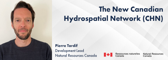
The new Canadian Hydrospatial Network (CHN) is set to replace the National Hydrographic Network (NHN) for Canada. Designed for improved use in hydrological models, the CHN is analysis ready with full-network traversing ability, and value-added attributes such as stream order. The CHN is also created from higher-resolution source data and better aligned to elevation than the NHN, where possible, and has been streamlined for production and maintenance.Work is on-going to refine methods a...
How exactly does artificial intelligence work and what can you use it for in the geomatics domain? Using real-life examples from our projects, they demonstrate how you can use AI to gain new insights and increase efficiency by automating your data processing workflows.We explore how GeoAI is fusing spatial data science and Geomatics technology to help automate the extraction, classification, and analysis of all types of spatial or non-spatial data. Learn how GeoAI can detect clusters, ...
Water is one of our most vital resources, and its management is becoming increasingly complex in the face of climate change, population growth, and competing demands from agriculture, industry, and municipalities. This panel will delve into how geospatial technologies are revolutionizing water policy by providing the data-driven insights needed for smarter decision-making.Join leading experts from academia, provincial and federal gov...
For the last five years I have been providing reality capture services to documentary film producers. These series have included NatGeo's Buried Secrets of WWII, NatGeo's Drain the Oceans, Discovery's Expedition Unknown and Expedition Bigfoot. LiDAR, photogrammetry, thermography, magnetometry, and multi spectral imagine all provide context that professional storytellers (TV producers) crave. Join me as I share stories, successes, and failures of these unique service offerings.
The First Peoples Innovation Centre (FPIC) plays a significant role in empowering Indigenous communities. The Centre has adapted the FabLab (Fabrication Laboratory) model developed by the Massachusetts Institute of Technology (MIT) with a culturally appropriate response to Indigenous youth, enabling them to take charge of their professional future. The FPIC, incorporating the FabLab Onaki, is pivotal in this empowerment process, as it funds and partners with various organizations to create co...
The integration of AI in infrastructure modeling has the potential to revolutionize decision-making processes by providing accurate predictions, identifying vulnerabilities, and optimizing resource utilization.The increasing complexity of modern infrastructure systems, coupled with growing demands on utilities, has necessitated the adoption of advanced analytical techniques. This panel discussion brings together ideas from acad...
In December 2023 a unique gathering of technology and talent gathered on Alcatraz to capture the entire island, inside and out, from the ground and from the air to assist the National Park Service understand the risks seal level rise and climate change present to the island. Join me and, perhaps, other members of the extended team as we share the technology, the experience, and the adventure of this unique experience.
Wrap up the first full day of Canada's National Geomatics Expo with the GoGeomatics Meetup! This lively party and networking event, free to attend, starts right after the day's sessions, offering a perfect blend of fun and professional interaction. Held on the expo main floor, the meetup features a cash bar to help you unwind and enjoy the evening. Join us for an exciting night of music, mingling, and making connections with fellow attendees. Don't miss this chance to relax and expand your ne...
Today, digital twins, autonomy and artificial intelligence (AI) dominate the lexicon of the geomatics industry. These capabilities provide significant productivity advantages to our profession, but our domain content and knowledge are critical to their success. These tools will change the way we work and transform the industry. However, they will not replace us, but rather change our role. This is no different than when the EDM, total station, CAD, or GPS became part of our professional lives...
środa 30 październik, 2024
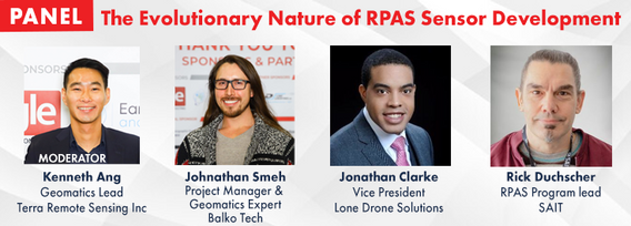
RPAS platforms and sensors have come a long way since their commerical adoption almost a decade ago and have quickly become a main stay of many professional's tool kits. This show's the industry's appetite for adopting new technologies and matching them up with the right application. With a pannel of very experienced professionals from various sectors of Canada's Geospatial RPAS scene, we explore what has driven sensor development and how sensors might further develop along the lines of use c...
Join us for an engaging panel discussion on Geo-Entrepreneurship, featuring distinguished experts from geospatial consultancies, geomatics communication and event companies, and geomatics software firms. This session is designed for those interested in the intersection of geospatial technology and entrepreneurship.Journey to Entrepreneurship: Hear from our panelists on their motivations for leaving traditional careers to pursue entrepreneurial ventures in the geospatial field. Dis...
Photogrammetry is not just limited to aerial platforms. Modern mobile devices contain high-quality cameras and increasingly have LiDAR and depth sensors built in. When combined with high-accuracy GNSS systems, these mobile devices can quickly collect accurate data for utilities, infrastructure, inspection, as-builts, construction, and more. Utilizing these readily available devices can reduce project delays, capture better documentation of utilities, and lay the foundations for digital infras...
In this year's reality capture track, we have shown you the unprecedented value of reality capture systems when adopted into high-cost, high liability and fast pace environments, some of the problems these systems are solving today, and tools to help the effectiveness and quality of those solutions. However, our presenters will also have demonstrated how critical digital lifecycle planning can be to any asset, from pre-design through construction and lifetime operation right up to demolition,...
Led by the World Geospatial Industry Council (WGIC) and moderated by Aaron Addison, Executive Director of WGIC, this panel will explore the transformative role of Earth observation (EO) technologies in fostering a resilient and sustainable future for Canada. With growing environmental challenges such as climate change and resource management, EO solutions provide essential insights into monitoring ecosystems, disaster resilience, and sustainable development. Panelists from diverse sectors wil...
Traditional teaching methods in post-secondary often included using powerpoint presentations and writing on a white or blackboard. The newer generations of students have been exposed to different ways of learning and this requires instructors or teaching professors to change their way of presenting information to help the students learn it at a deeper level. Using a radical constructivism philosophy, the students are required to engage in the material in their own way, connect wit...
In our rapidly evolving urban landscapes, inadequate accessibility maps leave many people with disabilities facing significant challenges. This talk begins by illustrating the problem with real examples of accessibility fails on platforms like Google Maps. Attendees are encouraged to check accessibility features on their phones, highlighting current gaps.We will then explore the necessity of specialized tools for meaningful navigation and destination planning for people with disabiliti...


