
Darren Flach
Elementy, w których Darren Flach attends
poniedziałek 6 listopada, 2023

Step into the exciting realm of the inaugural GoGeomatics Expo in Calgary, a historic event that is set to make waves in Canada's geospatial sector. This compelling panel discussion will delve into the groundbreaking significance of this first-of-its-kind expo, exploring why it is a game-changer for both the public and private sectors, and how it charts a new course for the geospatial industry in Canada. This panel discussion takes place after the expo reception buffet. Participants must b...


wtorek 7 listopada, 2023
Student posters will be available for viewing in the Expo Gallery November 7th and 8th. Authors will present a brief summary of their poster and will be available for questions on Tuesday, November 7th from 2-4 pm.
The Expo proudly showcases the Canadian Cartographic Association Student Map Competition.Discover the recipients of the Best Student Presentation & President’s Prizes in thematic map design showcased at the map gallery on the trade show floor.Entries include: President’s Prize (College Level Entries)Jessica Murdoch ...


Join us for a riveting panel discussion featuring leading experts in the realm of reality capture. As the industry stands on the precipice of monumental change, this session aims to unpack the intricacies of current challenges, explore the intricacies of the digital twin concept, and envision the future trajectory of reality capture. Our esteemed panelists, with their wealth of knowledge and diverse experiences, will shed light on the multifaceted struggles the industry grapple...


SUMMARYWith the increasing focus on damage prevention, public safety concerns, and environmental damage due to underground utility strikes, it has become more critical to accurately locate, store, and be able to visualize subsurface utilities. We show several key technical and business details when implementing a subsurface mapping system from data collection to the use of machine learning for 3D modelling and visualization and give real-world examples and use cases of the different le...

Is change the new normal? Every year seems to be the next warmest year. Those of us looking back at our planet from space are seeing these changes across our planet in near real-time through the eyes of satellites. But behind those pixels are real human stories of catastrophe and suffering. So, with all our constellations of satellites, massive computing power and new generative AI algorithms, can we do anything more than simply report what happened? What does the future hold for geospatial t...

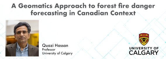
At the Earth Observation for the Environment Laboratory in The University of Calgary, we have been conducting research in developing remote sensing-based forecasting system for forest fire danger conditions since 2009. In the scope of this presentation, the chronology of such developments at daily, 4-day, and 8-day time scales will be discussed. We believe that these would be critical for managing forest fire regimes in Canada and elsewhere in the world.


Addressing the escalating levels of methane in the Earth's atmosphere is among the most urgent issues humanity faces. Methane ranks as one of the most potent greenhouse gases (GHGs), trapping over 25 times more heat than carbon dioxide over a 100-year period; thus, significantly reducing methane emissions will make a substantial impact in the fight against climate change.One of the most impactful methods for mitigating methane emissions involves the prompt detection and repair of metha...


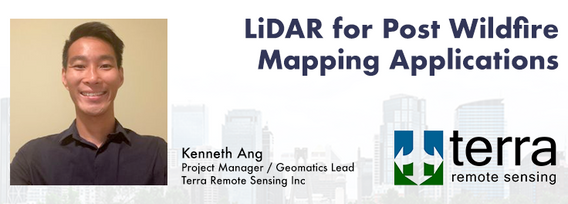
Canada has just experienced a record wildfire season with devastating impacts. Public safety and damage mitigation is a priority for all impacted by these disasters. From mapping vegetation, analyzing slope stability, planning fire breaks, qualitfiying wood debris and fuel loads, how does LiDAR play a role in meeting post wildfire needs?
LiDAR continues to be a cornerstone of the mapping industry. Since its inception, the technology has evolved from sole use on manned aircraft to being used on UAVs and mobile mapping platforms. As the LiDAR industry continues to evolve, our panel of experts will discuss what current and future trends impacting this industry. Join our award-winning panelists for an exciting discussion. Bring your questions.

Flooding is Canada’s most costly natural disaster, and flood risk intensifies as a result of urbanization and climate change. These impacts will change over time and can jeopardize the overall sustainability of communities if they remain unaddressed. As socio-economic consequences worsen, it underlines the need for governments to provide current and accurate hazard information to vulnerable populations, including Indigenous communities who are disproportionately affected, to make decisions...


Geodetic Reference Systems are the foundation for geospatial data, serving as the official reference for latitude, longitude, height and gravity in Canada. There are many contributors to providing such standards to Canadians, including Federal, Provincial and Municipal governments, the private sector, academia, and others. Users will know that every few years there are new versions introduced of the datums or reference frames. A change in reference system, however, invo...

Menu - Big Four OutletAppetizersRoasted Diablo Pork Bites (12) (GF/DF) SaladsSpiced Cauliflower, Chickpea & Tofu Bowl (GF/DF/V/VE) Sweet Potato, Roasted Cauliflower, Chickpeas, Mint Chutney,Grilled Tofu, Madras Curry DressingClassi...

This talk focused on those seeking work in GIS, cartography, remote sensing, programming, and other related geospatial fields.Jonathan Murphy, Managing Director of GoGeomatics Canada and geospatial career coach, will be sharing his valued tips and insight for your job search. He is an expert geomatics professional with close to 20 years of experience. Jon’s career has ranged from the oil fields of Alberta to projects w...

This talk focused on those seeking work in GIS, cartography, remote sensing, programming, and other related geospatial fields.Jonathan Murphy, Managing Director of GoGeomatics Canada and geospatial career coach, will be sharing his valued tips and insight for your job search. He is an expert geomatics professional with close to 20 years of experience. Jon’s career has ranged from the oil fields of Alberta to projects with...

The GoGeomatics Expo and our sponsors are proud to present the Diversity in Leadership Panel.As the common goals of diversity, equity, and inclusion become even more widespread, organizations have the daunting task of figuring out what works.It is our vision the expo will spur the grassroots of a more diverse ecosystem where diversity of thinking and knowledge w...


Incidents involving dangerous goods, including flammable gases and liquids, can happen at any time and in any place. When they do, Emergency Response Assistance Canada's 320+ members count on us to provide a safe and effective emergency response 24 hours a day, 365 days a year.Various GIS solutions exist within Emergency Response Assistance Canada (ERAC) to support these functions. Examples include our resource locator tool that spatially queries and returns key information from 40+...


Join us at the BIM/GIS panel of our conference as we delve into critical subjects shaping the intersection of Building Information Modeling (BIM) and Geographic Information Systems (GIS). Our expert panelists will explore the evolving landscape of BIM and GIS, offering invaluable insights into various aspects of this dynamic field.Agenda:The Importance of Standards and Interoperability...


Creating, managing and sharing geospatial information has never been easier, but how do we ensure the information we are using to make key business decisions is current, correct, accurate and the best fit for purpose? This session will explore the different types of geospatial information assets being used at The City and the different tools, methods and standards that are being used capture, manage and share authoritative City data across the organization and to the Citizens of Calgary.

Discover who Challenger is and the technology we use, while exploring employment opportunities.

As GIS professionals, we understand the pivotal role that geospatial data plays in decision-making across various industries. Now, imagine harnessing that power to transform facility management. This presentation delves into VertiGIS FM, a groundbreaking solution that revolutionizes facility management through the lens of spatial intelligence, creating new opportunities and efficiencies across organizations.

Harnessing the power of regular collection of imagery and Lidar, the City of Calgary provides valuable information for municipal service delivery. The City publicly shares various datasets in different formats, including Orthophotos, Lidar, and 3D buildings, oh-my! Beginning in 1990, the Aerial Imagery Program supported planning, development, and operations.Regularly collecting spatial data allows for more accurate assessments of changes over time. Annual Orthophoto collection aids in ...


The end of the first day of the National Canadian GoGeomatics Expo is being marked by a lively party that is eagerly anticipated by all participants. The party is being held on the floor of the tradeshow in a venue that hosts many of the best rock concerts and shows for the Calgary Stampede. It promises to be a lot of fun, with an atmosphere buzzing with excitement and energy as attendees mingle, network, and celebrate the end of a successful day.The party is made even better by the in...
środa 8 listopada, 2023
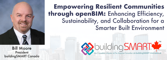
openBIM aims to make the built environment more efficient, sustainable, and productive, leading to more liveable and resilient communities. Smarter infrastructure and buildings help to improve energy-efficiency, sustainable practice and future-proof standards to ensure a more equitable society.Open standards ensure that different products and systems can work together seamlessly, regardless of who developed them or what platform they run on. This generates comprehensive, trusted and...


Great Leadership is central to our Industry – leaders that are adeptly able to connect and interoperate with business, government, and institutional entities. While traditional hub-and-spoke leadership structures remain, a wave of agile, resilient, and dynamic leaders are stepping up. But organizations aren’t made up simply of leaders. In our quest for the best leadership, have we overlooked or forgotten about the skills, resources, and commitment to developing and empoweri...


No matter what your GIS super-powers may be, there is a place for you at GeoBC. We offer clients a wide range of GIS services and products such as base mapping, imagery analysis, data science, data management, spatial analysis, programming/automation, project management, map making, web maps, and mobile app creation.On any given project your clients may be biologists, engineers, planners, First Nations relations staff, land and water authorizations staff, executives, Emerg...


The SLAM Scan-off results are in, but what does that mean, where can this technology be applied, and what technology can be applied to it?Join us for a discussion following the results of the GoGeomatics SLAM Scan-Off:- The strengths and weaknesses of adopting SLAM platforms into your workflow.- The appropriateness of SLAM platforms for specific uses.- The compatibility of SLAM platforms with downstream tools and methods.- The current and possible futures of SLAM sys...


Geoff Zeiss devoted over 30 years of his life to the Geospatial industry and global community, focusing on utility and construction sectors, and mapping underground utility infrastructure among many other projects. Sadly, Geoff passed away in September of 2022. The Geoff Zeiss Urban Infrastructure Mapping Fund was established to build on decades of innovation by Dr. Zeiss in developing effective and sustainable urban infrastructure through research and development supporting urban infor...


Menu - Big Four OutletAppetizersRoasted Diablo Pork Bites (12) (GF/DF) SaladsSpiced Cauliflower, Chickpea & Tofu Bowl (GF/DF/V/VE) Sweet Potato, Roasted Cauliflower, Chickpeas, Mint Chutney,Grilled Tofu, Madras Curry DressingClassi...
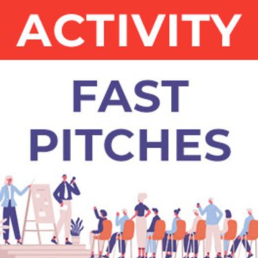
Got a cool geomatics product, service, student project, or academic/science research project/paper? Pitch it to a select panel of geomatics press and industry experts at the GoGeomatics expo held in Calgary, November 6-8 2023.Top picks will have their pitch written up as an online article published and promoted by GoGeomatics.You’ll have 3 minutes to make your presentation, with 2 minutes of questions from the panel. You can present a PowerPoint, do a live demonstration, or j...

The Department of National Defence, as steward of a real property (RP) portfolio that includes tens of thousands of buildings and supporting infrastructure, is seeking to manage its Real Property (RP) assets more effectively by modernizing and improving its digital capability. In this effort, interoperability between BIM and GIS through open data standards is crucial to enable the Integrated Digital Built Environment. BIM allows representation of detailed information regarding building elemen...
