
Kent Jacobs
Elementy, w których Kent Jacobs attends
wtorek 18 czerwca, 2019

Jonathan Murphy the Founder of GeoIgnite and GoGeomatics welcome participants to the conference

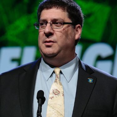
Mayor Watson welcomes delegates, exhibitors and VIPS to the inaugural National Geospatial event in Canada.
There's never been a more exciting time to be a part of the geospatial profession. From mapping the infrastructure beneath our cities to indoor wayfinding, to plentiful and powerful remote sensing capabilities in air and space which we could hardly have imagined just a few years ago, the opportunities - and the expectations - for geospatial professionals are immense. Technology is evolving at a pace which outstrips the ability of academics, governments, and industries to keep pace. How will w...

Let’s admit it! We live in exciting times with technology, social interactions and business models changing before our eyes: Flying taxis, self-driving cars, commercial Space missions, smart cities, SmallSats and Internet Of Things (IOT) to name just a few innovations! Our kids are growing up in a world of on-demand TV, GPS availability, all around virtual assistants, and mobile devices that pretty much can do anything! Each and every one of these innovations has a location element to i...
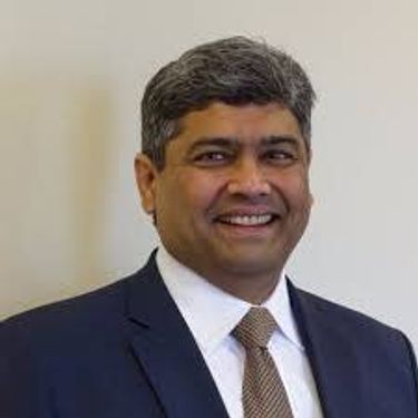
Prashant Shukle is the Director General for the Canada Centre for Mapping and Earth Observation Branch, Earth Sciences Sector, at Natural Resources Canada (NRCan).NRCan has fostered an enabling policy mechanism and provided a conducive framework for geospatial information infrastructure. In today’s digital age when geospatial is becoming more and more ubiquitous, open and inter-disciplinary policies are the key instruments of harnessing the true value of this wonderful technology...
What are the ramifications of the current digital transformation globally and what will it mean for Canada and the globe? Our award winning panel of international and Canadian experts disscuss and take questions from delegates.


Break

Alberta View: Economic impacts and Opportunities of the Geospatial SectorLocation technologies are changing the way we live, work, and play, and are having a transformative impact on industries across Canada. The intersection of location technologies with Virtual Reality and Augmented reality are rapidly transforming key sectors of the Canadian economy including transportation, the resource sector, the digital and interactive media sector and transforming how governments d...

The future is digital. Big data is an integral part of the digital transformation of a private or public organization. Location and geospatial technologies are at the heart of the digital transformation as enablers, game changers and contribute to the success of big data in many ways. Combined with emerging geospatial artificial intelligence, the possibilities are limitless. Smart cities and autonomous vehicles are examples of this potential. However, this big data revolution raises many lega...

Several key trends in the geospatial industry over the last few years have created the conditions needed to truly leverage remote sensing as a technology that has the potential to provide tremendous benefit to civil society. These include changes in data policy, most notably with USGS's decision in 2008 to make all Landsat archives free and open, a policy which led the European Space Agency to also implement free and open access to the Copernicus constellation. The volume of data that is incr...

Hope Spots are special places that are critical to the health of the ocean — Earth’s blue heart. Some Hope Spots are already formally protected, while others still need defined protection. The Mission Blue team has embarked on a series of expeditions to shed light on these vital ecosystems and ignite support to safeguard them as marine protected areas.The IUCN are an integral partner in the Mission Blue initiative and the Hope Spot concept ties into UN amb...

Global Grid Systems is pleased to sponsor the first lunch of the conference. GeoIgnite offers our delegates a special meal for the first day of the event. Executive Chef Derek Ragnitz has put together a delicious and healthy lunch.Geoignite Day 1 Mediterranean Style Lunch:Medley of mixed greens cherry tomatoes and cucumbers with dressings.Traditional Greek salad, freshly made hummus with tabbouleh and pita bread.Grilled M...

Today, geospatial technologies are embedded in many of the workflows that support the Fourth Industrial Revolution and therefore invaluable to users. This means that geospatial information is no longer the domain of specialists and suddenly has become a context for the rest of our augmented existence.From Pokémon Go, to Uber and autonomous vehicles (AV), Internet of Things (IoT) and Artificial Intelligence (AI), smart applications and on-line mapping tools give the public almost insta...

The Internet of Things (IoT) is here. Whether applied to industrial automation, wearables, connected transportation and logistics, drones or smart cities, IoT is poised to disrupt how we work, live and relate to each other, delivering great benefits along with new challenges. Improved revenue, costs, quality of life and convenience benefits are often confounded by concerns such as privacy, security, and social disruption, with location info playing no small role on both sides. So, what exactl...
The UK Government as part of its building information modeling (BIM) initiative has said repeatedly that it expects the big payoff of a digital model will be during operations and maintenance, which typically represents 80% of the cost of a facility. Companies who do design, build, finance, and maintain, or design, build, operate, or PPP projects often employ a full lifecycle BIM + geospatial strategy. For example, Crossrail appears to be the first major project that may be able to provide su...
The Earth is immense, and abundant with interesting information. Recent advancements in geospatial sensors (e.g. satellites, smart phones, meteorological instruments, and LIDAR) have resulted in the development of technologies capable of collecting large and dynamic geospatial data. As a result, we are experiencing an explosion in the volume and variability of geospatial data, and yet many in public remain unaware of or unable to access this wealth of data to make informed decisions regarding...


Cloudy with a chance of data science.Sparkgeo had been building cloud first geospatial applications, from day 1. But that was not the plan. The plan was to make more maps for more people, using the internet.Sitting at the intersection of software development and GIS we see how these two communities can benefit from each other. But, to do so, we will have to step out of our comfort zones.Let me tell you the story of a lowly GIS tech's journey through the technol...

The Mapbox live location platform was designed to serve all levels of government and the critical services they support. Develop custom mapping and location applications from start to finish in your own private cloud or on-premises infrastructure. Atlas offers the same capabilities found on Mapbox.com only offline, and deployable anywhere, even on your own infrastructure. Learn more about accessing and analyzing your sensitive geospatial data on and off network during this 30 minute session. ...

We are entering a new era of positioning, navigation and timing. Global, instantaneous, and easily accessible positioning at better than 10cm is coming, which will provide new ways of doing business and create new businesses in areas such as augmented reality. In recent years global Positioning, Navigation and Timing have been undergoing rapid technological development. New GNSS constellations (Galileo, Beidou) with new signal structures offer increased capabilities, while future posi...

Please join fellow conference attendees for an amazing networking reception in the exhibitor hall sponsored by Mapbox. The event will feature surprise performances and appetizers, and will be a great chance to connect with other geospatial professionals.
środa 19 czerwca, 2019

John Roos welcomes delegates and introduces the morning Industry tract as MC for GoGeomatics Canada.
Lauriault’s work on open data, big data, open smart cities, is international, transdisciplinary and multi-sectoral. She is one of the founders of critical data studies and of open data in Canada and founded Open Smart Cities with OpenNorth a data and technology governance approach to shape how Canadian cities roll out their ‘smart’ programs. She has expertise in data infrastructures, spatial media and smart cities, and is especially interested in the assemblage of social and technological pro...
Mainstreaming of the geospatial market has created a big demand for geospatial content and solutions across governments, businesses and consumers. The Fourth Industrial Revolution (4IR) has also helped scale up applications and value to much larger markets, amplifying overall impact and contribution of geospatial information in the world economy and society. With every added application and consumer, the return on investments get bigger and better. The panel shall focus...


Asset management is critical for many government agencies to manage their street assets. A.I. and machine learning technology is expanding to automate government work-flows which have traditionally required significant investments in field work, manual intervention, and data analysis. This session will showcase real-world examples of the benefits of street-level imagery and the power of A.I. in scaling up data collection and extraction for asset inventory, site surveys, property appraisals an...
NAV CANADA is a privately run, not-for-profit organization that is the Air Navigation Service Provider for Canada. With an airspace that spans all three coastlines of the country, from the west coast of British Columbia to the Arctic Ocean in the North to the east coast of Newfoundland, NAV CANADA covers a lot of territory. The Aeronautical Information Management group is responsible for creating instrument flight procedure designs (airways, instrument approach procedures, departure procedure...

Megan works with national players in the Construction Industry, balancing high-level strategic direction and thinking with operational needs and technologies. She works with Departmental Stakeholders, Clients, and Private Sector Service Providers alike to bring digital efficiencies and innovation to workflows and processes in Real Property portfolio, program, and project, management. Megan has been a strong voice for digital transformation within the Federal Government's Real Property Communi...
Remote sensing is the most cost-effective means for gathering timely detailed and reliable information over large areas with high revisit frequency. The integration of remote sensing data with national statistics, field observations and secondary data show great potential for mapping crop acreages. This requires the selection of appropriate satellite data, the collection of quality ground information, the application of suitable pre- and post-processing methods and the implementation of a rob...

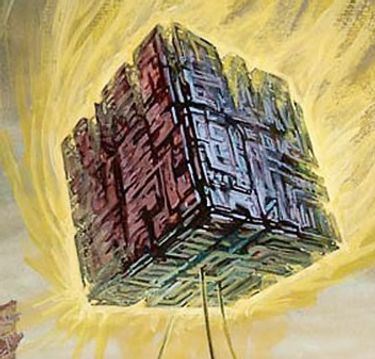
Global Grid Systems is on the leading edge of DGGS technology and is applying it in many exciting applications. A Discrete Global Grid (DGG) is a partition of the Earth’s surface into a set of regions (a.k.a. cells) containing a single point and meeting the needs for global sampling, storage, modeling, processing, analysis, discovery, integration, and visualization.We're building an engine that powers applications in marketing, telecommunications, insurance, and gov...
The GeoIgnite Conference and our sponsors are proud to present the inaugural Diversity in Leadership Summit (DILS). It is our vision that GeoIgnite will spur the grassroots of a more diverse ecosystem where diversity of thinking and knowledge will ignite innovation and better outcomes for us all. The DILS is the flagship forum for of geo professionals of all ages and stages in...


Synthetic Aperture Radar (SAR) satellites image the Earth in all weather conditions, day or night. Canada’s RADARSAT-2 satellite, launched in 2007, orbits the Earth with a 24-day revisit cycle. It is used for mapping ground deformation produced by natural and anthropogenic hazards; natural resource development; permafrost, glacier and coastal changes. The next generation of Canadian satellites, the RADARSAT Constellation Mission (RCM), to be launched in June 2019, will improve the revisit cyc...

Investment in building construction statistics for the residential and non-residential sectors account for approximately 5% of GDP and are used extensively by internal and external clients. The statistics available for the residential and non-residential building construction sectors provide an invaluable portrait of this activity in Canada at the national, provincial and census metropolitan area (CMA) level. In order to improve the quality of our estimates, while als...

The Government of Canada purchases on average $22 billion in goods and services each year to help deliver programs and services to Canadians. Many departments and agencies collect and manage large amounts of geospatial data, and significant investments have been made within these organizations. The demand for, and use of, geospatially-related data and tools is rapidly increasing across government, as well as in the broader public context. This information session will help you understand the ...
Canada has at least four federal level road network products. Knowing the differences, and when to use which one, is not as straight forward as it should be. Even worse, these products are updated on different schedules, so knowing which one has the most up to date information is a tricky task.We will discuss what the respective networks are and their intended use, covering distribution formats, dataset coverage, and examples of the types of analysis that can be performed with each on...
The value of geospatial big data and how to efficiently convert it to useful information is an important cross disciplinary question. There has been significant investment in the collection and archiving of geospatial and other environmental data and numerous organizations recognize the importance of this information resource. However, the software and computing systems to effectively and efficiently access, interrogate, and utilize this information for specific applications has not seen the ...

For the second day of the conference executive Chef Derek Ragnitz and his award winning culinary team offer a Mexican themed selection for delegates enjoyment.GeoIgnite Day 2 Mexican Style LunchChef Dereks Ragnitz's tasty Chicken Fajitas using fresh ingredients.Tortilla chip platters: Chips, fresh guacamole and salsa. Shredded cheese, sliced jalapenos, sour cream and Mexican re-fried beans.Southwestern three bean salad.<...

It takes village to raise a business, but there is no reason it shouldn’t be a global village. Sparkgeo started with the simple idea that it would be good to put maps on the internet. From there we have evolved into a geospatial consultancy providing generalized non-vendor specific geospatial advice, with an ability to back up what we say with code and data. This is a story about serendipity, intermingled with a pinch of good fortune with an occasional lucky break.
The purpose of this presentation is to make the case for greater Indigenous participation in the development of geospatial technology and information. Next to government and resource companies, Indigenous people are the prominent stakeholders of the land and all the economic development that can happen on their territory. For this reason, they should have access to their own Geospatial data such as GIS data and ground imagery. Often the sources for Geospatial data comes from the proponent who...
Over the last few years, the Data Exploration and Integration Lab (DEIL) at Statistics Canada has conducted an increasing amount of work with open data using various open source tools in an open ecosystem. This exploration and experience has given rise to the idea of using an “open project” approach; that is, an approach that, to the extent possible, makes use of open source software, open code, open standards, open data, open platforms and open project management tools. The presentation outl...
UrtheDaily will be a 6-satellite constellation to acquire scientific-grade quality, 9-band multispectral imagery, at 5-meter Ground Sampling Distance (GSD), of 92% the whole Earth’s landmass every day. The cloud-based, scientifically-calibrated processing system will produce Analytics Ready Data (ARD) for geoanalytics—machine learning and AI—to provide evidence-based, actionable insights for sustainable development strategies ranging from but not limited to agriculture, ecology, forestry, dis...

Due to climate change, natural hazards are happening more in recent days. Analyzing these changes and prediction of future hazards have been always a challenge in the field of Geographic information systems (GISs). Traditional GIS aims to use map versus globe for their models, standards, and analysis. With the advances on Discrete Global Grid Systems, a new research question has been raised on what if we adapt our traditional approaches into a Digital Earth rather than a map. Digital Earth (G...
The City of Hamilton has many service delivery applications for resident addresses. For example, street addresses are solicited in a free form method and not validated against a common address database. Thus, the City has numerous instances of address databases, used on a daily basis, that are not accurate or consistent. In many cases, addresses are misused and often invalid causing a breakdown of communications. Leading to embarrassment for the City, anger by the residents and in some cas...
While much of the data available about the Earth pertains to the surface, there also exists a large amount of data available about the atmosphere and regions below the surface. Examples of such data include weather information, lithospheric properties such as velocity, aircraft and satellite flight paths, and underground utility networks. Flattening such volumetric data to the surface for integration with a traditional discrete global grid system (DGGS) discards the spatial relationship betwe...
środa 14 kwietnia, 2021
Jonathan Murphy, serial geospatial entrepreneur and career coach explains what it means to go from employee to an independent contractor providing goods, labor or services in Canada.Independent contractors work as individual entities. You are, however, responsible for managing your own payment and taxes. Jon with 20 years experience as a consultant and business owner in the Canadian geospatial sector will explain what it takes to go solo and the pros and cons of being your own...
środa 21 kwietnia, 2021

Join us for the the launch of GeoIgnite with Jonathan Murphy, the Chair of GeoIgnite, and Dr. Minda Suchan of MDA.Abstract of MDA Keynote: Canada is the world leader in wide area space-based radar Earth observation through the highly successful RADARSAT program, supporting numerous operational and scientific uses for Synthetic Aperture Radar (SAR) data. MDA, in conjunction with the Canadian government, has created an internationally recognized brand and reputation for...


Do you know what the geospatial product trap is? We fall in love with the technology, not the problem. I am a lucky person. My job has evolved to one where I primarily get to talk about geospatial technology all day. I could be scoping out internal or external projects or evaluating technologies. Increasingly, I provide advice on product ideas. This final situation has forced me to consider the nature of our community-of-practice. The common assumption that geospatial ...

Over the past year, Minerva Intelligence, a Vancouver-based cognitive AI company, has been awarded two contracts with Natural Resources Canada to design schemas at a national level: the National Flood Hazard Data Layer (NFHDL) and the National Hydro Network V2 (NHNv2). You might be asking yourself why an AI company is designing and building these important database structures. Minerva's cognitive AI system makes use of semantically inoperable data in knowledge graphs and has designed syste...

À l'automne 2020, NV5 Geospatial, propulsé par Quantum Spatial, a été mandaté par la Communauté Métropolitaine de Montréal (CMM) pour réaliser l'un des plus grands levés lidar topobathymétriques aériens fluviaux jamais entrepris au Canada. Cette présentation examinera de plus près le contexte, les objectifs, les défis, la technologie, la méthodologie, ainsi que les résultats et conclusions préliminaires de cette importante étude aérienne des vingt-huit principaux cours d'eau entourant la v...

Maxar is building the highest resolution and most accurate 3D map of the planet and this talk will provide an overview of the products and capabilities that are making it possible.

Title: Advancing Space Based Observation in Canada:The GeoIgnite 2021 Directors General Geospatial Panel, part of Canada's National Geospatial Conference.Title: Advancing Space Based Observation in CanadaThis is a must attend panel for anyone interested in learning the direction Canada's Federal government geospatial leadership is taking.Join our panelists for an exploration of Canada's geospatial priorities and mission in this exciting discuss...


czwartek 22 kwietnia, 2021

Abstract forth coming: Oversight for CSA program sectors, including in Space Utilization, Space Exploration, and Space Science and Technology.


At a time of rising climate change impacts, there is a vital and growing need to prepare for, respond to, and recover from natural disasters. But there is a critical communication gap between authorities and citizens. Drawing on the results of our massive multi-year climate change R&D project, and with assistance from hundreds of students, citizens, academics, NGOs, and government officials, we have identified the top perceived climate change-relatedcommunication problem...

Applying SafeGraph’s Canadian POI data for community-level analysis in ArcGIS and TableauGeospatial data empowers research bodies, government agencies, and the private sector to visualize and analyze complex problems in new and innovative ways. But location data is only valuable if it is accurate - something many GIS and data analysts know all too well. Armed with accurate, precisely geocoded POI data that includes key attribution related to brands and business types, analys...

For nearly 50 years, geomatics representatives from Canadian provinces and territories have collaborated together and with the federal government on geomatics initiatives. This presentation will explore why such a council came to be and why its work matters to the Canadian geomatics sector and citizens alike. While the geomatics sector and the world we live in continue to change, the need for coordination across jurisdictions remains crucial to support decision-making and response to share...
piątek 23 kwietnia, 2021

In 2003, when GISPartner entered the business Poland was still far behind more developed countries in terms of IT implementation. In 2021 the gap is incomparably smaller and some of Polish IT solutions are widely used across the globe. When public administration is considered, it was also GISPartner, which greatly contributed into transforming paper & stamps into high-class software solutions. We want to share our thoughts on how clever, tailor-made IT solutions are driving this transf...
Presentation of Awards and Concluding Announcements.

This talk will be bringing together the power of location intelligence and blockchain technology for an increased speed and accuracy of transactions and improved decision-making.The value that blockchain brings to geospatial technology is security, immutability, and trusted data. On the other hand, geospatial technology provides the power of location to the blockchain. Together, they represent a game-changer both for their utility and disrupt...
poniedziałek 26 kwietnia, 2021

PLEASE NOTE THE PREFERRED BROWSER IS GOOGLE CHROME. If you are running into any issues accessing the session, please try logging in via Google Chrome.The use of drones or UAVs has expanded dramatically over the last few years and this technology is rapidly permeating a wide variety of professional disciplines and industries, including the broad field of GIS. Ideally suited for on-demand geospatial data collection, drones can effectively eliminate the logjam tha...

wtorek 27 kwietnia, 2021

Google Chrome is the preferred browser for this session.Tickets for this workshop must be claimed in advance.Have you ever wanted to learn more about Synthetic Aperture RADAR (SAR) and Electo-Optical (EO) products? Come join this session for an introduction to some of the basic imaging parameters and learn about the different p...
środa 28 kwietnia, 2021

Tickets for this workshop must be claimed in advance.The use of drones, officially referred to as Remotely Piloted Aerial Systems (RPAS), has been forecasted to play a key role in the digitalization and further optimization of a variety of geomatics applications such as in resource aggregates management, landfill management, civil engineering (3D reality capture, virtual surveying), and precision agriculture. To help realize this forecast it is important for ...


czwartek 29 kwietnia, 2021

Tickets for this workshop must be claimed in advance.This workshop will offer a deep-dive into the Avenza Maps app, a mobile app where users can upload or access custom maps for off-line navigation, way-finding, and data collection. The workshop will be composed of 5 modules covering the fundamentals of the apps usage, as well as more advanced industry-relevant features. We will also provide a walkthrough of using the Av...


