Ma. Carolina Valderas Bermejo
Elementy, w których Ma. Carolina Valderas Bermejo attends
wtorek 1 marca, 2022
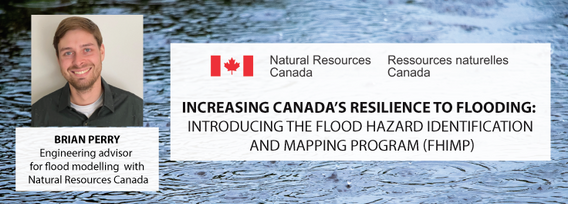
In Budget 2021, the government tabled a recovery plan for jobs, growth, and resilience. Within the budget were specific investments to promoting a healthy environment for a healthy economy, with $145.5 million dedicated to supporting initiatives that will increase resiliency to the natural hazards of wildfires and floods, which are becoming more frequent, severe, and devastating due to climate change and urban development. Flood hazard maps are essential to un...
piątek 4 marca, 2022
The Association of Canada Lands Surveyord (ACLS) has developed a certification model for hydrographers which, has been officially recognized by the IHO/FIG/ICA International Board of Standards and Competence for Hydrographic Surveyors and Nautical Cartographers (IBSC) in April of 2016. The ACLS program is the second internationally recognized scheme in the world. Certification for a hydrographic surveyor is desirable because: - Certification provides a formal...
In this short technical demonstration, I’ll explore some of the ways that Planetscope’s new 8-band capabilities can be used to both detect and monitor invasive plant species, such as Watermoss-Salvinia, within water bodies. We’ll focus on the role that the 4 new spectral bands (Coastal Blue (433-453nm) , Yellow (600-620nm), Green-II (547-583nm) and Red-edge (697-713nm)) can have in this use case. I’ll compare how some spectral indices unlocked via 8-band data compare to previous 4-band, RG...
wtorek 8 marca, 2022
The Integrated Cadastral Information Society (ICI Society) is a leader in sharing geospatial information, promoting the integration, adoption, and use of spatial data for the social and economic benefit of British Columbians. In addition to data sharing, ICI Society works to facilitate opportunities for training, education, and collaboration across government, industry, and other interested organizations. Incorporated in May 2001 and registered under the BC Societies Act as a ...
środa 9 marca, 2022
Join us in this training to learn about some of the latest and greatest features in ERDAS IMAGINE! With the exponentially increasing amount of data being collected in the world today, customized repeatable, batchable workflows are needed to extract as much valuable information from raw data as possible. The Spatial Modeler is the key to setting up these types of workflows. The creation of spatial models and the use of AI, machine learning and deep learning allow mo...
piątek 11 marca, 2022
Please join us for the MDA-hosted workshop on multi-band SAR presented by MDA (Canada), Iceye (Finland) and VENG (Argentina). After presenting SAR fundamentals, we will dive deep into the specifications of X-band (Iceye), C-band (RADARSAT-2) and L-band (SAOCOM) missions, as well as the sensors’ merit and strength in specific applications that are of relevance to Canada. The last hour would be Q&As and discussion.
At a time of rising climate change impacts, there is a vital and growing need to prepare for, respond to, and recover from natural disasters. But there is a critical communication gap between authorities, citizens, and communities. Drawing on the ongoing results of our massive multi-year climate change research project, and with assistance from hundreds of students, citizens, academics, NGOs, government officials, and industry partners, Deploy Solutions has identif...


