
Lindsey Goncalves
Elementy, w których Lindsey Goncalves attends
środa 21 kwietnia, 2021

Do you know what the geospatial product trap is? We fall in love with the technology, not the problem. I am a lucky person. My job has evolved to one where I primarily get to talk about geospatial technology all day. I could be scoping out internal or external projects or evaluating technologies. Increasingly, I provide advice on product ideas. This final situation has forced me to consider the nature of our community-of-practice. The common assumption that geospatial ...
czwartek 22 kwietnia, 2021

At a time of rising climate change impacts, there is a vital and growing need to prepare for, respond to, and recover from natural disasters. But there is a critical communication gap between authorities and citizens. Drawing on the results of our massive multi-year climate change R&D project, and with assistance from hundreds of students, citizens, academics, NGOs, and government officials, we have identified the top perceived climate change-relatedcommunication problem...

Join us April 22nd for a Fireside Chat with Dr. Steve Liang, Founder and CTO of SensorUp. Professor and Rogers IoT Research Chair at University of Calgary and Dr. Nadine Alameh the OGC’s Chief Executive Office (CEO).Steve's goal is to disrupt the silos of the Internet of Things by creating, using, and implementing open and interoperable standards and products for device-cloud communications and cloud-cloud communications. Steve is chairing and the editor of several key IoT enabling...


In this presentation, Dr. Walter Scott will compare the satellite imaging constellations of Maxar and other commercial companies to show how they stack up in three key metrics: product-market fit, adaptability and capital efficiency. He will also share some key insights on the next generation of Earth Intelligence arriving in 2021 with the launch of WorldView Legion, and what impact that will have for the Canadian geospatial market in the months and years ahead.

Applying SafeGraph’s Canadian POI data for community-level analysis in ArcGIS and TableauGeospatial data empowers research bodies, government agencies, and the private sector to visualize and analyze complex problems in new and innovative ways. But location data is only valuable if it is accurate - something many GIS and data analysts know all too well. Armed with accurate, precisely geocoded POI data that includes key attribution related to brands and business types, analys...

The Canadian Geodetic Survey (CGS) of Natural Resources Canada (NRCan) is responsible for defining, maintaining, and providing access to the Canadian Spatial Reference System (CSRS). The CSRS provides a consistent reference for surveying, mapping, and other applications which require accurate positioning. This presentation will describe the CGS products, tools and services which are currently available and provide access to the Canadian Spatial Reference System (CSRS). It will also take a ...
piątek 23 kwietnia, 2021

In this presentation by Avenza Systems, we will be showcasing how high quality cartographic outputs after your data analysis can actually be achieved! We will demonstrate how to develop and design a map from raw statistical census data in Adobe Illustrator by leveraging the geospatial functionalities of MAPublisher - the industry-standard cartography solution for high quality graphical output. We’ll show how GIS data can be imported, managed, and transformed on-the-fly all d...
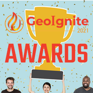
Presentation of Awards and Concluding Announcements.

Join GeoIgnite for this inaugural panel of provincial and territorial geospatial and location technology leaders.We will be discussing issues surrounding: What are main priorities and challenges across jurisdictions? What types of geospatial tools we use to monitor and respond to key challenges like emergency response? How are jurisdictions aligning geospatial tools, data, and people to address climate change? What are some current data...


