
Sushmita Gautam
Hi. My name is Sushmita. And I am from New Delhi. I participate in Geomatics event to gather information about new tech and workshops and hot jobs in the same line.
Elementy, w których Sushmita Gautam attends
środa 14 kwietnia, 2021

Join Jonathan Murphy, Chair of GeoIgnite and Canada's Geospatial Career Coach as we welcome our keynote Daniel Schulten, MDA's LaunchPad Director. Keynote: In this discussion, we will look at MDA's past 20 years of success in the Geointelligence and Earth Observation domain and look forward to what the next 20 years holds for us.We will specifically look at Canada's unique Geointelligence requirements and the impact it will have on the industry here in Canada as w...


At Sparkgeo, we create interesting geospatial technology for our partners. In order to continue to build the geospatial web, we need technical project managers.We’re looking for people who have good domain expertise in geospatial and love making those spreadsheets sing. Does this mean micromanaging each step of the project? Nope. It means advising and inspiring those with the talent to develop the required technology.It means professional and honest communication with the cli...

Jonathan Murphy, serial geospatial entrepreneur and career coach explains what it means to go from employee to an independent contractor providing goods, labor or services in Canada.Independent contractors work as individual entities. You are, however, responsible for managing your own payment and taxes. Jon with 20 years experience as a consultant and business owner in the Canadian geospatial sector will explain what it takes to go solo and the pros and cons of being your own...


Jonathan Murphy the Geospatial career coach and GeoIgnite conference chair will discuss some strategies when apllying for jobs online and share some jobs for participants to consider.

Serving the world from our Canadian home and our global offices, MDA is a robotics, satellite systems and geointelligence pioneer and an international space mission partner with a 50-year story of firsts on and above the Earth. Today, we're leading the charge towards viable Moon colonies, enhanced Earth observation, communication in a hyper-connected world and more. We’re fuelled by a pioneering spirit that carries us beyond. And together we enable highly skilled people to continuall...

The GeoIgnite Conference and our sponsors are proud to present the third annual Diversity in Leadership Panel.As the common goals of diversity, equity, and inclusion become even more widespread, organizations have the daunting task of figuring out what works.It is our vision that GeoIgnite will spur the grassroots of a more diverse ecosystem where diversity of thinking and knowledge will ignite innovation and better outcomes for us all.The next generation o...


czwartek 24 marca, 2022

GIS platforms are typically populated with XYZ coordinates with a point spacing of 1 meter or more. in fact, most traditional land surveying techniques, like GPS, often have a point spacing of 3 meters or more, and that is understandable given the procedure to obtain these points. But have you ever wondered what amount of detail is lost when increasing the point frequency? Well, in this seminar, Otto Ballintijn will demonstrate the impact point frequency has on pipe detail usin...


Scribble Maps is an easy-to-use online GIS and web mapping visualization solution. The software has a robust toolset along with vast operations that can help you annotate maps, plot territories, filter and analyze data, optimize routes, add images, and more.Our powerful mapping software can easily be integrated with many different file formats including GeoJson, SHP, KML, CSV, GPX, DXF, and PDF. Founded in 2009, Scribble Maps has been developed from direct user f...

piątek 25 marca, 2022

An overview of Prostar's "Cloud and Mobile Precision Field Data Collection Solution and the set up of the ProStar "PointMan Plus" application FREE to WorkShop attendees. PointMan is a patented cloud and mobile mapping software application that captures, records, and displays the precise location and the associated metadata of critical surface and subsurface infrastructure, all in "real-time" Workshop includes: -1 FREE annual subscription of...
środa 26 kwietnia, 2023

Join NavVis in-house specialists Gaspar Lima, Senior Channel Manager, and Michael Dutch, Customer Success Team Lead, as they discuss how NavVis users successfully deliver complex survey projects by leveraging hybrid terrestrial and mobile laser scanning workflows. Discover how to get the best accuracy and coverage with reduced time on site and lower cost of capture.


RIEGL's next generation of terrestrial laser scanners are focused on maximizing productivity, simplifying workflow, and improving the overall user experience. Join us as we provide a live demonstration of the features, capabilities and superior performance of RIEGL's innovative VZ-600i terrestrial lidar scanner, a purpose-designed sensor for the collection of engineering-grade data from both static and mobile platforms.

środa 17 maja, 2023

Geoff Zeiss devoted over 30 years of his life to the Geospatial industry and global community, focusing on utility and construction sectors, and mapping underground utility infrastructure among many other projects. Sadly, Geoff passed away in September of 2022. The Geoff Zeiss Urban Infrastructure Mapping Fund was established to build on decades of innovation by Dr. Zeiss in developing effective and sustainable urban infrastructure through research and development supporting ...


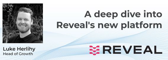
A deep dive into Reveal's new platform for major civil infrastructure projects, highlighting the workflow and features for project managers, engineers and contractors. Reveal for Projects helps stakeholders in the underground build a Unified Utility Model from multiple sources of data, with an intuitive and efficient web interface.