Jeff Osborne
Elementy, w których Jeff Osborne attends
środa 21 kwiecień, 2021
The Canadian Centre for Mapping and Earth Observation (NRCan) continues its work to implement the National Elevation Data Strategy. Through this strategy, one of NRCan's goal is to provide Canadians with an accurate three-dimensional representation of the country, in support of government priorities such as flood mapping. Because of the enormous task of obtaining a high-precision and up-to-date national elevation layer, NRCan works with different entities.The data coverage of the st...
Over the past year, Minerva Intelligence, a Vancouver-based cognitive AI company, has been awarded two contracts with Natural Resources Canada to design schemas at a national level: the National Flood Hazard Data Layer (NFHDL) and the National Hydro Network V2 (NHNv2). You might be asking yourself why an AI company is designing and building these important database structures. Minerva's cognitive AI system makes use of semantically inoperable data in knowledge graphs and has designed syste...
Maxar is building the highest resolution and most accurate 3D map of the planet and this talk will provide an overview of the products and capabilities that are making it possible.
Title: Advancing Space Based Observation in Canada:The GeoIgnite 2021 Directors General Geospatial Panel, part of Canada's National Geospatial Conference.Title: Advancing Space Based Observation in CanadaThis is a must attend panel for anyone interested in learning the direction Canada's Federal government geospatial leadership is taking.Join our panelists for an exploration of Canada's geospatial priorities and mission in this exciting discuss...
piątek 23 kwiecień, 2021
In this presentation by Avenza Systems, we will be showcasing how high quality cartographic outputs after your data analysis can actually be achieved! We will demonstrate how to develop and design a map from raw statistical census data in Adobe Illustrator by leveraging the geospatial functionalities of MAPublisher - the industry-standard cartography solution for high quality graphical output. We’ll show how GIS data can be imported, managed, and transformed on-the-fly all d...
Join GeoIgnite for this inaugural panel of provincial and territorial geospatial and location technology leaders.We will be discussing issues surrounding: What are main priorities and challenges across jurisdictions? What types of geospatial tools we use to monitor and respond to key challenges like emergency response? How are jurisdictions aligning geospatial tools, data, and people to address climate change? What are some current data...
wtorek 27 kwiecień, 2021
Google Chrome is the preferred browser for this session.Tickets for this workshop must be claimed in advance.This workshop will be broken down into 4 parts:1. Introduction to ERDAS IMAGINE2. Spatial Modeling for Wildlife Applications3. Using AI, Spatial Modeling and Python to Break Down Big Data Barriers4. Q & ASpatial Modeling ...
środa 28 kwiecień, 2021
Tickets for this workshop must be claimed in advance.The use of drones, officially referred to as Remotely Piloted Aerial Systems (RPAS), has been forecasted to play a key role in the digitalization and further optimization of a variety of geomatics applications such as in resource aggregates management, landfill management, civil engineering (3D reality capture, virtual surveying), and precision agriculture. To help realize this forecast it is important for ...
wtorek 1 marzec, 2022
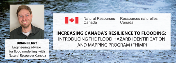
In Budget 2021, the government tabled a recovery plan for jobs, growth, and resilience. Within the budget were specific investments to promoting a healthy environment for a healthy economy, with $145.5 million dedicated to supporting initiatives that will increase resiliency to the natural hazards of wildfires and floods, which are becoming more frequent, severe, and devastating due to climate change and urban development. Flood hazard maps are essential to un...
środa 9 marzec, 2022
The Topobathymetric Lidar Solutions & Applications Workshop presented by NV5 Geospatial is designed to provide a comprehensive overview of topobathymetric lidar in a relaxed, collaborative environment to allow discussion and answer any questions. This interactive, virtual event will review our latest sensor technology, present typical project planning and execution, and provide processing insights to successfully completing and delivering ...
Join us in this training to learn about some of the latest and greatest features in ERDAS IMAGINE! With the exponentially increasing amount of data being collected in the world today, customized repeatable, batchable workflows are needed to extract as much valuable information from raw data as possible. The Spatial Modeler is the key to setting up these types of workflows. The creation of spatial models and the use of AI, machine learning and deep learning allow mo...
środa 26 kwiecień, 2023
RIEGL's next generation of terrestrial laser scanners are focused on maximizing productivity, simplifying workflow, and improving the overall user experience. Join us as we provide a live demonstration of the features, capabilities and superior performance of RIEGL's innovative VZ-600i terrestrial lidar scanner, a purpose-designed sensor for the collection of engineering-grade data from both static and mobile platforms.
środa 27 marzec, 2024
The United States’ National Geodetic Survey (NGS) plans to modernize their National Spatial Reference System (NSRS) in 2025, including adopting a new dynamic geometric reference (the North American Terrestrial Reference Frame of 2022 (NATRF2022)) and a new geoid-based height system (the North American-Pacific Geopotential Datum of 2022 (NAPGD2022)). To ensure continued geospatial referencing compatibility, the Canadian Geodetic Survey (CGS) plans to modernize the Canadian Spatial Reference Sy...


