Steffen Shaigec
Sessions in which Steffen Shaigec attends
sexta-feira 4 março, 2022
In this short technical demonstration, I’ll explore some of the ways that Planetscope’s new 8-band capabilities can be used to both detect and monitor invasive plant species, such as Watermoss-Salvinia, within water bodies. We’ll focus on the role that the 4 new spectral bands (Coastal Blue (433-453nm) , Yellow (600-620nm), Green-II (547-583nm) and Red-edge (697-713nm)) can have in this use case. I’ll compare how some spectral indices unlocked via 8-band data compare to previous 4-band, RG...
segunda-feira 7 março, 2022
The world is dynamically changing and so are businesses. By some estimates, 20% of new businesses close within one year of opening. In 2020,
terça-feira 8 março, 2022
Maxar’s WeatherDesk is a mature product platform that has continually evolved to satisfy changing customer requirements. It sets the standard for reliable and accurate weather forecasting through sound attention to science, an intense focus on customer service including 24/7 meteorological and operational support, and optimally solving customer problems. WeatherDesk products elegantly translate weather data into insights and actionable intelligen...
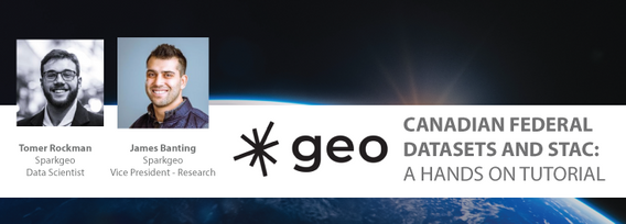
This workshop will use open tools and standards to create STAC compliant data for a Canadian Federal Dataset. The workshop will focus on the nuances of working on Canadian Data in a Cloud environment. It will further demonstrate modern geospatial data science tools to create a SpatioTemporal Asset Catalogue. Sparkgeo will also demonstrate use in leading desktop and cloud mapping software.
quarta-feira 9 março, 2022
Join us in this training to learn about some of the latest and greatest features in ERDAS IMAGINE! With the exponentially increasing amount of data being collected in the world today, customized repeatable, batchable workflows are needed to extract as much valuable information from raw data as possible. The Spatial Modeler is the key to setting up these types of workflows. The creation of spatial models and the use of AI, machine learning and deep learning allow mo...
sexta-feira 11 março, 2022
Please join us for the MDA-hosted workshop on multi-band SAR presented by MDA (Canada), Iceye (Finland) and VENG (Argentina). After presenting SAR fundamentals, we will dive deep into the specifications of X-band (Iceye), C-band (RADARSAT-2) and L-band (SAOCOM) missions, as well as the sensors’ merit and strength in specific applications that are of relevance to Canada. The last hour would be Q&As and discussion.
At a time of rising climate change impacts, there is a vital and growing need to prepare for, respond to, and recover from natural disasters. But there is a critical communication gap between authorities, citizens, and communities. Drawing on the ongoing results of our massive multi-year climate change research project, and with assistance from hundreds of students, citizens, academics, NGOs, government officials, and industry partners, Deploy Solutions has identif...
terça-feira 5 abril, 2022
Simultaneous localization and mapping (SLAM) based systems have proved their value for rapid mapping of complex environments, but achieving survey grade accuracy and repeatability has been a challenge in some environments. Surveyors were faced with a compromise between fast data capture and data accuracy, depending on the job requirements.This is no longer the case with Emesent's Automated Ground Control feature, which enhances t...
Case study outlining the challenges, solution and final result associated to a complex commercial renovation project.
Use case outlining the challenges, solution and result associated to a Lidar data acquisition using drone and vehicle.
Multi-beam bathymetric surveys are used to gather detailed information about the features on the sea, river or lake bed by measuring multiple depths from a transducer array at high resolution. The result is a highly accurate 3D point cloud representation of the sea floor – similar to aerial LIDAR.
In recent years the geospatial drone market has expanded dramatically. Drone based UAS (LiDAR) and UAV (Imagery) systems vast differences make it difficult to choose one over the other. This presentation aims to explore their differences from the point cloud processing aspect. We will examine the pros and cons of each system for practical survey and mapping applications such as topographies, bare earth, volumetrics, etc. Learn how data accuracy, density, intensit...
The autonomous vehicle industry is in the process of developing high definition (HD) maps to serve as the reference for their real time navigation systems. By 2030 the HD maps market is expected to reach $16.9 billion per year. Currently there is no accepted standard for HD maps here in the U.S. and Canada. It is the Wild West with each vendor collecting their own data. This presentation will encourage the key players to develop a strategic plan that involve...
A distinguished panel of 3D laser scanning industry veterans will be offering examples of some of their more difficult projects, along with the best practices they applied and the lessons they learned. This will be one of the highlights of the event.
quarta-feira 6 abril, 2022
Learn more about the transportation industry's most productive software solution for extracting topography, 3D models, GIS Assets, and more from drone (UAV) point cloud data. We will demonstrate how TopoDOT®'s comprehensive tool suite allows you to establish a highly productive process to extract break-lines, surface models and assets in a CAD environment. Learn how high quality data promote feature extraction automatization and productivity.
Lidar! This ubiquitous 3D technology is transforming how we visualize, map and analyze the world around us. What is it and how does it fit into the remote sensing toolbox? This presentation provides an overview of the core advantages of lidar data and an overview of the latest sensor solutions from RIEGL.


