Ian MacIsaac
He
Sessions in which Ian MacIsaac attends
quarta-feira 21 abril, 2021
Join us for the the launch of GeoIgnite with Jonathan Murphy, the Chair of GeoIgnite, and Dr. Minda Suchan of MDA.Abstract of MDA Keynote: Canada is the world leader in wide area space-based radar Earth observation through the highly successful RADARSAT program, supporting numerous operational and scientific uses for Synthetic Aperture Radar (SAR) data. MDA, in conjunction with the Canadian government, has created an internationally recognized brand and reputation for...
Do you know what the geospatial product trap is? We fall in love with the technology, not the problem. I am a lucky person. My job has evolved to one where I primarily get to talk about geospatial technology all day. I could be scoping out internal or external projects or evaluating technologies. Increasingly, I provide advice on product ideas. This final situation has forced me to consider the nature of our community-of-practice. The common assumption that geospatial ...
The Canadian Centre for Mapping and Earth Observation (NRCan) continues its work to implement the National Elevation Data Strategy. Through this strategy, one of NRCan's goal is to provide Canadians with an accurate three-dimensional representation of the country, in support of government priorities such as flood mapping. Because of the enormous task of obtaining a high-precision and up-to-date national elevation layer, NRCan works with different entities.The data coverage of the st...
Over the past year, Minerva Intelligence, a Vancouver-based cognitive AI company, has been awarded two contracts with Natural Resources Canada to design schemas at a national level: the National Flood Hazard Data Layer (NFHDL) and the National Hydro Network V2 (NHNv2). You might be asking yourself why an AI company is designing and building these important database structures. Minerva's cognitive AI system makes use of semantically inoperable data in knowledge graphs and has designed syste...
À l'automne 2020, NV5 Geospatial, propulsé par Quantum Spatial, a été mandaté par la Communauté Métropolitaine de Montréal (CMM) pour réaliser l'un des plus grands levés lidar topobathymétriques aériens fluviaux jamais entrepris au Canada. Cette présentation examinera de plus près le contexte, les objectifs, les défis, la technologie, la méthodologie, ainsi que les résultats et conclusions préliminaires de cette importante étude aérienne des vingt-huit principaux cours d'eau entourant la v...
Explore the structure of an enterprise location intelligence platform at Agriculture Agri-food Canada and how they created a strategic road map to systematically diagnose strengths and weaknesses to drive the use of location intelligence in everyday program and policy decisions of a federal department.Agriculture and Agri-Food Canada supports the Canadian agriculture and agri-food sector through initiatives that promote innovation and competitiveness.
Maxar is building the highest resolution and most accurate 3D map of the planet and this talk will provide an overview of the products and capabilities that are making it possible.
Title: Advancing Space Based Observation in Canada:The GeoIgnite 2021 Directors General Geospatial Panel, part of Canada's National Geospatial Conference.Title: Advancing Space Based Observation in CanadaThis is a must attend panel for anyone interested in learning the direction Canada's Federal government geospatial leadership is taking.Join our panelists for an exploration of Canada's geospatial priorities and mission in this exciting discuss...
quinta-feira 22 abril, 2021
For nearly 50 years, geomatics representatives from Canadian provinces and territories have collaborated together and with the federal government on geomatics initiatives. This presentation will explore why such a council came to be and why its work matters to the Canadian geomatics sector and citizens alike. While the geomatics sector and the world we live in continue to change, the need for coordination across jurisdictions remains crucial to support decision-making and response to share...
The Canadian Geodetic Survey (CGS) of Natural Resources Canada (NRCan) is responsible for defining, maintaining, and providing access to the Canadian Spatial Reference System (CSRS). The CSRS provides a consistent reference for surveying, mapping, and other applications which require accurate positioning. This presentation will describe the CGS products, tools and services which are currently available and provide access to the Canadian Spatial Reference System (CSRS). It will also take a ...
sexta-feira 23 abril, 2021
The global geospatial industry is estimated at US$ 500 Billion and delivers an even more significant impact on society, with derived economic benefits estimated to be multifold. These benefits, however, are still not fully understood by key stakeholders and policy and decision-makers, ultimately hindering the global uptake of geospatial information. With decades of national spatial data infrastructure efforts around the world, how can this be? Focusing on the importance of...
With rapid advances in Earth observation, cloud computing, and analytics technologies, more information on our changing world is more readily available than ever before. Planet is an aerospace and data analytics company at the forefront of these advances -- working to make global change visible, accessible, and actionable, Planet images the full Earth daily at 3.5m resolution and anywhere sub-daily at <50cm. In this talk, we’ll hear from Tara O’Shea, Planet’s Director of Forest Programs, o...
The Government of Canada and organizations such as the UN recognize the critical role of standards in geographic information and geomatics to support stewardship and interoperability of information, ensuring that organizations access, use and share geospatial data efficiently and effectively to support program and service delivery to Citizens. The data inventory/catalogue and the supporting standards are foundational components of any national geospatial information framework. As such, wel...
This talk will be bringing together the power of location intelligence and blockchain technology for an increased speed and accuracy of transactions and improved decision-making.The value that blockchain brings to geospatial technology is security, immutability, and trusted data. On the other hand, geospatial technology provides the power of location to the blockchain. Together, they represent a game-changer both for their utility and disrupt...
Join GeoIgnite for this inaugural panel of provincial and territorial geospatial and location technology leaders.We will be discussing issues surrounding: What are main priorities and challenges across jurisdictions? What types of geospatial tools we use to monitor and respond to key challenges like emergency response? How are jurisdictions aligning geospatial tools, data, and people to address climate change? What are some current data...
terça-feira 27 abril, 2021
Google Chrome is the preferred browser for this session.Tickets for this workshop must be claimed in advance.This session will occur from 10:00AM-11:00AM and repeat again from 11:00AM-12:00PMBeSpatial is a geospatial community platform in Ontario that has opened doors to connect, communicate and innovate. BeSpatial aims to provide networking opportunities, programs, and ...
terça-feira 1 março, 2022
In this talk Dan Nord will share key insights on Maxar’s position as a centerpiece in the global tech shift from 2D to 3D. Join us to hear more about how Maxar is accelerating its Earth Intelligence business with the launch of WorldView Legion in 2022, as well as building on our lead in mapping, monitoring, and new markets of the future.
"GHG Monitoring from Space: A mapping of capabilities across public, private and hybrid missions" was a collaborative effort undertaken by the Group on Earth Observations (GEO), WattTime, and the World Geospatial Industry Council (WGIC).This report, presented at the United Nations Framework Convention on Climate Change (UNFCCC) Earth Information Day at the 26th session of the Conference of the Parties (COP 26), was the first syst...
In Budget 2021, the government tabled a recovery plan for jobs, growth, and resilience. Within the budget were specific investments to promoting a healthy environment for a healthy economy, with $145.5 million dedicated to supporting initiatives that will increase resiliency to the natural hazards of wildfires and floods, which are becoming more frequent, severe, and devastating due to climate change and urban development. Flood hazard maps are essential to un...
Abstract: Organizations are increasingly relying on geospatial analysis to power their decision making and business processes. But in such a dynamically changing world, maintaining an accurate database of critical locations is no small task. Everyday worldwide, businesses open and close, change names, or update their operating hours. When these changes happen, any map, application, or model immediately becomes stale. How can organizations strategize if they are not...
NV5 Geospatial has been at the forefront of hydrospatial data acquisition and processing for decades. This presentation will provide a brief corporate introduction and overview of some of the technologies relevant to remotely sensed hydrospatial data collection and development. This will also include associated analyses and ancillary data integration to solve questions surrounding hydrology and wetland mapping, flood risk modeling, and habitat...
The landscapes in the Northwest Territories (NWT, Canada) are amongst the most rapidly changing in the world due to climate-induced permafrost thaw. This presentation provides an overview of recent remote sensing and mapping investigations of permafrost thaw landslides across different spatial and temporal scales in the NWT. A common thread of ever-expanding geospatial capabilities (remote sensing, machine learning) is juxtaposed against rapidly intensifying permafrost thaw with many growi...
quarta-feira 2 março, 2022
Join our DG Panel discussion moderated by Jonathan Murphy, Managing Director of GoGeomatics Canada. Our panelists are Eric Laliberté, Éric Loubier and David Harper.As a country spanning almost 10 million square kilometres, Canada has always faced a unique challenge in collecting the day-to-day information needed to provide critical services to Canadians. Today, space offers a unique perspective that is increasingly important to under...
quinta-feira 3 março, 2022
The increase in the availability of high-resolution lidar and other point cloud datasets has given rise to the use of this data for detecting change in the environment over time. Continual improvements in airborne technology and the miniaturization of the requisite sensors has cultivated a nimble new branch of the industry that provides cost-effective data collection services virtually on demand. This ability to employ temporal analysis of the geospatial landsca...
Climate change affects everybody. Solutions will be successful when everyone can get involved. An examination of the Diversity of viewpoints, needs, wants, and must haves is vital when approaching this topic. This panel will discuss and engage each other as well at the audience.
quarta-feira 26 abril, 2023
RIEGL's next generation of terrestrial laser scanners are focused on maximizing productivity, simplifying workflow, and improving the overall user experience. Join us as we provide a live demonstration of the features, capabilities and superior performance of RIEGL's innovative VZ-600i terrestrial lidar scanner, a purpose-designed sensor for the collection of engineering-grade data from both static and mobile platforms.
terça-feira 26 março, 2024
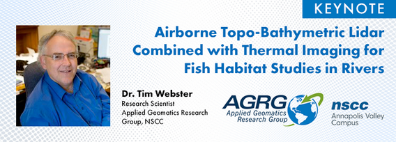
Airborne Topo-Bathymetric Lidar Combined with Thermal Imaging for Fish Habitat Studies in RiversResearchers at Nova Scotia Community College’s Applied Geomatics Research Group have been using the airborne Leica Chiroptera 4X topo-bathymetric lidar sensor for nearly a decade and have surveyed coastal, riverine and lake environments. They have concentrated on mapping submerged aquatic vegetation (SAV). Topo-bathy lidar data of rivers provides an opportunity for improved flood hazard h...
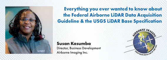
The Canadian government first formally created LiDAR Guidelines in 2017. The document was updated in 2022 to Version 3.1. This session will review the Canadian Guidelines and compare them to the USGS LiDAR Base specification, updated in 2023. Included in the presentation will be:LiDAR for Flood Mapping and funding from the National D...
Canada has just experienced a record wildfire season with devastating impacts. Public safety and damage mitigation is a priority for all impacted by these disasters. From mapping vegetation, analyzing slope stability, planning fire breaks, qualitfiying wood debris and fuel loads, how does LiDAR play a role in meeting post wildfire needs?
Canada’s LiDAR Panel: Future Trends in Service and Tech, is a deep dive into the evolving landscape of LiDAR technology in Canada. Our panel of experts will explore cutting-edge developments in LiDAR, focusing on new trends in service delivery and technological advancements. Expect insights into the integration of AI, enhancements in data processing, and future applications in sectors like urban development and environmental management. This session promises to equip attendees with a forward-...
quarta-feira 27 março, 2024
The United States’ National Geodetic Survey (NGS) plans to modernize their National Spatial Reference System (NSRS) in 2025, including adopting a new dynamic geometric reference (the North American Terrestrial Reference Frame of 2022 (NATRF2022)) and a new geoid-based height system (the North American-Pacific Geopotential Datum of 2022 (NAPGD2022)). To ensure continued geospatial referencing compatibility, the Canadian Geodetic Survey (CGS) plans to modernize the Canadian Spatial Reference Sy...
quarta-feira 29 janeiro, 2025
This keynote presentation will revisit some of the fundamentals behind lidar that influence the precision and detail the systems produce. The laser ranging systems that are used strongly influence how the lidar system works and factors including: wavelength, beam divergence, pulse width and pulse repetition frequency will be reviewed and discussed. Most airborne topographic lidars use a 1064 nm Near-Infrared laser, while topo-bathymetric lidar systems deploy both a NIR laser and a green laser...
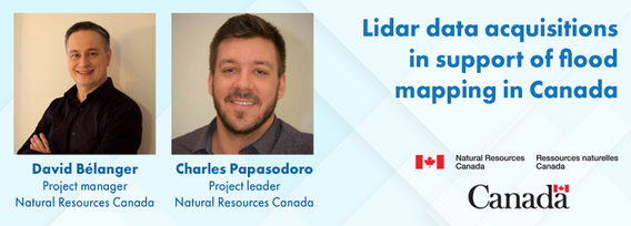
Flooding is the most costly natural disaster in Canada. Although flood hazard maps are essential for understanding a community’s risk to flooding, in Canada, many flood maps are not always available or up to date. High quality flood mapping that is current and accessible will help governments, communities, and individuals understand flood hazards and to implement effective mitigation strategies to reduce their impacts.Since 2021, Natural Resources Canada (NRCan) has been leading the Fl...
Traditional LiDAR acquisition platforms are commonplace in the industry and can be relied upon for efficient data acquisition for most relatively flat and uniform project areas. However, when multisource data acquisition is required or acquisition is impacted by complex corridors, excessive terrain, low-hanging clouds or airspace limitations, alternative approaches are required. This presentation will highlight some of NV5’s innovations to address these challenges including the Comprehensive ...
AI-driven mapping revolutionizes the use of LiDAR and photo datasets, addressing challenges like underutilized data and the complexity of heavy datasets. By transforming big data into lightweight, accessible information, XEOS offers practical solutions for municipalities and private companies. Through a step-by-step breakdown of the AI mapping process and product demonstrations, attendees will discover how this innovation enables smarter decision-making and brings more value to LiDAR data.
Join us at LiDARCanEX 2025 for an insightful panel discussion moderated by Dr. Tim Webster. This session will bring together experts to explore the current state of LiDAR projects in Canada and discuss what the future holds. Topics include:Wide-Area Topographic LiDAR Mapping: Applications in forestry, flood risk assessment, powerlines, infrastructure, and urban development.Topo-Bathymet...


