Sarah Kohlsmith
Sessions in which Sarah Kohlsmith attends
terça-feira 7 novembro, 2023
Over his decade plus at Suncor, Alonzo has been both witness to and active participant in a quiet digital Geospatial revolution. This revolution has democratized access to Geospatial data and tools to everyone at Suncor. Which meant that teams and professionals across a myriad of disciplines have embraced and pushed the limits of Geospatial data and software. The constant demand for newer and higher-resolution data has relegated the paper map to secondary status as the tool for spatial commun...
MAXAR Technology provides integrated space infrastructure and earth intelligence capabilities that make global change visible, information actionable and space accessible. MAXAR has been highly active in remotely sensed projects in Western Canada and this talk with discuss some of the current applications using high resolution data across a number of important sectors. Moreover, it will discuss the current and future platforms that are bei...
Geodetic Reference Systems are the foundation for geospatial data, serving as the official reference for latitude, longitude, height and gravity in Canada. There are many contributors to providing such standards to Canadians, including Federal, Provincial and Municipal governments, the private sector, academia, and others. Users will know that every few years there are new versions introduced of the datums or reference frames. A change in reference system, however, invo...
The workshop focuses on the role of Cloud Optimized Point Clouds (COPC) datasets and the SpatioTemporal Asset Catalog (STAC) within geospatial cloud systems. Attendees will gain insights into the Pointcloud Data Abstraction Library (PDAL) and the nuances of creating cloud-native metadata. Demonstrations will showcase practical methods for managing and processing large datasets in cloud infrastructures.COPC & STAC Overview: Gain a clear understanding of COPC datasets and the role of...
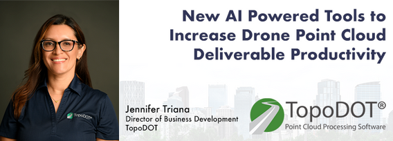
Learn how newly implemented surface modeling tools employing artificial intelligence reduce the turnaround time of point cloud surface models by 400% while maintaining high-fidelity results around break lines. Faster ground extraction routines for UAV data can be achieved without the need for classification or noise removal. In this presentation, we'll discuss several examples including how a query volume calculation project compared with traditional modeling workflows yielded nearly exact...
The end of the first day of the National Canadian GoGeomatics Expo is being marked by a lively party that is eagerly anticipated by all participants. The party is being held on the floor of the tradeshow in a venue that hosts many of the best rock concerts and shows for the Calgary Stampede. It promises to be a lot of fun, with an atmosphere buzzing with excitement and energy as attendees mingle, network, and celebrate the end of a successful day.The party is made even better by the in...
quarta-feira 8 novembro, 2023
Join us at the GoGeomatics Expo for a dynamic panel discussion on the latest trends in Lidar technology. Our panel of experts will dive into the advancements in Lidar data, hardware, and software, providing valuable insights into the ever-evolving geospatial world. Discover the future of Lidar and its applications, and stay at the forefront of geomatics innovation.lidarcanex.com
Wetlands are important to water quality, nutrient cycling, and biodiversity, and have been identified as a management priority across Canada. Reclaiming wetlands that have been impacted can be a long-term, costly process depending on the type of wetland, location, and potential access constraints. One challenge with wetland reclamation is that the work may cause additional or new wetland impacts during access and execution of the work. Concurrent with wetland reclamation priorities, there ...
How do you decide when to mobilize and when not to, or even where can you safely and legally fly. As the frequency of unpredictable weather and forest fire smoke increase, so too does the risk in mobilizing to a job site. This presentation will demonstrate OGL Engineering’s process and different geospatial resources available to better inform your decision and minimize risks.
The talk presents how multi-band SARs (X-band Iceye, C-band RADARSAT-2 and L-band SAOCOM) support various earth observation applications, such as target identification, change and displacement detection, and soil moisture map generation. Furthermore, it presents MDA's next-generation Chorus constellation (combination of C-band and X-band SARs).

