Judith Marie Beaudoin
Sessions in which Judith Marie Beaudoin attends
quarta-feira 28 abril, 2021
Tickets for this workshop must be claimed in advance.The use of drones, officially referred to as Remotely Piloted Aerial Systems (RPAS), has been forecasted to play a key role in the digitalization and further optimization of a variety of geomatics applications such as in resource aggregates management, landfill management, civil engineering (3D reality capture, virtual surveying), and precision agriculture. To help realize this forecast it is important for ...
quinta-feira 29 abril, 2021
Tickets for this workshop must be purchased in advance.
Moderator: Prashant ShuklePresenters: Rob Martindale, Olive Powell, DND, PSPC
sexta-feira 30 abril, 2021
Tickets for this workshop must be purchased in advance.
terça-feira 1 março, 2022
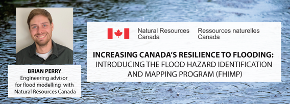
In Budget 2021, the government tabled a recovery plan for jobs, growth, and resilience. Within the budget were specific investments to promoting a healthy environment for a healthy economy, with $145.5 million dedicated to supporting initiatives that will increase resiliency to the natural hazards of wildfires and floods, which are becoming more frequent, severe, and devastating due to climate change and urban development. Flood hazard maps are essential to un...
quarta-feira 2 março, 2022
Join our DG Panel discussion moderated by Jonathan Murphy, Managing Director of GoGeomatics Canada. Our panelists are Eric Laliberté, Éric Loubier and David Harper.As a country spanning almost 10 million square kilometres, Canada has always faced a unique challenge in collecting the day-to-day information needed to provide critical services to Canadians. Today, space offers a unique perspective that is increasingly important to under...
terça-feira 8 março, 2022
The Integrated Cadastral Information Society (ICI Society) is a leader in sharing geospatial information, promoting the integration, adoption, and use of spatial data for the social and economic benefit of British Columbians. In addition to data sharing, ICI Society works to facilitate opportunities for training, education, and collaboration across government, industry, and other interested organizations. Incorporated in May 2001 and registered under the BC Societies Act as a ...
quarta-feira 9 março, 2022
The Topobathymetric Lidar Solutions & Applications Workshop presented by NV5 Geospatial is designed to provide a comprehensive overview of topobathymetric lidar in a relaxed, collaborative environment to allow discussion and answer any questions. This interactive, virtual event will review our latest sensor technology, present typical project planning and execution, and provide processing insights to successfully completing and delivering ...
terça-feira 25 junho, 2024
The applications of GeoAI are as wide and diverse as our imaginations. Many applications like remote sensing, image classification and object detection using computer vision, improve visual clarity and allow higher zoom levels using super-resolution networks, extract geospatial information from unstructured data using natural language processing, deep learning application for large 3D geospatial datasets etc. and have shown positive trends in GeoAI.With the increasing focus on damage p...
In 2017, representatives of Gopher State One Call (GSOC) reached out to the leadership of Emergency Preparedness Committee of the Minnesota Geospatial Advisory Council (EPC) in hopes of learning what could potentially be done to improve the use of geospatial technology in the underground utility community. From ensuing discussions over the next three years, the Underground Utilities Mapping Project Team (UUMPT) came into existence under the auspices of the EPC in early 2020. Now comprised of ...
BC's Master Municipal Construction Documents Association was founded in the early 1990's as a non profit organization to publish standardized infrastructure specifications and construction contract documents. MMCD Infrastructure Data Standards (IDS) were introduced in 2009 as an initiative to not only standardize infrastructure geomatics, design modeling, drawing production and construction workflows, but also to support standardized post construction data submissions to support automat...
In recent years, Canada and the United States have witnessed numerous injuries and fatalities due to accidental contact with underground infrastructure, highlighting the need to enhance current damage prevention practices. This presentation, "Knowing What's Below: Maps Save Lives," authored by Steve Slusarenko, Director of Subsurface Utility Map Data Exchange (SUMDEx), delves into the current damage prevention processes and underscores the importance of creating and exchanging accurate maps.


