Kent Jones
Sessions in which Kent Jones attends
terça-feira 29 outubro, 2024
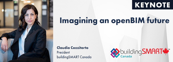
We explore the motivations behind the implementation of openBIM and its integral role in advancing the built asset industry. The built environment is immense and complex, it is also a huge responsibility. Our industry directly impacts it, designing, creating and maintaining it. In an era where what we all need is a better built environment, openBIM stands out as a key enabler. Together we will imagine a future where our industry works more effectively, efficiently and with more c...
Building Information Modeling (BIM) is transforming the built asset industry, yet firms of varying sizes—large, medium, and small—adopt BIM in distinct ways tailored to their unique resources and project demands. This session will explore BIM’s origins, current applications, and future directions as shared by representatives from three different firms. A significant focus will be on the importance of data integrity and governance, particularly as Artificial Intelligence (AI) becomes increasin...
The Alberta Biodiversity Monitoring Institute (ABMI) defines human footprint as the visible alteration or conversion of native ecosystems to temporary or permanent residential, recreational, agricultural, or industrial landscapes. It also includes land that is periodically reset to earlier successional conditions by industrial activities such as forestry harvest areas and seismic lines. To monitor and map human footprint across Alberta, the ABMI, in partnership with the Alberta Human Footprin...
How exactly does artificial intelligence work and what can you use it for in the geomatics domain? Using real-life examples from our projects, they demonstrate how you can use AI to gain new insights and increase efficiency by automating your data processing workflows.We explore how GeoAI is fusing spatial data science and Geomatics technology to help automate the extraction, classification, and analysis of all types of spatial or non-spatial data. Learn how GeoAI can detect clusters, ...
Sessions: Human footprint datasets for Canada: mapping and monitoring in support of land and resource managementDisturbance is a key component of boreal-forest ecosystems, impacting their structure and functions. In Alberta, disturbances are both natural and anthropogenic, including > 30,000 sqkm of harvest areas. The recovery of all types of forest disturbance influences not only local landscapes, but also carbon dynamics and biodiversity. In the face of a changing climate, the imp...
Accurate mapping of road networks is essential for navigation, disaster response, and urban planning. Traditional methods relying on remote sensing images, Lidar data, and GPS trajectories are hampered by time-consuming manual updates and incomplete extraction due to obstructions from trees, buildings, and shadows. However, recent advancements in deep learning models have shown promise in improving road mapping and automating the detection of missing roads.This study uses a transfer le...
Maintaining undisturbed habitat is key to the recovery strategy of the Woodland Caribou boreal population. Seismic lines have been identified as a human footprint feature that requires specific attention for habitat restoration in part because linear features are linked to increases in the predation rates of caribou as they provide lines of sight and easy transportation routes for predators. It is estimated that there are hundreds of thousands of kilometers of seismic lines within Alberta (AB...
Too often, when discussing the value proposition of geospatial data, we focus in on raw data or output products without spending a lot of time in the juicy middle of data throughputs. That is to say that modern geospatial is leaving a lot of value on the table and thus limiting our ability to good with our data by: -> Focusing too heavily on the capturing aspect of geospatial technologies;-> Ignoring or discounting analytical capabilities of geospatial technologie...
Large-scale habitat inventories are necessary for understanding how human land-use, natural disturbances (e.g., fire) and climate change are influencing ecological processes, species declines and how restoration can address these changes. Within the boreal forest of Alberta, Canada anthropogenic habitat alteration, also referred to as human footprint or the physical disturbance of a landscape as a result of human activity, covers over 19% of the land area. Much of this human footprint is not ...
Construction contracts are the same worldwide. While there are differences in language, classification, project delivery and other factors, the one common denominator is that a construction contract requires Drawings and Specifications. While geometric modelling software and specification software have both evolved over time, very little effort is currently being exerted in Canada to integrate them in document development processes.According to Arcadis global surveys, the #1 cause of c...
For the last five years I have been providing reality capture services to documentary film producers. These series have included NatGeo's Buried Secrets of WWII, NatGeo's Drain the Oceans, Discovery's Expedition Unknown and Expedition Bigfoot. LiDAR, photogrammetry, thermography, magnetometry, and multi spectral imagine all provide context that professional storytellers (TV producers) crave. Join me as I share stories, successes, and failures of these unique service offerings.
The First Peoples Innovation Centre (FPIC) plays a significant role in empowering Indigenous communities. The Centre has adapted the FabLab (Fabrication Laboratory) model developed by the Massachusetts Institute of Technology (MIT) with a culturally appropriate response to Indigenous youth, enabling them to take charge of their professional future. The FPIC, incorporating the FabLab Onaki, is pivotal in this empowerment process, as it funds and partners with various organizations to create co...
The three building blocks of digital building delivery are BIM, VDC and Digital Twins. There are various definitions for these three things, but based on my experience I define them as follows:- Building Information Modelling: a model with or without 3D geometry that hosts the information about building material, dimensions, connections, forces, power, flow rates, and all other elements required in each element that forms the building. - A key subset of understanding BIM is under...
The integration of AI in infrastructure modeling has the potential to revolutionize decision-making processes by providing accurate predictions, identifying vulnerabilities, and optimizing resource utilization.The increasing complexity of modern infrastructure systems, coupled with growing demands on utilities, has necessitated the adoption of advanced analytical techniques. This panel discussion brings together ideas from acad...
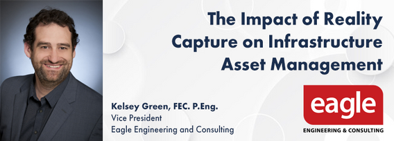
The integration of reality capture technologies—such as LiDAR, photogrammetry, and 3D scanning—into infrastructure asset management is revolutionizing how municipalities and organizations manage and maintain, their assets and deliver services. This presentation will explore the transformative impact of reality capture on the accuracy, efficiency, and overall effectiveness of infrastructure management practices. By enabling effective data collection and visualization, reality capture provides ...
Despite the rhetoric surrounding the use of building information modelling (BIM) to enhance collaboration by connecting people and data, the status quo is to work with proprietary solutions and closed file formats, limiting accessibility and interoperability. Additionally, the increasing complexity of projects in the Architecture, Engineering, Construction, and Operations (AECO) industry requires technology that integrates data at a range of scales, from asset to city, and beyond. To address ...
buildingSMART Canada will summarize the buildingSMART International Certification Program and its implementation in Canada. Attendees will gain insights into how the certification process works, including the steps required for individuals and organizations to achieve certification. We will explain the program's goals, benefits, and by adhering to internationally recognized standards, professionals and organizations in Canada can ensure enhanced collaboration, interoperability, and efficiency...
Today, digital twins, autonomy and artificial intelligence (AI) dominate the lexicon of the geomatics industry. These capabilities provide significant productivity advantages to our profession, but our domain content and knowledge are critical to their success. These tools will change the way we work and transform the industry. However, they will not replace us, but rather change our role. This is no different than when the EDM, total station, CAD, or GPS became part of our professional lives...
quarta-feira 30 outubro, 2024
Case Study: How DOTs and Utility owners took a Proactive Approach to Protect Underground Pipeline Assets Due to aging infrastructure and lack of accurate utility location information resulting in huge increased operational risk & especially at waterway, transportation, and ROW utility crossings. Utility owners understand the significant underground congestion and utility conflicts which result in future damages and the value the importance of geo location of UNLOCA...
Photogrammetry is not just limited to aerial platforms. Modern mobile devices contain high-quality cameras and increasingly have LiDAR and depth sensors built in. When combined with high-accuracy GNSS systems, these mobile devices can quickly collect accurate data for utilities, infrastructure, inspection, as-builts, construction, and more. Utilizing these readily available devices can reduce project delays, capture better documentation of utilities, and lay the foundations for digital infras...
Utility mapping is a crucial practice in urban planning and construction, focusing on identifying, documenting, and visualizing the precise locations of underground utilities such as water pipes, gas lines, electrical conduits, and telecommunication cables. Accurate mapping of these utilities is vital to ensure safety, efficiency, and cost-effectiveness in construction projects, preventing accidental damages that can lead to significant service disruptions, safety hazards, and financial losse...
With drones like the DJI Matrice 300 now being positioned using RTK GNSS, combined with Structure from Motion (SfM), high precision mosaics are possible without deploying targets. The ability to mount lidars (DJI L1 and L2) and other optical sensors (RGB, multispectral, thermal) allows for precise surveying and the production of high resolution and high accuracy mosaics with minimal ground control. While battery power still remains an issue and the limiting factor for flight duration (10’s of...
The time has come for the presentation of this year's mobile mapping system and SLAM system participants.Are you looking to collect more data, faster and accurately? Looking to buy a mobile mobile mapping or SLAM system and incorporate it into your workflows? If you are, you're considering tens of thousands to millions of dollars of investment. Do you know what's available to you? Are you sure that's all of them? Do the options available suit your needs? Is there candid data you can lo...
Traditional teaching methods in post-secondary often included using powerpoint presentations and writing on a white or blackboard. The newer generations of students have been exposed to different ways of learning and this requires instructors or teaching professors to change their way of presenting information to help the students learn it at a deeper level. Using a radical constructivism philosophy, the students are required to engage in the material in their own way, connect wit...
How do hydrographic surveys, aerial Remote Sensing and GIS help with environmental efforts? Terra explores 2 projects that use a combination of different sensors and visualizations to achieve these goals. The projects include a rapid marine data collection supported by Aerial LiDAR to aid in rescue efforts of a trapped Orca cafe, and using LiDAR with GIS to support change detection efforts of a major land slide.
Reduced snowpack in the Rockies presents a severe drought risk for Southern Alberta. Mountain snowmelt in the Bow and Oldman basins maintains reservoir levels, crop irrigation, municipal and industrial supply, and ecosystem services. As climate and consumption pressures increase, accurate snow water equivalent (SWE) data is crucial for water supply forecasts, which impact allocations and emergency drought measures. Field snowpack monitoring does not provide accu...


