Ashling Redmond
Sessions in which Ashling Redmond attends
segunda-feira 28 outubro, 2024
Join us at the National Geomatics Networking Reception Enjoy a selection of gourmet hors d'oeuvres, including savoury Moroccan lamb meatballs, smoked pork belly lollipops, and wild mushroom arancini with truffle oil. Vegetarian options like vegetable samosas with mango chutney and goat cheese tartelettes will satisfy all palates. Plus, your ticket includes a drink to enjoy while you connect with industry professionals. Elevate your evening with these delicious bites and great company!
terça-feira 29 outubro, 2024
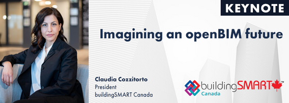
We explore the motivations behind the implementation of openBIM and its integral role in advancing the built asset industry. The built environment is immense and complex, it is also a huge responsibility. Our industry directly impacts it, designing, creating and maintaining it. In an era where what we all need is a better built environment, openBIM stands out as a key enabler. Together we will imagine a future where our industry works more effectively, efficiently and with more c...
Got a great idea, paper, project or product? Here’s an opportunity to hone your skills in making a “fast pitch”. There’s and art to making a fast pitch, where less can be more.The GoGeomatics Expo in 2023 launched the Fast Pitch session. Modelled after the Pitch-the-Press session of GeoWeek, presenters have 3 minutes to make your best case, followed by 2 minutes of questions from a panel and the audience. The panel of geo-journalists and industry experts judge th...
Too often, when discussing the value proposition of geospatial data, we focus in on raw data or output products without spending a lot of time in the juicy middle of data throughputs. That is to say that modern geospatial is leaving a lot of value on the table and thus limiting our ability to good with our data by: -> Focusing too heavily on the capturing aspect of geospatial technologies;-> Ignoring or discounting analytical capabilities of geospatial technologie...
The health of the global ocean environment is of critical importance. Planetary limits for climate change and biodiversity are being reached, and unsustainable resource management practices are rampant. Space-based Maritime Monitoring has proven to provide foundational support for sustainable management of ocean resources. In the Keynote, John will provide a high-level overview of ocean problems, space-based maritime monitoring, the beneficiaries and outcomes of the application of...
The integration of AI in infrastructure modeling has the potential to revolutionize decision-making processes by providing accurate predictions, identifying vulnerabilities, and optimizing resource utilization.The increasing complexity of modern infrastructure systems, coupled with growing demands on utilities, has necessitated the adoption of advanced analytical techniques. This panel discussion brings together ideas from acad...
In flood mapping and dam breach analysis, engineers and planners define inundation areas through flow modeling. A crucial input for this analysis is a comprehensive topographic surface of the area of interest and any upstream zones. These areas can span hundreds of kilometers and cover thousands of square kilometers.Previous studies have indicated that low-resolution topography can results in larger inundation areas, greater flow volumes, and faster flood streams. However, a comparison...
Wrap up the first full day of Canada's National Geomatics Expo with the GoGeomatics Meetup! This lively party and networking event, free to attend, starts right after the day's sessions, offering a perfect blend of fun and professional interaction. Held on the expo main floor, the meetup features a cash bar to help you unwind and enjoy the evening. Join us for an exciting night of music, mingling, and making connections with fellow attendees. Don't miss this chance to relax and expand your ne...
Today, digital twins, autonomy and artificial intelligence (AI) dominate the lexicon of the geomatics industry. These capabilities provide significant productivity advantages to our profession, but our domain content and knowledge are critical to their success. These tools will change the way we work and transform the industry. However, they will not replace us, but rather change our role. This is no different than when the EDM, total station, CAD, or GPS became part of our professional lives...
quarta-feira 30 outubro, 2024
Join us for an engaging panel discussion on Geo-Entrepreneurship, featuring distinguished experts from geospatial consultancies, geomatics communication and event companies, and geomatics software firms. This session is designed for those interested in the intersection of geospatial technology and entrepreneurship.Journey to Entrepreneurship: Hear from our panelists on their motivations for leaving traditional careers to pursue entrepreneurial ventures in the geospatial field. Dis...
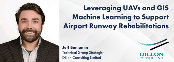
Dillon was retained by the Government of Nunavut to perform a Needs Assessment for the rehabilitation of the Runway 13-31, Taxiway A (Alpha), Taxiway C (Charlie), Apron A, and Apron C of the Rankin Inlet Airport.The project included pavement rehabilitation and geotechnical investigations for Runway 13-31, which is a 6000’ x 150’ asphalt paved runway, along with Phase I ...
As the drone industry is increasingly focuses on developing larger airframes and equipping them with bigger sensors, Spexi is taking a revolutionary approach to aerial imagery. At Spexi, we believe that the future of geospatial data collection lies not in size and complexity, but in numbers and standardization. The Spexi platform leverages the power of crowdsourcing, deploying local pilots with small drones to capture standardized imagery across entire cities. This method allows us to achieve...
Led by the World Geospatial Industry Council (WGIC) and moderated by Aaron Addison, Executive Director of WGIC, this panel will explore the transformative role of Earth observation (EO) technologies in fostering a resilient and sustainable future for Canada. With growing environmental challenges such as climate change and resource management, EO solutions provide essential insights into monitoring ecosystems, disaster resilience, and sustainable development. Panelists from diverse sectors wil...
How do hydrographic surveys, aerial Remote Sensing and GIS help with environmental efforts? Terra explores 2 projects that use a combination of different sensors and visualizations to achieve these goals. The projects include a rapid marine data collection supported by Aerial LiDAR to aid in rescue efforts of a trapped Orca cafe, and using LiDAR with GIS to support change detection efforts of a major land slide.
This session explores the strategic implementation of IDS (Information Delivery Specifications) to IFC (Industry Foundation Classes) validation, emphasizing its crucial role in aligning organizational requirements with validation criteria for effective data handover and operational efficiency within real property and asset management. Attendees will gain insights into how these processes can be used to structure and transform organizational data, ensuring better control, accuracy, and long-te...
For the built environment, digitalization is a key sustainability enabler. It helps stakeholders across the construction sector increase productivity and transparency while reducing emissions, resource consumption and costs, and adding digital tools that can help companies establish and optimize their sustainability performance.
Earth Observation technologies have experienced unprecedented innovation and accessibility over the past several years. The role of the commercial sector has stepped in to offer several capabilities historically only available from government. This session will focus on examples of how EO technology is being...


