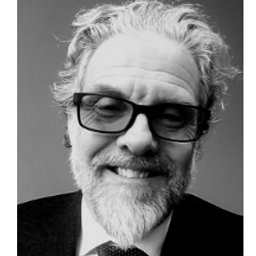
Dr. Andrew M. Davidson is the Associate Director of Agriculture and Agri-Food Canada’s Agroclimate, Geomatics, Earth Observation and Agroenvironmental Resilience Centre (ACGEO-AER). He is also an Adjunct Research Professor in the Department of Geography and Environmental Studies at Carleton University and an Affiliated Researcher with the University’s Global Water Institute. Dr Davidson is Canada’s alternate representative on the Group on Earth Observation (GEO) Programme Board and a member of the GEO Global Agricultural Monitoring (GEOGLAM) Executive Committee. He actively supports Canada's remote sensing community through his involvement with various remote sensing organizations. In November 2013, Dr Davidson was elected to the College of Fellows of the Royal Canadian Geographic Society (RCGS).
Sessions in which Andrew Davidson participates
terça-feira 18 junho, 2019
We will have a remote sensing specialist speaking about careers: Andrew Davidson, a scientist with the Canadian Government, will talk about his experiences negotiating the minefield that can be the Government hiring process, and the things you need to do when applying for that Government job. Have you ever applied for a job with the Government of Canada and wondered why you weren't considered for future selection? Applying for Government jobs is tricky, and rarely, if ever, does a ...
quarta-feira 19 junho, 2019
Remote sensing is the most cost-effective means for gathering timely detailed and reliable information over large areas with high revisit frequency. The integration of remote sensing data with national statistics, field observations and secondary data show great potential for mapping crop acreages. This requires the selection of appropriate satellite data, the collection of quality ground information, the application of suitable pre- and post-processing methods and the implementation of a rob...
terça-feira 14 maio, 2024
We will have a Government of Canada science Director speaking about careers: Andrew Davidson, a scientist with the Canadian Government, will talk about his experiences negotiating the minefield that can be the Government hiring process, and the things you need to do when applying for that Government job. Have you ever applied for a job with the Government of Canada and wondered why you weren't considered for...
Sessions in which Andrew Davidson attends
quarta-feira 21 abril, 2021
Join us for the the launch of GeoIgnite with Jonathan Murphy, the Chair of GeoIgnite, and Dr. Minda Suchan of MDA.Abstract of MDA Keynote: Canada is the world leader in wide area space-based radar Earth observation through the highly successful RADARSAT program, supporting numerous operational and scientific uses for Synthetic Aperture Radar (SAR) data. MDA, in conjunction with the Canadian government, has created an internationally recognized brand and reputation for...
The Canadian Centre for Mapping and Earth Observation (NRCan) continues its work to implement the National Elevation Data Strategy. Through this strategy, one of NRCan's goal is to provide Canadians with an accurate three-dimensional representation of the country, in support of government priorities such as flood mapping. Because of the enormous task of obtaining a high-precision and up-to-date national elevation layer, NRCan works with different entities.The data coverage of the st...
Explore the structure of an enterprise location intelligence platform at Agriculture Agri-food Canada and how they created a strategic road map to systematically diagnose strengths and weaknesses to drive the use of location intelligence in everyday program and policy decisions of a federal department.Agriculture and Agri-Food Canada supports the Canadian agriculture and agri-food sector through initiatives that promote innovation and competitiveness.
Title: Advancing Space Based Observation in Canada:The GeoIgnite 2021 Directors General Geospatial Panel, part of Canada's National Geospatial Conference.Title: Advancing Space Based Observation in CanadaThis is a must attend panel for anyone interested in learning the direction Canada's Federal government geospatial leadership is taking.Join our panelists for an exploration of Canada's geospatial priorities and mission in this exciting discuss...
quinta-feira 22 abril, 2021
Abstract forth coming: Oversight for CSA program sectors, including in Space Utilization, Space Exploration, and Space Science and Technology.
With PetaBytes of data flowing out of Low Earth Orbit everyday, the opportunity afforded by Earth Observation seems to be greater than ever. But is our community realizing that opportunity yet? Are there winners? How should we be thinking about EO businesses in the roaring 2020s?
sexta-feira 23 abril, 2021
The global geospatial industry is estimated at US$ 500 Billion and delivers an even more significant impact on society, with derived economic benefits estimated to be multifold. These benefits, however, are still not fully understood by key stakeholders and policy and decision-makers, ultimately hindering the global uptake of geospatial information. With decades of national spatial data infrastructure efforts around the world, how can this be? Focusing on the importance of...
With rapid advances in Earth observation, cloud computing, and analytics technologies, more information on our changing world is more readily available than ever before. Planet is an aerospace and data analytics company at the forefront of these advances -- working to make global change visible, accessible, and actionable, Planet images the full Earth daily at 3.5m resolution and anywhere sub-daily at <50cm. In this talk, we’ll hear from Tara O’Shea, Planet’s Director of Forest Programs, o...
terça-feira 27 abril, 2021
Google Chrome is the preferred browser for this session.Tickets for this workshop must be claimed in advance.Have you ever wanted to learn more about Synthetic Aperture RADAR (SAR) and Electo-Optical (EO) products? Come join this session for an introduction to some of the basic imaging parameters and learn about the different p...
sexta-feira 30 abril, 2021
Tickets for this workshop must be claimed in advance.This half-day workshop cuts through the theory and fluff to present, in practical terms, the essential practices for successful GIS project planning and management. Its intent is to provide project managers, teams, and stakeholders with the key actions methods, and tools to launch and execute successful projects --delivering results on time and on budget providing valuable...


